
Format Types
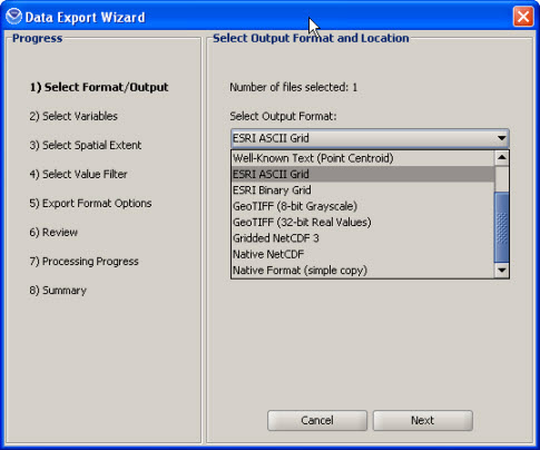
When using the Data Export Wizard, there are several export formats available: Native Format (copy), Raw NetCDF, Shapefile, Well-Known Text, GeoTIFF, ESRI ASCII Grid, ESRI Binary Grid, and Gridded NetCDF.
Vector (Polygon/Point) formats (Shapefile, and Well-Known Text) preserve the native structure of the data by encoding
the data as polygons (radar only), or points. The polygons represent the exact range bin with vertices in
latitude/longitude NAD83 coordinates while the points represent the centroid of the grid cell in latitude/longitude NAD83
coordinates.
Point export: The cell centroid export allows the greatest flexibility for post-processing. GIS applications can interpolate the
point locations into custom grids using a variety of interpolation techniques, projections and resolutions. Some visualization programs can
create 3D interpolations and visualizations using the height fields. The fields/attributes
for point exports are defined below:
'Radial' (Radar) Data Types:
- 'time' = UTC/GMT time for data
- 'value' = the data value of the selected moment/variable, in the same units used in the map viewer and displayed in the legend
- 'radialAng' = azimuth angle in the radar's polar coordinate system, where 0 is north
- 'surfaceRan' = range from radar site in meters
- 'heightRel' = height relative to radar in meters
- 'heightASL' = altitude above sea level
- 'value' = the data value of the selected moment/variable, in the same units used in the map viewer and displayed in the legend
- 'time' = UTC/GMT time for data, if available
- 'value' = the data value of the selected moment/variable, in the same units used in the map viewer and displayed in the legend
Raster (Gridded) formats (GeoTIFF, ESRI ASCII Grid, ESRI Binary Grid, and Gridded NetCDF) are gridded
representations of the data in the latitude/longitude NAD83 coordinate system.
A simple nearest-neighbor resampling technique is used to populate the output grid when the input
data are not on a NAD83 latitude/longitude grid. This includes input data in projections (such as Albers,
Lambert or Polar Stereographic), irregularly spaced grids (curvilinear grids) and all
'Radial' (weather radar) data.
GeoTIFF '8 bit' vs. GeoTIFF '32 bit':
The GeoTIFF '8 bit' format are scaled data values between 0 and 255 and do not contain the actual data
values. The data are scaled by the min and max values in each file. These files can be useful when a simple
grayscale image is desired, however, due to the scale factor changing with each file, animations or
any multiple file analysis is impossible.
The GeoTIFF '32 bit' contain the actual data values, stored as 4 byte decimal floating point values.
The 'Native NetCDF' format does not resample the data to the lat/lon coordinate system. The data is represented in the NetCDF format and should exactly match the input data projection, structure and values.
The 'Native Format' format will do a simple copy of the data to the output directory selected. This option can be used to easily download remote data to local disk.
Go To The Filtering Tutorial