Updated: 5 August 2011


Overview
Record breaking wildfire activity was observed across the southern tier of the U.S. during the first six months of the year (January-June), but July 2011 brought somewhat of a reprieve. Although over 1.2 million acres (485,000 hectares) burned nationwide during the month, it was significantly less than the 2000-2010 July average of 1.6 million acres (647,000 hectares) and the July record high of 3.4 million acres (1.4 million hectares), which burned in 2004. July 2011 marks the first month since January 2011 with below-average acreage burned. Although July was a relatively slow wildfire month, during the January-July 2011 period, 6.1 million acres (2.5 million hectares) burned across the country – the largest on record for the year-to-date period by nearly one million acres.
July Wildfire Statistics*
| July 2011 | 2001-2010 Average (10-years) | Rank (of 12 years) | Record (year) | |
|---|---|---|---|---|
| Area Burned | 1,295,630 acres | 1,610,142 acres | 5thsmallest (8thlargest) | 3,439,347 acres (2004) |
| Number of Fires | 9,208 | 9,219 | 5thmost (8thleast) | 17,352 (2008) |
| Area Burned per Fire |
140.7 acres | 192.1 acres | 6thsmallest (7thlargest) | 518.9 acres (2004) |
Year-to-Date Wildfire Statistics*
| Year-to-Date as of July 31st 2011 |
2001-2010 Average (10-years) | Rank (of 12 years) | Record (year) | |
|---|---|---|---|---|
| Area Burned | 6,091,571 acres | 3,505,217 acres | 1st largest | 5,164,996 acres (2006) |
| Number of Fires | 45,632 | 50,013 | 5thmost (8thleast) | 69,656 (2006) |
| Area Burned per Fire |
133.5 acres | 70.6 acres | 1st largest | 116.1 acres (2005) |
*Data Source: The National Interagency Fire Center (NIFC)
Discussion

During July, a ridge of high pressure was anchored across the central and eastern parts of the United States, limiting precipitation across the Plains and Southeast and causing temperatures to soar. See the U.S. Temperature and Precipitation discussion for more information. The large scale weather pattern caused drought conditions to remain dire across the Southern Plains and to worsen across parts of the East. According to the U.S. Drought Monitor, during July across the contiguous U.S., the overall size of the drought footprint (D1-D4) expanded to cover 32.3 percent of the country. Drought conditions changed little during the month across the Southwest and Southern Plains where little to no precipitation fell. Most of the region continued to be classified under extreme to exceptional drought (D3-D4). Exceptional drought expanded northward into Kansas and parts of southern Colorado. Beneficial rains fell along the Gulf Coast, improving drought conditions one to two categories in Louisiana, Mississippi, Alabama, Georgia, and Florida. Most of the exceptional drought was alleviated in those states. Dry conditions across the eastern Carolinas prompted classification of extreme drought there, while moderate drought expanded northward into the Mid-Atlantic, the eastern Great Lakes, and the Midwest.
Wildfire information and environmental conditions are provided by the National Interagency Fire Center (NIFC) and the U.S. Forest Service (USFS) Wildland Fire Assessment System (WFAS).

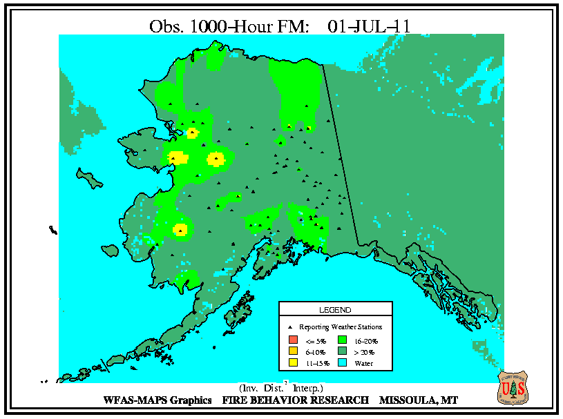
At the beginning of July, there were 30 large wildfires burning across the country. Twelve of the large fires were observed across New Mexico and Arizona, where exceptionally dry fuels of all sizes (low 10-hour ,100-hour
 , and 1,000-hour
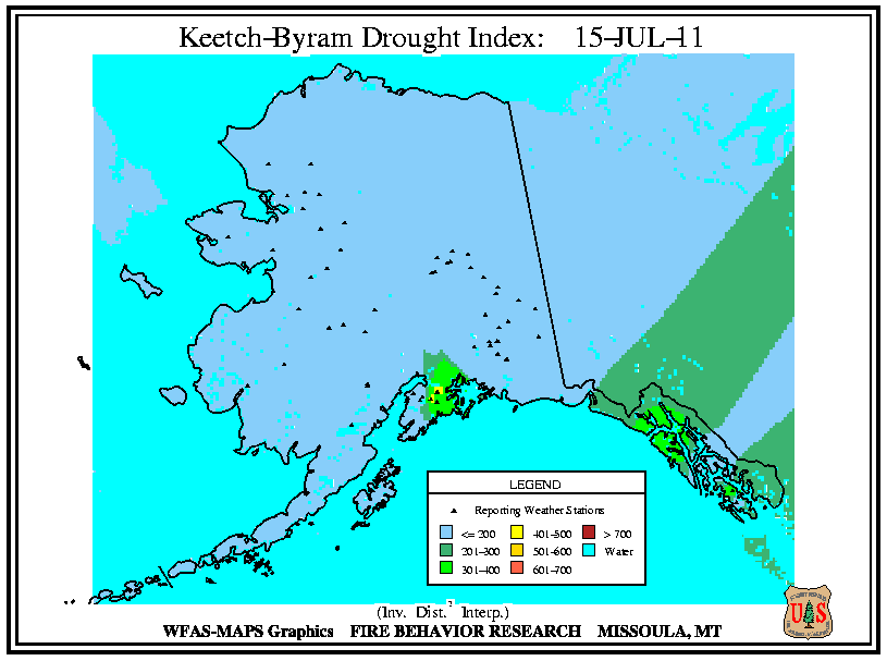
 fuel moistures), combined with high Keetch–Byram Drought Index (KBDI)
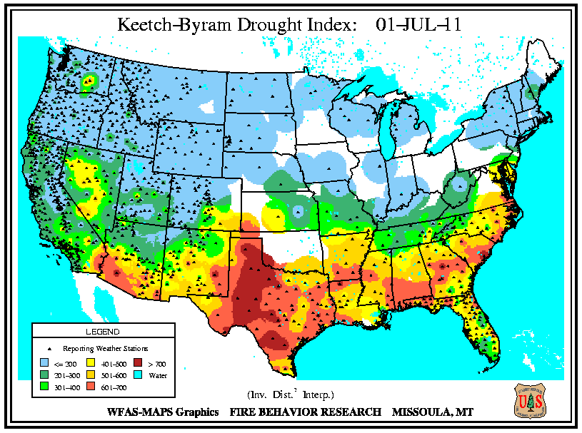 values, created a large extent of high fire danger
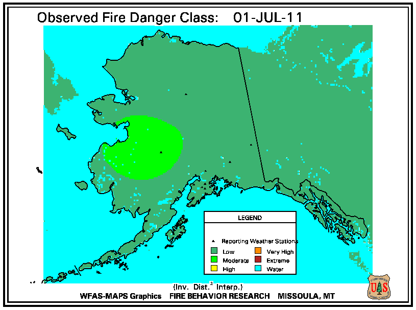
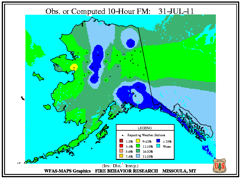
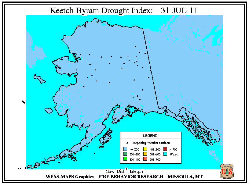
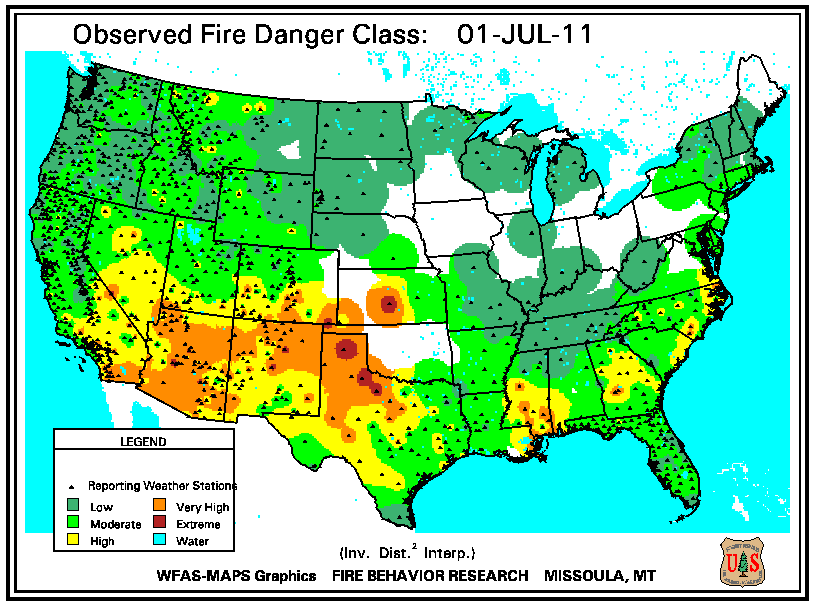 across the region. Four large fires were burning across Texas, where high fire danger was observed, as well as low 10-hour fuel moistures and extremely high KBDI values. Eight large fires were active across the Southeast in Georgia (3), Florida (2), North Carolina (2), and Alabama (1). Across the region, the observed fire danger was relatively low, but extremely low 10-hour fuel moistures and high KBDI values created favorable wildfire conditions. Individual large wildfires were also reported in central Colorado, eastern Utah, and central California. Across Alaska, two large fires were burning, consistent with the location of observed low 10-hour
 fuel moistures.

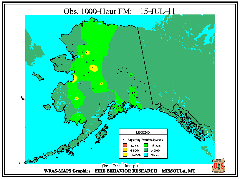
On July 15th, there were 26 large wildfires burning nationwide. Eight of the wildfires were burning across northern and western Texas. Across this region, dry fuels of all sizes (low 10-hour , 100-hour
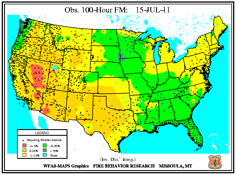 , and 1,000-hour
 hour fuel moistures) and high KBDI
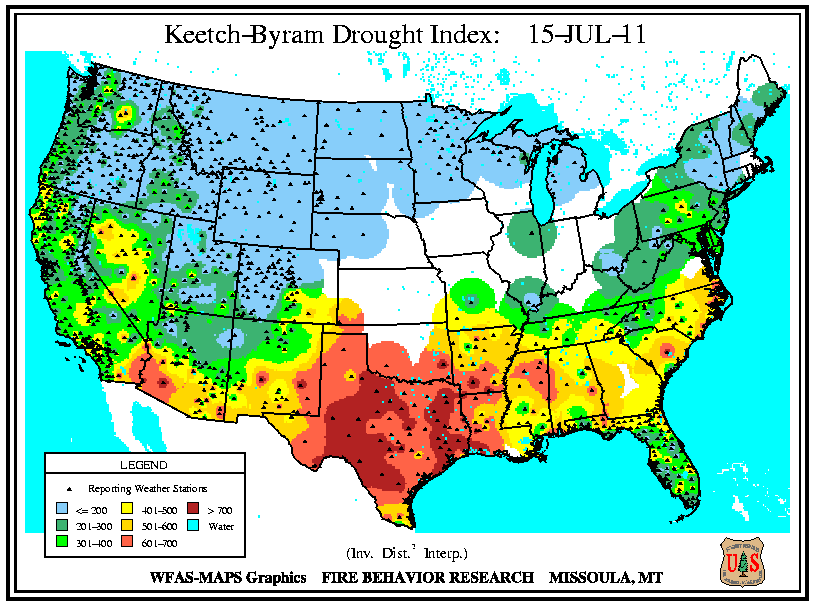 values were observed, driven by the on-going drought and hot temperatures, increasing the fire danger
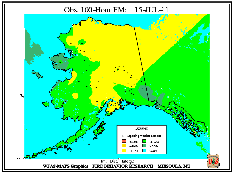
 . Across northern Arizona and New Mexico, monsoonal rainfall increased 10-hour fuel moistures and lowered KBDI values, limiting wildfire development. However, large wildfires did continue across the portions of New Mexico (4), Colorado (1), and Arizona (1), where little to no precipitation occurred. There were five large wildfires burning across the Southeast — three in Georgia and two in North Carolina. Precipitation was observed across the region during the first half of the month, increasing fuel moistures and lowering KBDI values and fire danger, but the large wildfires burning were remnants of the previous large fires and were fully to near-fully contained. Across Alaska, there were five large wildfires burning on the 15th, primarily across the central regions of the state, where low 10-hour
 fuel moistures were observed. One additional large wildfire was active in California.

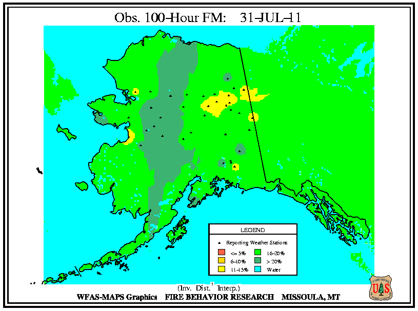
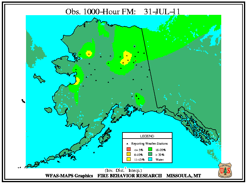
At the end of July, there were 28 large wildfires active across the country. Eight large wildfires were burning across Arkansas (4), Oklahoma (3), and Missouri (1), where very hot and dry conditions dominated during the second half of July causing low 10-hour fuel moistures and extremely high KBDI
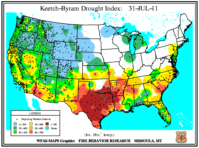 values. The large wildfires across the Southeast continued to burn by the end of the month, with two each in Florida and North Carolina, although environmental conditions did not favor large wildfire growth. Monsoonal precipitation across the Southwest limited large wildfires there, with three burning in New Mexico and one burning in west Texas. Most of the region continued to experience low 100-hour
 and 1,000-hour
 fuel moistures, but the scattered precipitation increased 10-hour fuel moistures and lowered KBDI values and subsequently the high fire danger
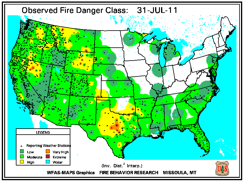 . Meanwhile, large wildfire activity increased across the Intermountain West and along the Great Basin with three large fires active in Nevada and Idaho, and two large fires active in Wyoming, Oregon, and California. Across the region, dry conditions dominated the last seven days of the month. The weeklong period of dry and warm conditions lowered 10-hour fuel moistures considerably across the region increasing the fire danger. However, larger fuels (low 100-hour and 1,000-hour fuel moistures) remained relatively moist, and KBDI values remained low.