
Updated: 8 June 2011
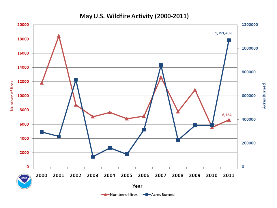
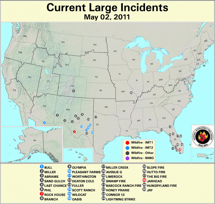
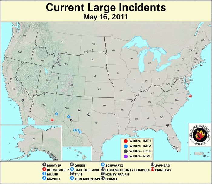
Much-above-average fire activity, which has persisted for several months across the Southern U.S., continued into May 2011. The hardest hit region of the country continued to the Southern Plains, where drier than average conditions prevailed. Many climate divisions across western Texas and southeastern New Mexico experienced their driest May on record, and a string of states from New Mexico to Florida had below-normal precipitation during the month. This marks the eighth consecutive month with below-average precipitation for parts of the Southern Plains. Temperatures were near normal across most of the south, except for Texas which had above normal temperatures during May, and the Southwest which had below-normal temperatures. When weather conditions were averaged for the entire country for May, the country was cooler and wetter than normal. See the U.S. State of the Climate Report for additional information. During May, there were 6,625 fires which burned approximately 1.1 million acres (0.45 million hectares). This is the most acres burned during the month of May on record, and brings the year-to-date acreage burned to 3.45 million acres (1.4 million hectares), also the largest in the 12-year period of record. At the beginning of May, there were 30 large fires burning nationwide — 11 in Florida, 10 in Texas, five in New Mexico, and one each in Arizona, Colorado, Missouri and Georgia. By the middle of the month, wildfire activity calmed across most of the country, with 14 large fires burning across the country — four in both New Mexico and Texas, two in Florida, and one each in North Carolina, Georgia, Arizona and California. On May 30th there were 23 large first active with eight in Texas, four in Alaska, three in New Mexico, two each in Arizona, Florida, and Georgia, and one in California and North Carolina.
2011 Wildfire Statistics
(Source: NIFC)| Year–To–Date Totals as of June 2nd | Nationwide Number of Fires | Nationwide Number of Acres Burned |
|---|---|---|
| 06/02/2011 | 29,857 | 3,450,882 |
| 06/02/2010 | 25,784 | 674,222 |
| 06/02/2009 | 41,785 | 1,410,776 |
| 06/02/2008 | 27,120 | 1,501,036 |
| 06/02/2007 | 36,714 | 1,334,672 |
| 06/02/2006 | 41,845 | 2,556,162 |
| 06/02/2005 | 25,058 | 374,405 |
| 06/02/2004 | 32,068 | 531,270 |
| 06/02/2003 | 21,542 | 405,937 |
| 06/02/2002 | 30,817 | 1,115,133 |
| 06/02/2001 | 33,876 | 726,576 |
| 06/02/2000 | 39,865 | 1,027,072 |
| 5–yr average (2006 – 2010) |
34,650 | 1,495,374 |
| 10–yr average (2001 – 2010) |
31,661 | 1,063,019 |
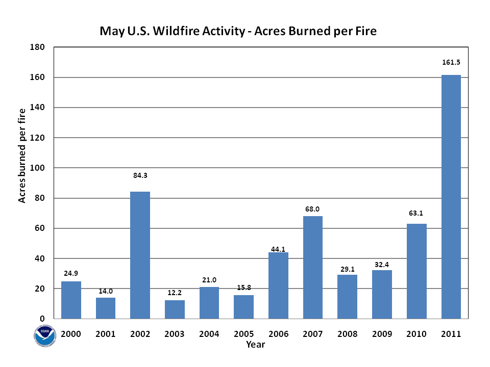
According to statistics from the National Interagency Fire Center (NIFC), at the beginning of June, the nationwide number of fires year-to-date was 29,857 which burned approximately 3.45 million acres (1.4 million hectares), with an average of 115 acres (47.0 hectares) per fire. This marks the fifth smallest (eight largest) number of fires for the year-to-date period and the largest acreage burned since records began in 2000. The relatively small number of fires compared to the acreage burned was associated with the large average fire size. During May, an estimated 1.1 million acres (0.45 million hectares) burned across the U.S., which was roughly three times the 2000-2010 average. A total of 6,614 fires were reported during the month, which was below the 2000-2010 average of 9,509. The average number of acres burned per fire was 161.5 acres (65.0 hectares), which was the largest in the period of record and six times the 2000-2010 average of 37.2 acres (15.1 hectares).

According to the U.S. Drought Monitor, during the month of May, the overall size of the drought footprint shank slightly, but the percent area of the country experiencing Severe-to-Exceptional drought grew. Abnormally dry conditions improved across much of the Great Lakes, and Nebraska. The drought conditions across northeastern Colorado, northern and eastern Kansas also improved. Further to the south and east, drought conditions deteriorated by one to two categories across much of Texas, western Oklahoma, along the Gulf Coast, and along the southeastern Coast. Drought conditions improved slightly across northeastern Texas, which was on the edge of the active storm track through the center of the country. Exceptional drought developed across extreme southwestern Florida, where dry conditions have prevailed for several months. By the end of May, Extreme drought enveloped the southern half of Georgia, and along the North Carolina coast where precipitation deficits were approaching 12 inches (305 mm) on the year, leading to the classification of Severe drought. Drought conditions improved across Hawaii, where the remainder of the Extreme drought was reclassified as Severe drought on the Big Island, and abnormally dry conditions continued across southern Alaska.

According to the U.S. Forest Service (USFS) – Wildland Fire Assessment System, at the beginning of May, very high and extreme fire danger was occurring across the southern half of Texas, along the Mexican-U.S. border in California, Arizona, and New Mexico. Areas of coastal California were also experiencing high fire danger on May 1st. By the 15th, the high fire danger subsided somewhat across southern Texas, but it persisted and spread across the Four Corners region and northward into the Great Basin. Dry conditions across the western Great Lakes during the first half of May caused very high fire danger across the Upper Peninsula of Michigan and most of Minnesota. At the end of May, the high fire danger across the western Great Lakes lowered. Very high fire danger developed across most of Georgia and along the Gulf Coast, where very dry and very hot conditions prevailed. Across the Southern Plains, into the southern Rockies and Great Basin, the very high and extreme fire danger spread to cover nearly the entire southwestern quadrant of the country.
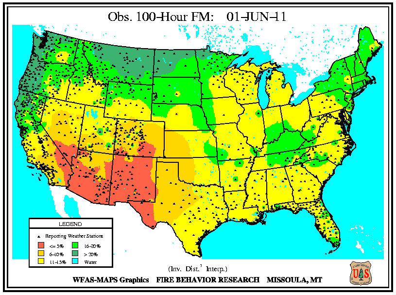
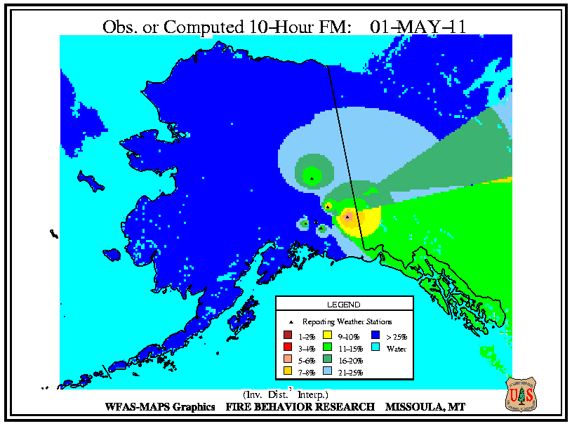
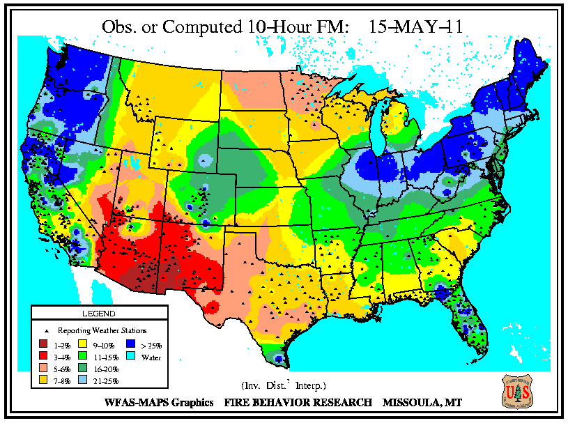
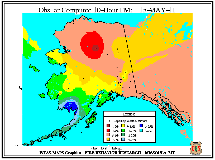
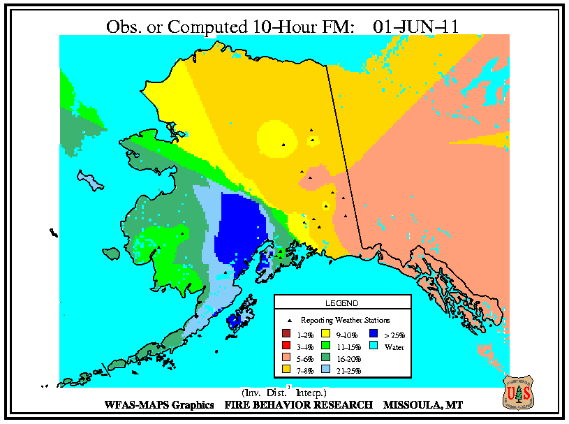
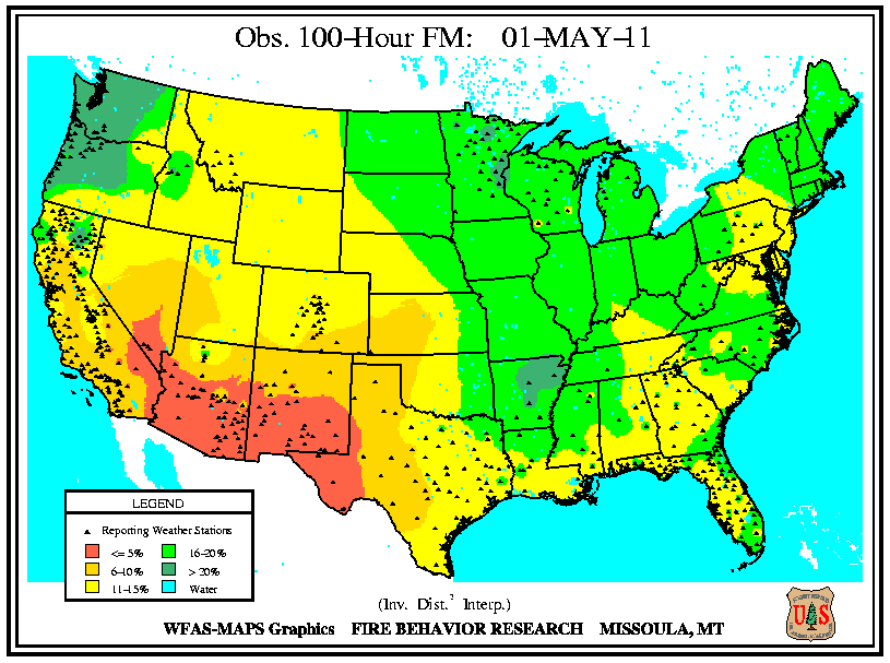
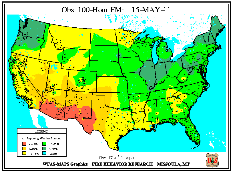
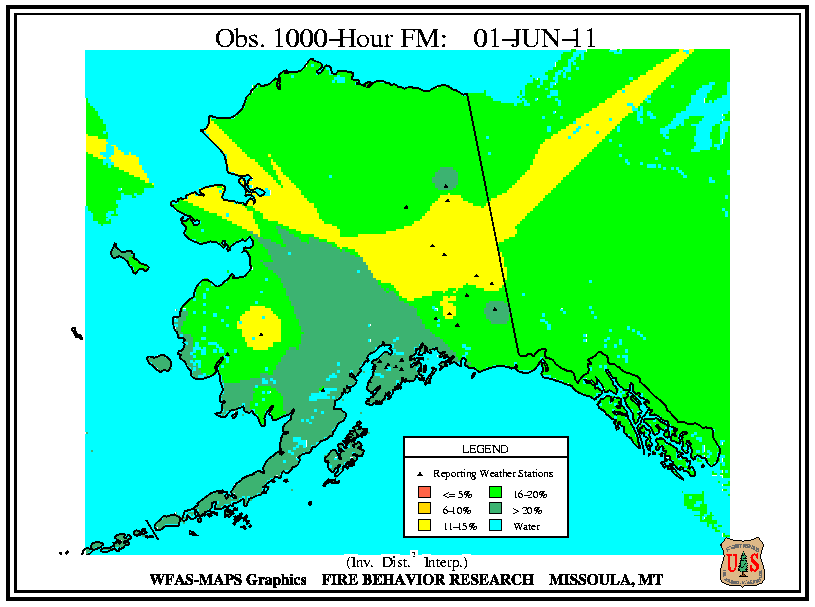
According to the USFS – Wildland Fire Assessment System, at the beginning of May, low 10-hour fuel moistures were widespread around the edges of the country. Low 10-hour fuel moistures were observed across most of New England, along the southeastern coast and stretching along the Gulf Coast, across southern Texas, southern New Mexico, most of Arizona, and southern regions of Nevada and California. Low 100-hour and 1,000-hour fuel moistures were less widespread, with low 100-hour and1,000-hour fuel moistures confined to the southwestern regions of the country. By the 15th, precipitation raised the 10-hour fuel moistures across New England, most of Florida, and southern California. Low 10-hour fuel moistures persisted across the Southern Rockies and the Great Basin and expanded into much of Texas and Oklahoma. Low 10-hour fuel moistures developed across the Northern Plains, enveloping most of Minnesota and North Dakota. Low 100-hour and 1,000-hour fuel moistures persisted across the Southwest and expanded northward into the Great Basin and central Rockies and expanded eastward into the southern Plains. At the end of May, low 10-hour fuel moistures were reported across most of the country, with the exception of New England, and the Pacific Northwest. The lowest 10-hour fuel moistures were observed across the Upper Midwest, the Gulf Coast, the Southern Plains, the Four Corners Region, and the Great Basin. The low 100-hour and 1,000-hour fuel moistures continued to be confined to the southwest and continued their slow creep northward and eastward.

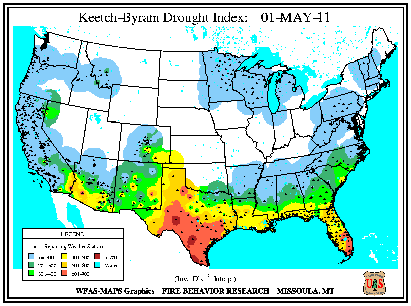
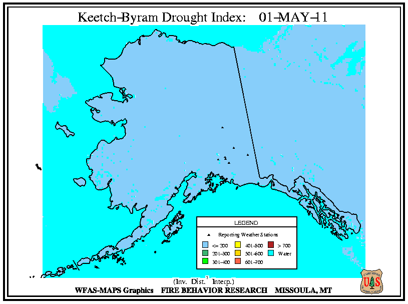
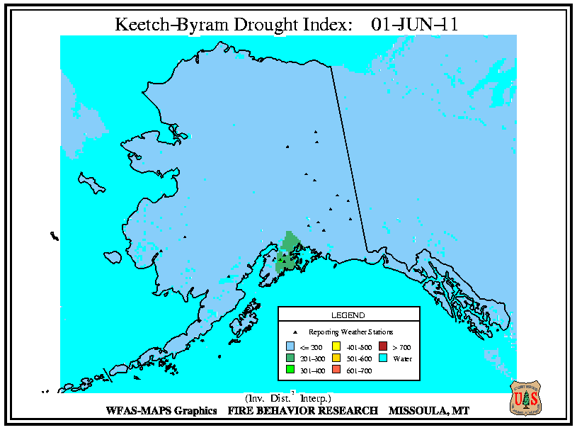
According to the USFS – Wildland Fire Assessment System, at the beginning of the month, high Keetch–Byram Drought Index (KBDI) values were occurring across the regions experiencing the most extreme drought — central and southern Texas, the Gulf Coast, and most of Florida. On the 15th, high KBDI values had spread northwards to cover most of Texas. High KBDI values were observed over more of the Gulf Coast and stretched northward to the coastal Carolinas. By the end of the month, the high KBDI values covered southern Arizona, southern New Mexico, most of Texas, and most of the Gulf Coast and southeastern states.