Atlantic Basin
Overview
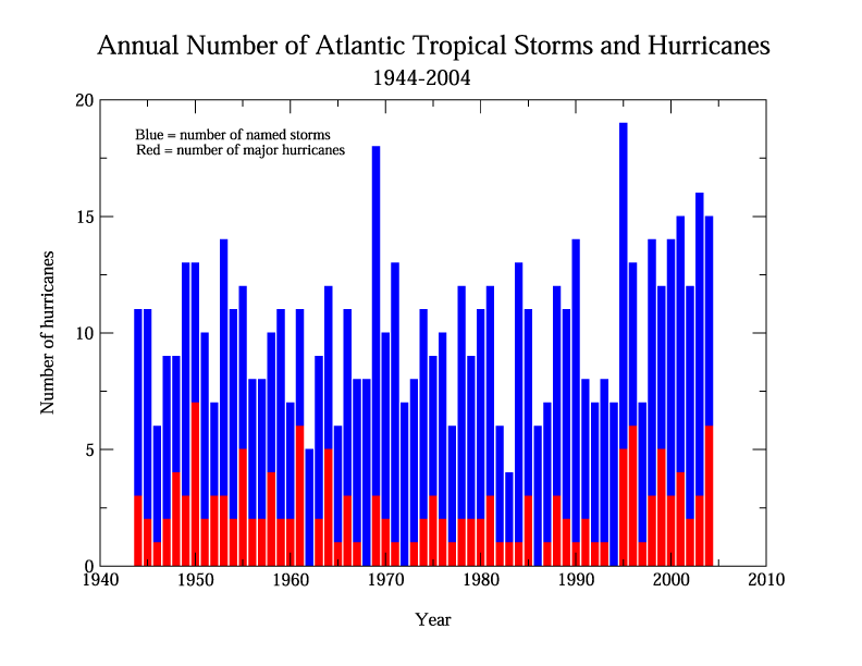
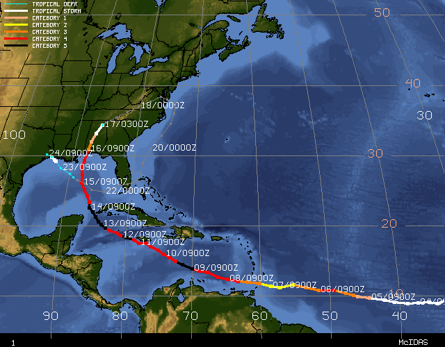
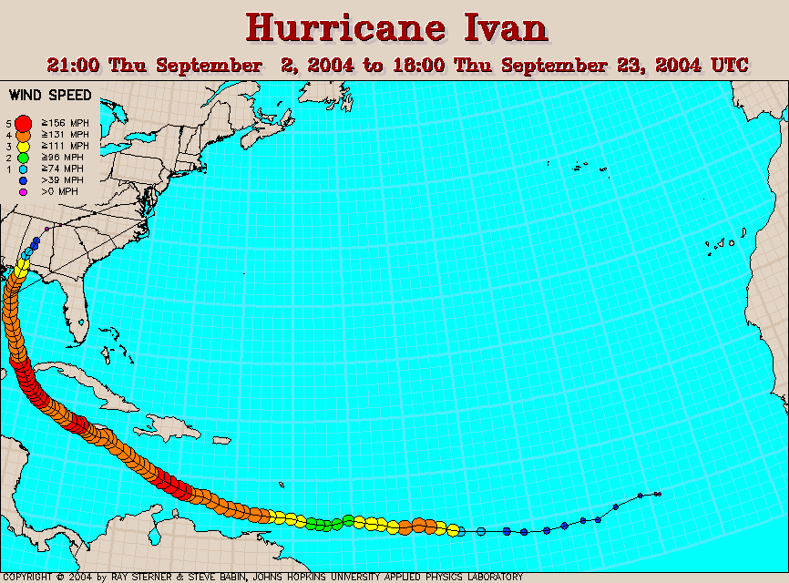
The Atlantic Basin had a more active season than average in 2004 with 15 tropical storms and 9 hurricanes, including 6 major hurricanes. The average (based on data from 1944-1996) is approximately 10 named storms and 6 hurricanes, including 2-3 major hurricanes. The ACE index of hurricane activity also indicates an above average season, with a preliminary value of approximately 220 x104 knots. An average season is anywhere from 66 x104 knots to 103 x104 knots. Hurricane Ivan alone produced an ACE value of 69.9 x10⁴ knots. Its strength and longevity contributed substantially to the cumulative seasonal activity and it holds the record for the greatest consecutive time (7 days) spent with windspeeds of 120 kts/138 mph or greater for any basin. After weakening back to a depression, Ivan also looped southward and then westward through the Atlantic to regenerate into a tropical storm in the Gulf of Mexico. The first named storm of the season, Alex, brushed North Carolina in August before moving northeast and reaching windspeeds of 105 kts (121 mph), category 3 on the Saffir-Simpson scale. The only other storm to reach major hurricane status north of 38N was Hurricane Ellen in 1973 and it reached 100 kts (115 mph). This season is also the most costly hurricane season on record ($42 billion) for the US, with 9 storms affecting its coast. Impacts are described below. Of additional interest was the development, in March, of a hurricane in the South Atlantic, the only documented hurricane in that basin to impact land, and the first hurricane in the South Atlantic to be recorded in the satellite era.
Influencing Factors:
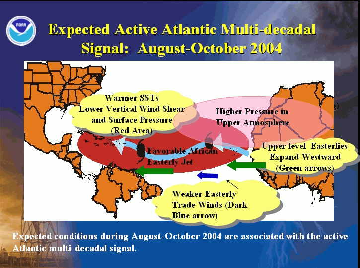
The official NOAA forecast for this season was for 12-15 named storms, with 6-8 becoming hurricanes and 2-4 major hurricanes. This forecast was based on several different factors: The likely continuation of a multi-decadal cycle that has been in an active phase since 1995, warmer than normal sea surface temperatures (SSTs), and a neutral ENSO phase. Tropical cyclone activity in the Atlantic has been above normal since 1995 in response to the active phase of the multi-decadal signal. The average number of tropical storms since 1995 has been 13, compared to 8.6 during the preceding 25 years during which time the multi-decadal signal was in an inactive phase. An average of 7.7 hurricanes and 3.6 major hurricanes since 1995 compares to 5 hurricanes and 1.5 major hurricanes from 1970-1994. Features of an active multi-decadal signal in the Atlantic include warmer SSTs in the tropical Atlantic, an amplified sub-tropical ridge at upper levels across the central and eastern North Atlantic, and reduced vertical wind shear in the deep tropics over the central North Atlantic. The African Easterly Jet (AEJ) also needs to be favorable for promoting hurricane development from tropical disturbances moving westward off the coast of Africa.
The existence of an El Niño or La Niña also significantly impacts the seasonal tropical cyclone activity in the Alantic. Generally, an El Niño in the tropical Pacific will limit activity in the Atlantic and vice versa for a La Niña. Despite the existence of a weak El Niño beginning in August 2004, the lack of a (Pacific) basin-wide structure to the El Niño led to the delayed onset of Atlantic teleconnections, permitting the above average activity to continue through the season.
Of primary importance in this Atlantic hurricane season then, was the continuation of the active phase of the Altantic multi-decadal signal, including above average SSTs.
Impacts of 2004 Season:
Nine tropical systems affected the US during 2004. The estimated cost of damage to the US from hurricanes and tropical storms in 2004 is over $42 billion. This is the most costly hurricane season ever for the US, with the second most costly, at $35 billion, being 1992, the year that Hurricane Andrew impacted Florida.
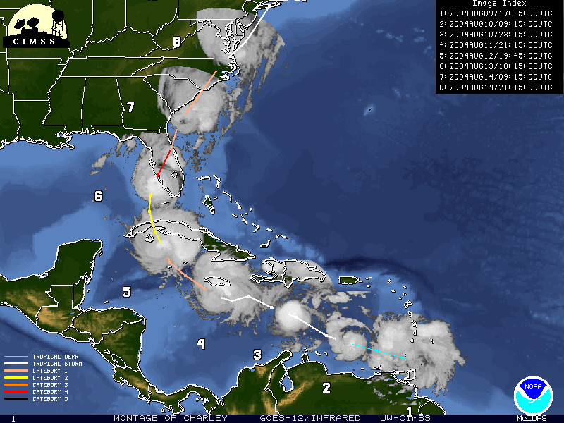
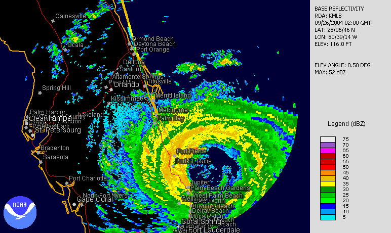
Five hurricanes made landfall in the US with Hurricane Alex also impacting North Carolina without officially making landfall. The record number of landfalling hurricanes in a season is 6 and this occurred in both 1916 and 1985. 2004 shares second place with 1933. An unprecented 4 hurricanes (Charley, Frances, Ivan and Jeanne) affected Florida this year, indeed no other state has been affected by four hurricanes in one season since Texas in 1886. An estimated one in five homes in Florida were damaged by hurricanes during August and September 2004 and 117 people lost their lives in the state from the storms.
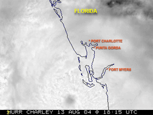
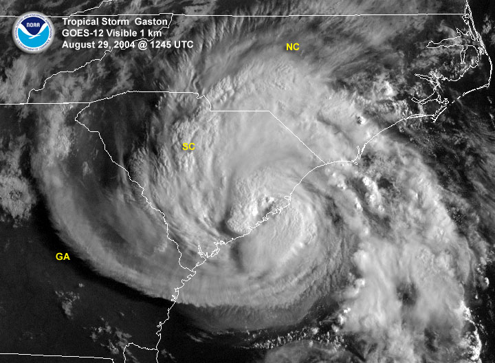
The first hurricane officially to make landfall in the US in 2004, Hurricane Charley, was the strongest and costliest storm to hit the US since Andrew in 1992. Charley was a category 4 storm when it made landfall in Florida and caused approximately $14 billion in damage. The hurricane made a second landfall along the South Carolina coast at category one strength. Hurricane Gaston (reclassified as a hurricane in post-storm analysis) made landfall within a few miles of Charley in South Carolina and within less than three weeks. 2004 is the first year since 1959 that two named storms have come ashore along the South Carolina coast in one season.
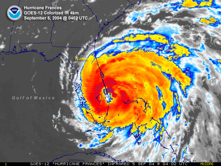
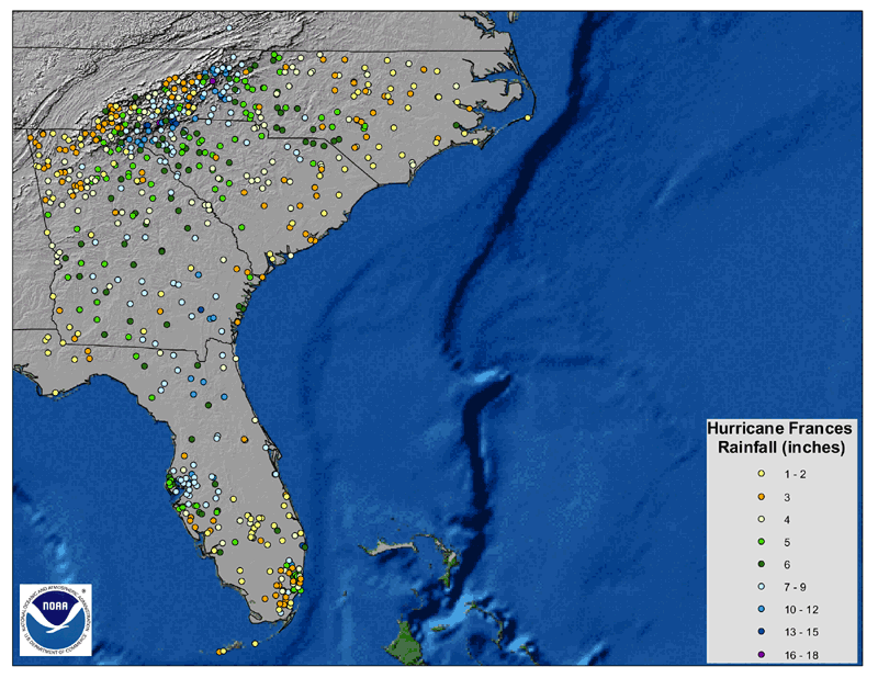
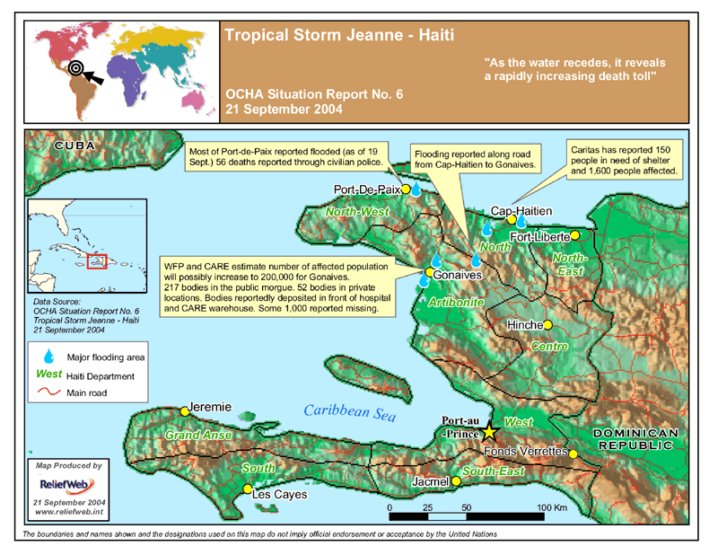
Hurricane Frances made landfall in Florida as a category 2 hurricane in early September and caused over $8 billion in damage. Widespread rainfall amounts over 6 inches and extensive flooding occurred as Frances moved northward through the Appalachian Mountains. This flooding was compounded by the remnants of Ivan less than 2 weeks later. Ivan made landfall as a category 3 storm near Gulf Shores Alabama on September 16th. Overall, Ivan caused $13 billion in damage. Approximately 3 weeks after Hurricane Frances came ashore near Sewall's Point, Florida, Hurricane Jeanne made landfall at almost the exact same location. This is the first known occurrence of two hurricanes making landfall so close in space and time. Jeanne was a category 3 storm at the point of landfall and led to over $6 billion in damages in the U.S. However, the main impact of Jeanne was in Haiti where over 3,000 people were killed due to flooding from Jeanne's torrential rainfall.
More information on these storms and all others this Atlantic hurricane season can be found in the monthly summaries below.
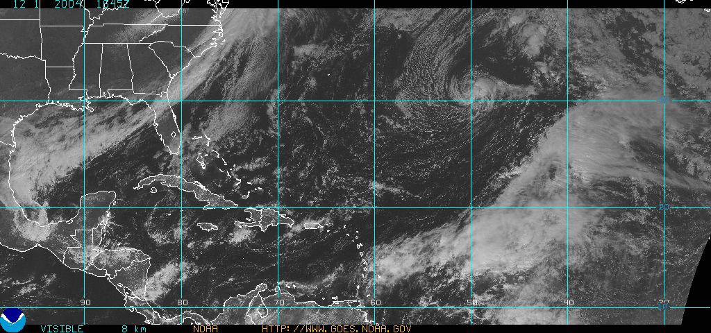
Late November Storm:
Tropical Storm Otto formed late in November on the 30th, about 800 miles east of Bermuda. November 30th is the last official day of the hurricane season. Otto moved southeastward over the two days and slowly weakened to a depression on December 2nd about 880 miles east-southeast of Bermuda.