
January was warmer and wetter than average for the United States

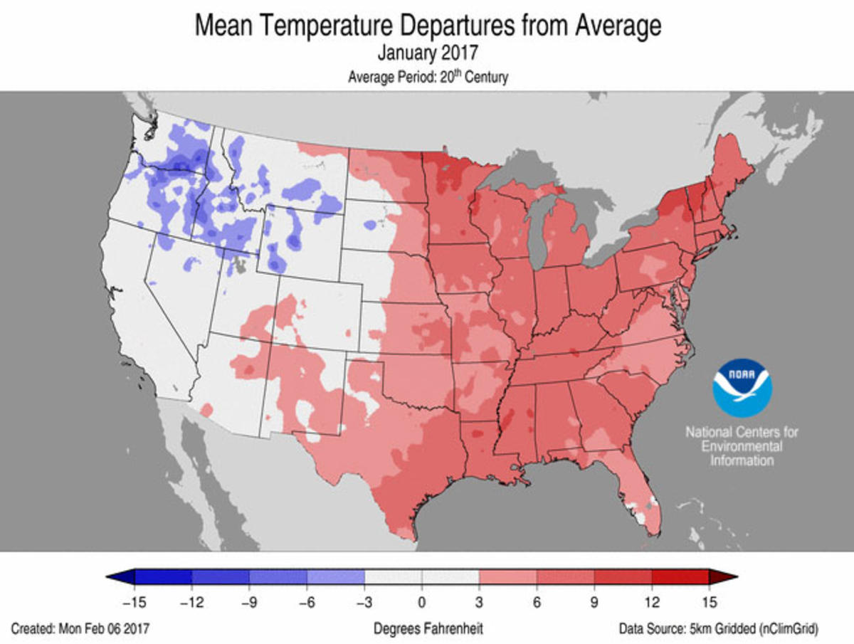
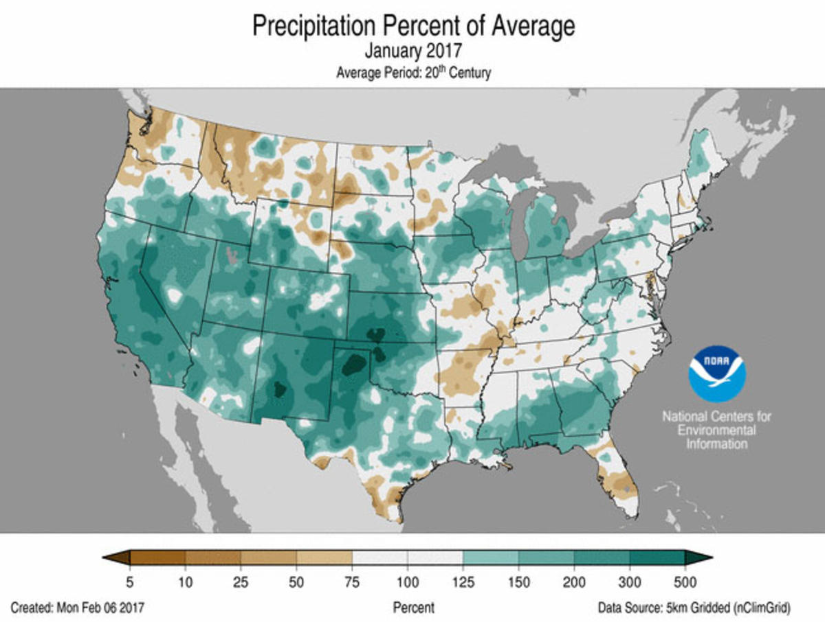
During January, the average contiguous U.S. temperature was 33.6°F, 3.5°F above the 20th century average. This ranked as the 18th warmest January in the 123-year period of record. The January precipitation total was 3.18 inches, 0.87 inch above the 20th century average. This was the ninth wettest January on record and wettest since 1998.
This monthly summary is part of the suite of climate services NOAA provides to government, business, academia, and the public to support informed decision-making.
For extended analysis of regional temperature and precipitation patterns, as well as extreme events, please see our full report that will be released on February 13, 2017.

January Temperature
-
Most locations from the Rockies to the East Coast were warmer than average with 24 states across the Southeast, Midwest, and Northeast much warmer than average. The Northwest and Northern Rockies were cooler than average. No state was record warm or cold during January.
-
The Alaska January temperature was 4.3°F, 1.9°F above the 20th century average. This ranked near the median value in the 93-year period of record for the state and was also the coldest January for the state since 2012. Northern areas of Alaska, particularly along the Arctic Coast, were warmer than average, while most other regions had near- to below-average temperatures.
January Precipitation
-
Large areas of the contiguous United States were wetter than average in January. Much-above-average precipitation was observed across the Southwest, Southern Plains, Midwest, and Southeast. Ten states had much-above-average January precipitation. Below-average precipitation was observed across parts of the Northwest and Mid-Mississippi Valley. No state was record wet or dry in January.
-
According to the January 31 U.S. Drought Monitor report, 14.6 percent of the contiguous U.S. was in drought, down from 22.5 percent at the beginning of the month. Drought improved by several categories across California and Nevada where a series of Pacific storms dumped significant amounts rain and snow. Despite the heavy precipitation, multi-year precipitation deficits persist. Drought also improved across parts of the Southern Plains, Southeast and Northeast. For the first time since March 2011, no location in the country was experiencing Exceptional Drought (D4), the worst category.
Significant Events
-
A strong storm system swept through the Southeast during January 20-22, spawning tornadoes from Texas to South Carolina. There were over 80 preliminary tornado reports, although the confirmed final count will likely be lower. Southern Georgia and Mississippi were the hardest hit areas with over 20 tornado-related fatalities. The deadliest single tornado from the event was an EF-3 that tracked 24 miles across southern Georgia, killing 11 people.
-
A series of Pacific storms slammed into the West Coast during January. While the storms provided much needed drought relief for California and Nevada, the heavy precipitation caused widespread flooding and mudslides. The huge amounts of snow also increased the avalanche threat. A single storm early in the month dropped over 10 feet of snow on the California mountains. According to the USDA, as of February 1, mountain locations across California, Nevada, Oregon, Utah, Arizona and Colorado had snowpack totals more than 180 percent of normal.


