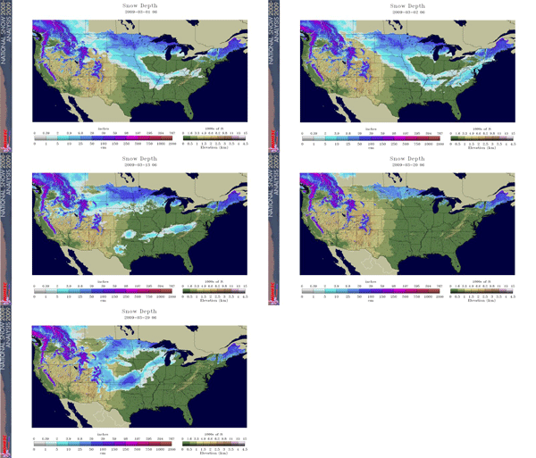
The two satellite-derived images above show the daily snow cover across North America (left map) and the Northern Hemisphere (right map) throughout March 2009. The maps help illustrate the snow coverage expanding and contracting across the U.S. The early March snow storm that affected much of the Southeast is well depicted during the first few days of the month. As a result of the late-month blizzards that affected the Front Range and Midwest, 31 percent of the contiguous U.S. was covered by snow on March 29, according to an analysis by the National Operational Hydrologic Remote Sensing Center. By the end of the month, the snow coverage across the U.S. had decreased to 27 percent, compared to 37 percent on the first of the month.
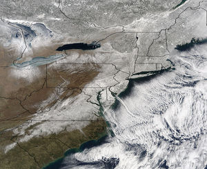
A  major winter storm affected the Eastern Seaboard and southern Appalachian Mountains during March 1st through the 3rd. Before the storm, only 4.5 percent of the eastern coastal region (northeast Georgia, northern South Carolina, the Piedmont and coastal North Carolina, eastern Virginia, through D.C. , and into eastern Pennsylvania, and New Jersey) was covered by snow. By the end of the event, more than 63 percent of that area was covered by snow. As a result of the storm, numerous records were broken during the first few days of the month.
The Black Hills of South Dakota experienced a powerful blizzard on March 23-24. As much as 43 inches (109 cm) of snow fell in western South Dakota. The Rapid City airport received 11.5 inches of snow from the event. The airport also recorded consecutive record highs of 73°F and 77°F on the 21st and 22nd. Fargo, North Dakota received a record amount of snow for the month of March. The 28.1 inches (71 cm) shattered the previous record of 26.2 inches (67 cm) set in 1997. Just to the west, 29.7 inches (75 cm) at Bismarck tied with March 1950 for its highest amount of snow for March and its 5th highest amount for any month.
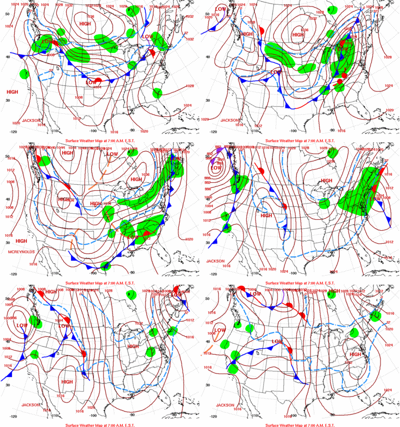
During the later part of the month the weather pattern began to shift with a ridge in the east and deep buckling trough in the west. This pattern improved the chances of severe weather across the country, replacing the relatively calm March that the U.S. was experiencing. Heavy, blizzard-like snows spread misery through much of the Front Range and well in the central and northern Plains. The same systems spawned tornadoes and copious amounts of rainfall across the South. Some locations experienced thunder snow which is typical of an early spring snowstorm. The International Airport in Kansas City was closed for more than two hours on Saturday, the 28th, due to a mixed bag of freezing rain and sleet. Airport officials stated that the maintenance crews could not keep up with the waves of freezing rain and snow which resulted in conditions that were too slick for the aircraft to operate safely. A National Weather Service cooperative network observer in Follett, Texas reported a 24-hour snowfall total of 25 inches (64 cm). If this preliminary report is confirmed, then it would be the greatest 24-hour snowfall total in Texas history. It was also reported that drifts were 10 feet (305 cm) high or greater in some areas. For additional information on this late March blizzard please visit the Amarillo, Texas and Norman, Oklahoma National Weather Service Office special reports page.
The rest of the month was relatively quite as most of the snow events were confined to the Northern Rockies. By the end of April the snowpack levels were at or slightly above normal for the Pacific Northwest. Some areas along the Coastal Ranks of Oregon and the Cascade Range of Washington received more than 200 percent of 1971-2000 snowfall normal. In contrast, the Sierra Nevada snowpack levels were as much as 50 percent below normal. The Front Range of Colorado and much of the Rocky Mountains received some much needed late season snowfall that placed them around near normal levels for the season. The southern Rockies were not as fortunate, as some of those areas received less than 25 percent of normal snowfall this season.
 NOAA's National Centers for Environmental Information


