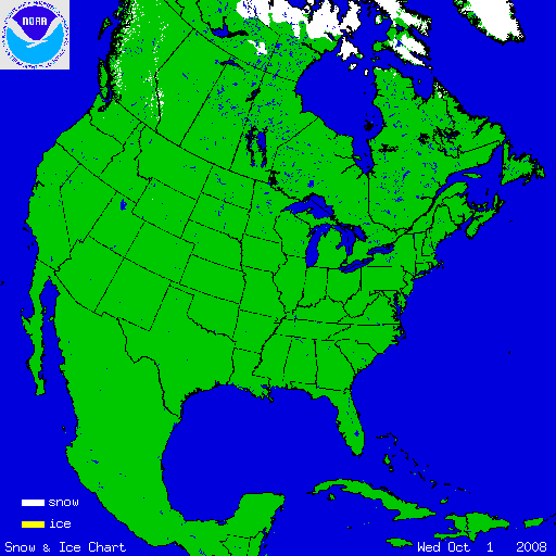
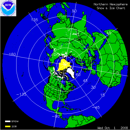
The two satellite-derived images above show the daily snow cover across the Northern Hemisphere (left map) and North America (right map) throughout October 2008. The maps show very small amounts of snow cover on October 1st, illustrating the beginning of the snow pack in the northern latitudes. By clicking on the images, the gradual expansion of snow and ice cover is shown to increase throughout the month across much of Siberia as well as parts of Alaska and Canada. Snow events in the contiguous U.S. are seen in the Rockies, Sierras and the Northeast throughout the month of October, yet snow cover is short-lived.

During the last week of October, a low pressure system off the coast of New England brought much of the Northeast and Mid-Atlantic states an unusually early snowfall. The Catskill Mountains of New York and the Pocono Mountains of Pennsylvania reported the heaviest amounts as 25.6 inches (65 cm) fell in Roxbury, NY and 15 inches (38 cm) fell in Pocono Peak Lake, PA. According to utilities National Grid and New York State Electric and Gas, more than 40,000 customers lost power because of the storm. Areas of the southern Appalachian Mountains also received snowfall amounts that ranged from 1-3 inches (2.5 cm - 7.6 cm).

On October 10-12, a major snowstorm occurred over the western U.S. that dumped as much as 48.8 inches (124 cm) of snow in Cole Creek, Montana and 29.9 inches (76 cm) of snow in Lander, Wyoming. It is reported that the Lander measurement was the greatest October snowfall ever recorded. Glasgow, Montana also received 12.8 inches (33 cm) of snowfall which was a daily record for the month. To view additional records related to this storm, please visit NCDC's U.S. Records page.