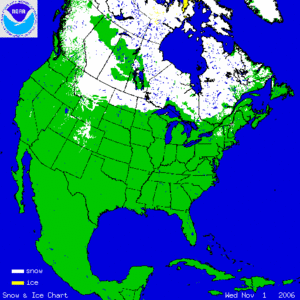
The two satellite-derived animations above show the daily snow cover across the Northern Hemisphere (left map) and North America (right map) throughout November 2006. The maps illustrate the advance of the snow pack in the northern latitudes. By clicking on the images, the gradual expansion of snow and ice cover is shown throughout the first 3 weeks of the month. During the last several days of November, snow cover expanded across Canada, the U.S. and parts of Asia. By the 30th, much of Russia, Kazakhstan, Mongolia, Alaska, Canada and the western U.S. were snow covered. Arctic sea-ice also increases throughout the month and ice cover on Hudson Bay begins to form along the perimeter. Great Lakes ice cover has yet to develop in 2006.
More information on significant winter weather and other hazards can be found on NCDC's Hazards page.
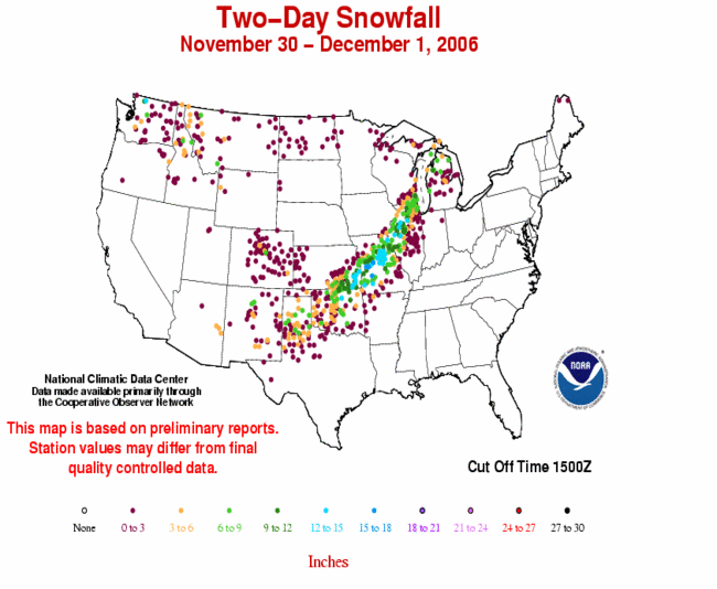
The map to the left depicts the 2-day accumulated snowfall present across a wide swath from the southern Great Plains to the Great Lakes from mid-day on November 29th through mid-day on December 1st. A major winter storm swept across this region bringing widespread ice and snow and causing major power outages. Over a foot of snow was reported from southeast Kansas to western Illinois during this event.
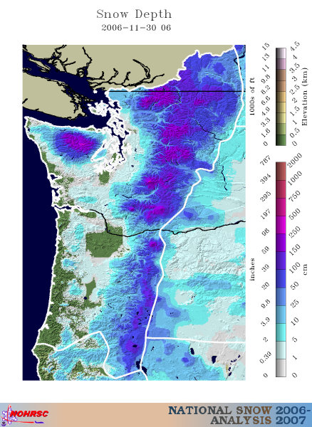
A few days prior to this snowstorm, heavy snowfall blanketed areas of the Pacific Northwest. New snowfall accumulations of up to two feet (60 cm) fell in the Cascades of Washington and Oregon. More information on November severe winter weather can also be found on NCDC's Hazards page.