Updated: 8 September 2011

Overview
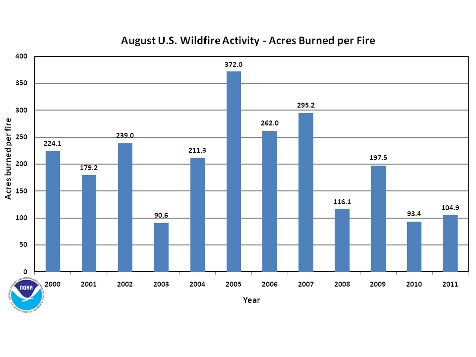
Record-breaking wildfire activity was observed across the southern tier of the U.S. during the first six months of the year (January-June), but the slowdown in wildfire activity which began in July 2011 continued into August. During the month, just over 0.86 million acres (348,000 hectares) burned nationwide — significantly less than the 2001-2010 August average of 1.8 million acres (768,900 hectares) and the August record high of 3.1 million acres (1.25 million hectares), which burned in 2005. The August acreage burned was the second least in the 12-year period of record. Although August was a relatively slow wildfire month, during the January-August 2011 period, nearly 7.0 million acres (2.8 million hectares) burned across the country — much above average for the year-to-date period and the fourth most on record.
August Wildfire Statistics*
| August 2011 | 2001-2010 Average (10-years) | Rank (of 12 years) | Record (year) | |
|---|---|---|---|---|
| Area Burned | 864,470 acres | 1,827,8302 acres | 2ndsmallest (11thlargest) | 3,078,418 acres (2005) |
| Number of Fires | 8,238 | 8,955 | 4thleast (9thmost) | 11,217 (2000) |
| Area Burned per Fire |
104.9 acres | 205.6 acres | 3rdsmallest (10thlargest) | 3712.0 acres (2005) |
Year-to-Date Wildfire Statistics*
| Year-to-Date as of August 31st 2011 |
2001-2010 Average (10-years) | Rank (of 12 years) | Record (year) | |
|---|---|---|---|---|
| Area Burned | 6,956,042 acres | 5,334,675 acres | 4th largest (9thlargest) | 7,599,563 acres (2006) |
| Number of Fires | 53,870 | 57,940 | 4thleast (9thmost) | 78,948 (2006) |
| Area Burned per Fire |
129.1 acres | 92.1 acres | 3rd largest (10thsmallest) | 162.6.2 acres (2005) |
*Data Source: The National Interagency Fire Center (NIFC)
Discussion
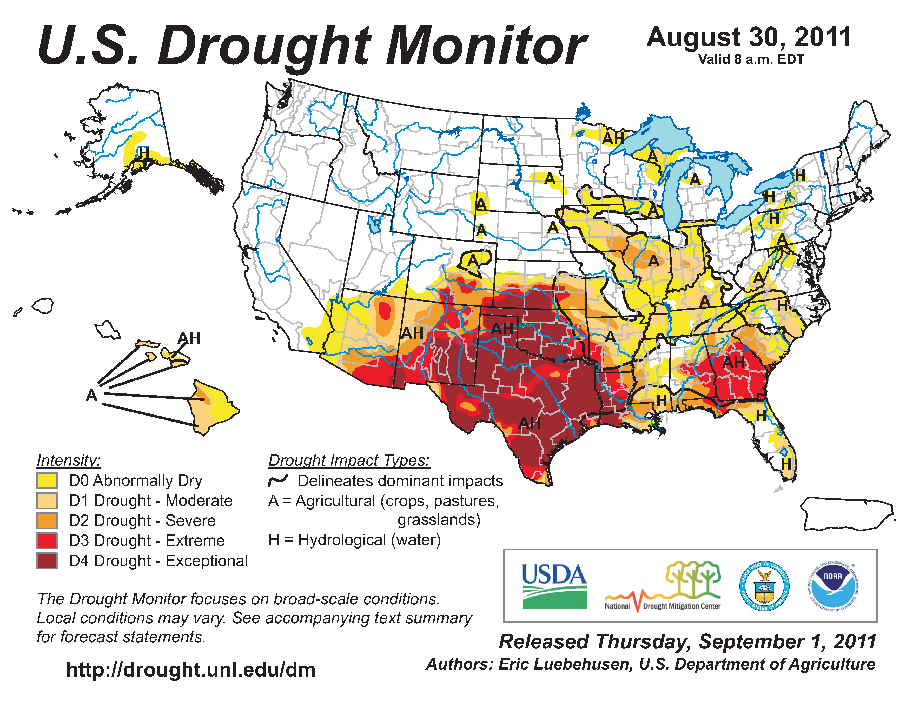
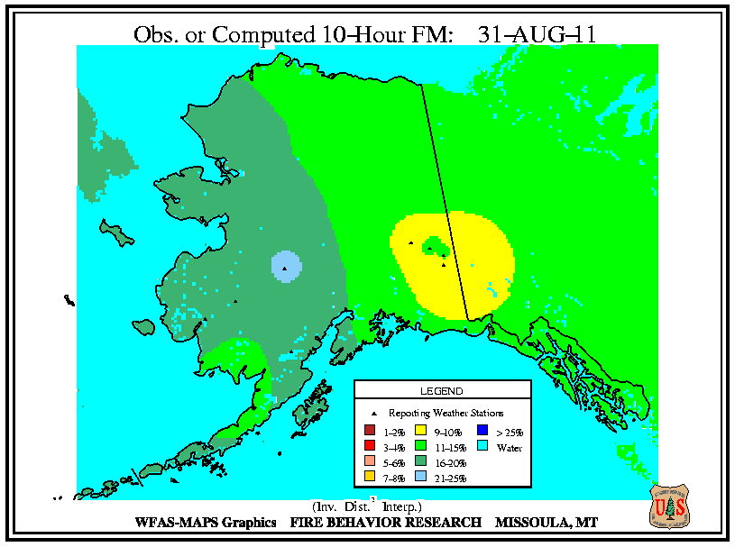
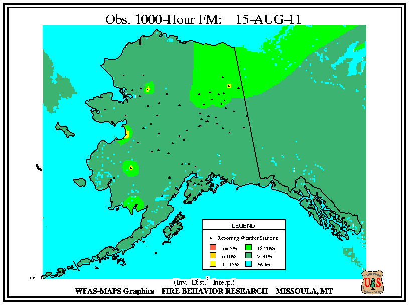
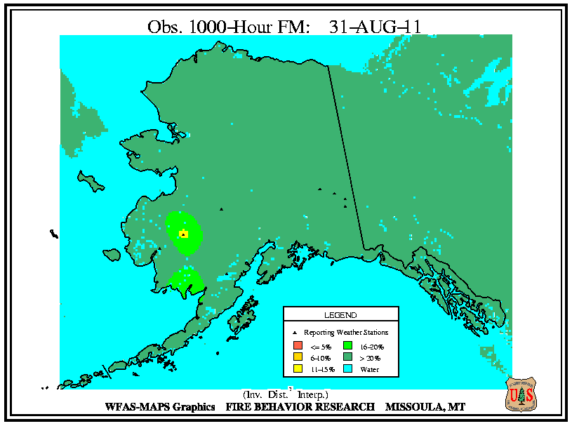
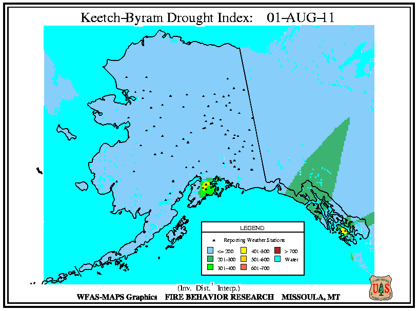
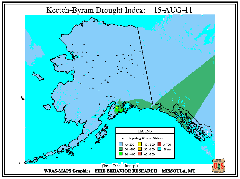
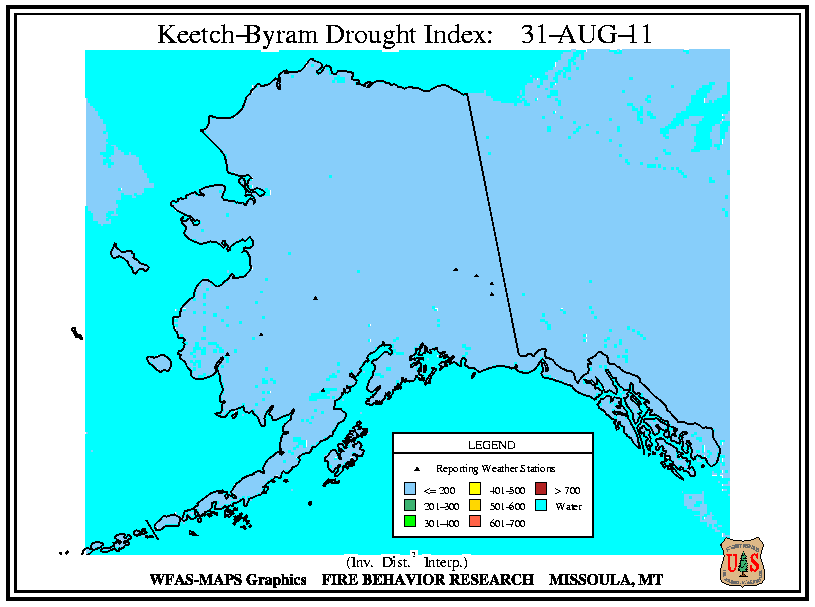
During August, a similar weather pattern which has existed most of the summer continued. See the U.S. Temperature and Precipitation discussion for more information. According to the U.S. Drought Monitor, the overall size of the drought footprint changed little during August, but the size of the exceptional drought (D4) foot print expanded to cover 11.2 percent of the country. Across the Southern Plains and Southwest, very little to no precipitation fell, causing the extreme and exceptional drought (D3-D4) to persist across Texas, Arizona, New Mexico, Oklahoma, and parts of Colorado and Kansas. The exceptional drought (D4) expanded to cover much of Louisiana. Drought conditions worsened from abnormally dry at the beginning of August to moderate-to-severe drought (D1-D2) across the mid-Mississippi River Valley, and the Ohio and Tennessee Valleys. Extreme drought (D3) persisted across Georgia and expanded into Alabama. Hurricane Irene brought beneficial rain to much of the coastal mid-Atlantic and Northeast, improving drought conditions one to three categories, and eliminating the extreme drought (D3) across North Carolina. Storm systems moving through the Northeast also eliminated drought conditions across the eastern Great Lakes. Across Alaska drought conditions remained unchanged with abnormally dry conditions persisting across the southern coastal regions of the state.
Wildfire information and environmental conditions are provided by the National Interagency Fire Center (NIFC) and the U.S. Forest Service (USFS) Wildland Fire Assessment System (WFAS).

At the beginning of August, there were 28 large wildfires active across the country. Eight large wildfires were burning across Arkansas (4 fires), Oklahoma (3), and Missouri (1), where very hot and dry conditions dominated during the second half of July causing low 10-hour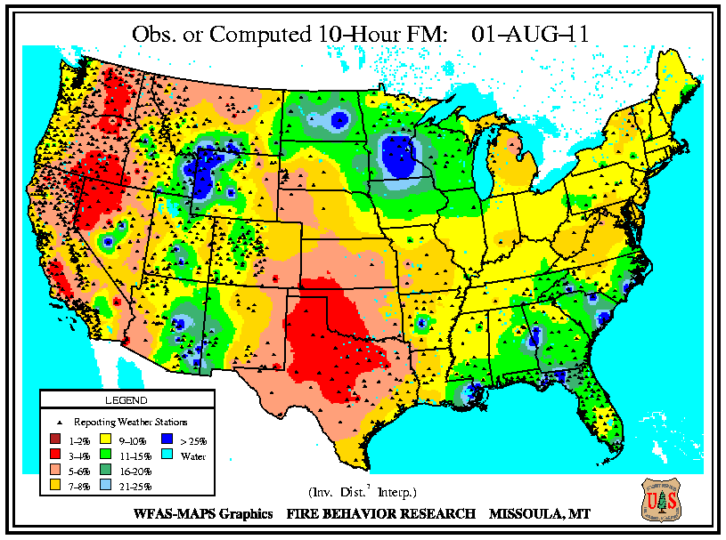 fuel moistures and extremely high Keetch–Byram Drought Index (KBDI)
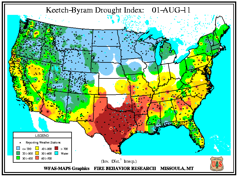 values. The large wildfires across the Southeast active at the end of July continued to burn into August, with two each in Florida and North Carolina, although environmental conditions did not favor large wildfire growth. A continuation of monsoonal precipitation across the Southwest limited large wildfires there, with three burning in New Mexico and one burning in west Texas. Most of the region continued to experience low 100-hour
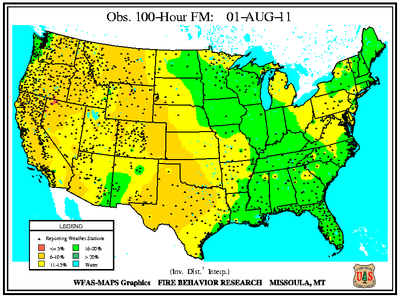 and 1,000-hour
 fuel moistures, but the precipitation at the end of July increased 10-hour fuel moistures and lowered KBDI values and subsequently the high fire danger
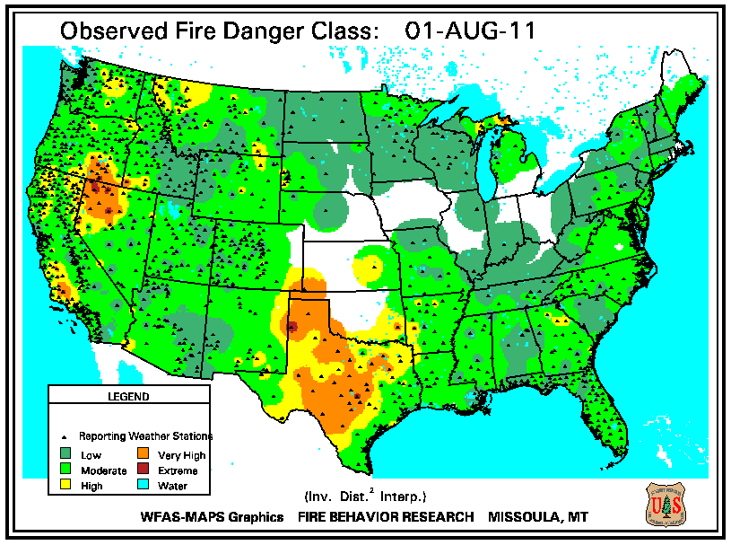 . Meanwhile, large wildfire activity increased across the Intermountain West and along the Great Basin, with three large fires active in Nevada and Idaho, and two large fires active in Wyoming, Oregon, and California. Across the region, dry conditions dominated the last seven days of July. The weeklong period of dry and warm conditions lowered 10-hour fuel moistures considerably across the region increasing the fire danger. However, larger fuels (low 100-hour and 1,000-hour fuel moistures) were moist, and KBDI values were low.
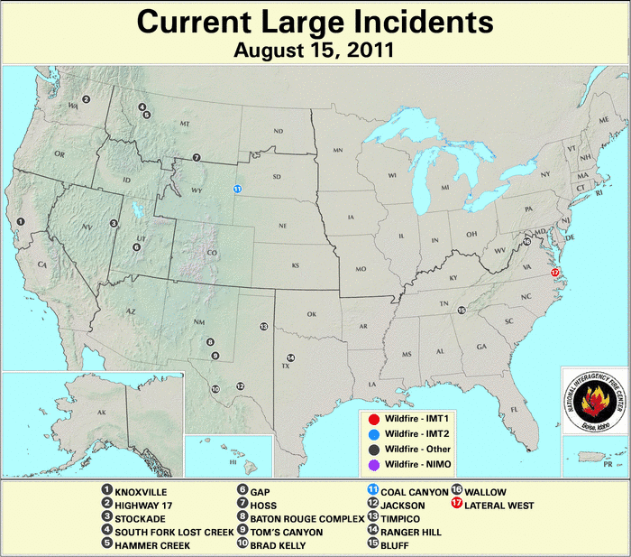
By August 15th, there were 17 large wildfires burning across the country. Six large wildfires were burning across Texas (4 fires) and New Mexico (2), where warm and dry conditions persisted for the first half of the month. High to very-high fire danger was reported across central Texas, stretching across the western part of the state into eastern New Mexico. Across the region, fuels of all sizes (10-hour
 , 100-hour
 , and 1,000-hour
 fuel moistures) were dry and very high KBDI
 values were observed. Eight large wildfires were burning across the Intermountain West — Montana (3), Wyoming (1), Washington (1), Utah (1), Nevada (1), and California (1) — where cool, but dry conditions persisted for several weeks. The dry weather decreased the 10-hour, 100-hour, and 1,000-hour fuel moistures across the region, as well as increased the fire danger across the higher terrain. The reported KBDI values were relatively low. In the East, large wildfires were active across Virginia (2) and Tennessee (1). Across the region, much of the summer was dry and warm, and the beginning of August was no exception. On the 15th, the observed fire danger was moderately high with low 10-hour fuel moistures observed. High and very high KBDI values were also reported across the region, although 100-hour and 1,000-hour fuel moistures were high.

By the end of August, wildfire activity across the western half of the country increased significantly. On the 31st, there were 59 large wildfires burning across the contiguous United States. In the northwestern quadrant of the country, 27 large wildfires were burning across Montana (10 fires), Oregon (8), Washington (3), Idaho (3), and Wyoming (3). Dry conditions the second half of August increased the fire danger across the region, as well as the KBDI values
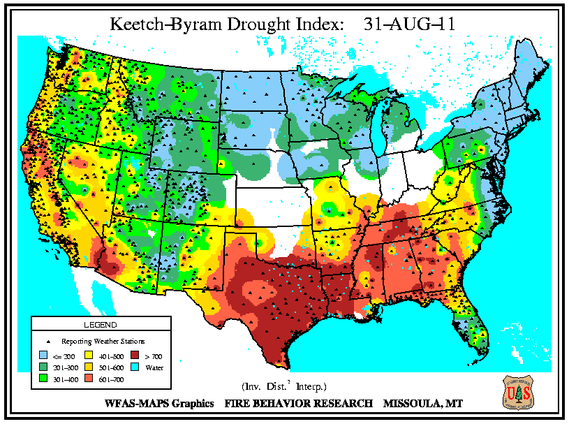 across the higher elevations. Extremely low 10-hour
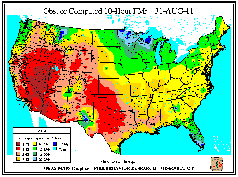 fuel moistures were widespread, with moderately low 100-hour
 and 1,000-hour
 fuel moistures. Thirteen large wildfires were active across the Southwest, with fires active in California (5), Nevada (2), Utah (2), Arizona (2), New Mexico (1), and Colorado (1). During the second half of August, the monsoonal rain showers across the Southwest slowed significantly, and the heat across the region created ideal wildfire conditions. Very high and extreme fire danger was observed across portions of the Southwest, stretching across the Great Basin. Small fuels (10-hour fuel moistures) were extremely dry, while larger fuels (100-hour and 1,000-hour fuel moistures) were moderately dry across the region. KBDI values were relatively low, with the exception of extreme southwestern Arizona and California’s Central Valley. Across the Southern Plains, 14 large wildfires were active with 12 of those being in Texas and one in both Oklahoma and Arkansas. The last half of the month was extremely warm, and the dryness continued, causing 10-hour fuel moistures to plummet and the fire danger to increase. KBDI values remained high across the area. Four large wildfires were active across the Southeast, with one each in Florida, Alabama, Tennessee, and Virginia. Low 10-hour fuel moistures were widespread, with moderately low 100-hour and 1,000-hour fuel moistures. Precipitation across some parts of the Southeast lowered the fire danger and KBDI values, while high fire danger and high KBDI values persisted in others, particularly where the large wildfires were burning.