Updated: 5 November 2010

*Data are for the period October 1st–October 29th, and are from the National Interagency Fire Center.


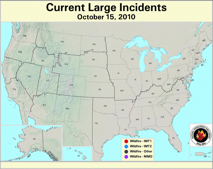
October 2010 brought near-normal number of fires and acreage burned for the month. An estimated 3.18 million acres have burned during 2010 to-date, which is 3.42 million acres below the 10–year average and the least acreage burned for the January–October period on record. Weather conditions averaged for October were warmer and drier than normal for the nation as a whole, but wetter–than–average conditions dominated the western United States. See the national temperature and precipitation State of the Climate report for additional information on temperatures and precipitation. On October 1st there were 10 large wildfires burning across the U.S. with three in Alaska, two in Wyoming, and one each in Idaho, Colorado, Utah, Arkansas, and Florida. By the 15th, there were no large wildfires were burning in the country. Conditions favorable for fire were prevalent east of the Rockies the last half of the month with 13 new large fires burning by the end of October — three in Kentucky; two in Oklahoma, Missouri, and Florida; and one each in Colorado, Virginia, Louisiana, and Mississippi.
2010 Wildfire Statistics
(Source: NIFC)| Year–To–Date Totals as of October 29th | Nationwide Number of Fires | Nationwide Number of Acres Burned |
|---|---|---|
| 10/29/2010 | 61,736 | 3,182,499 |
| 10/29/2009 | 73,206 | 5,708,150 |
| 10/29/2008 | 73,352 | 5,034,070 |
| 10/29/2007 | 76,731 | 8,695,499 |
| 10/29/2006 | 86,391 | 9,400,909 |
| 10/29/2005 | 56,589 | 8,256,081 |
| 10/29/2004 | 62,852 | 8,042,281 |
| 10/29/2003 | 55,533 | 3,337,304 |
| 10/29/2002 | 69,274 | 6,707,556 |
| 10/29/2001 | 69,290 | 3,779,562 |
| 10/29/2000 | 87,809 | 7,048,206 |
| 5–yr average (2005 – 2009) |
73,254 | 7,418,942 |
| 10–yr average (2000 – 2009) |
70,703 | 6,600,962 |
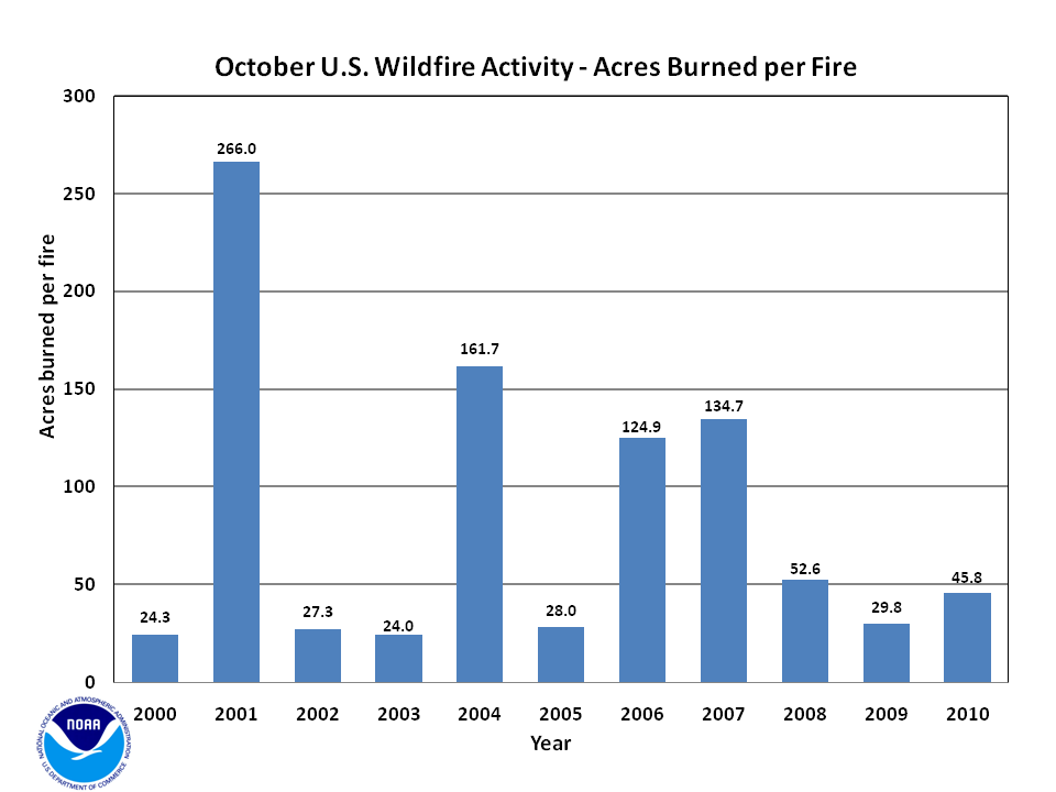
According to statistics from the National Interagency Fire Center (NIFC), at the end of October, the nationwide number of fires year-to-date was 61,736 which burned 3.18 million acres (1.29 million hectares), with an average of 51.6 acres (20.9 hectares) per fire. Between October 1st and October 29th, an estimated 210,259 acres (85,089 hectares) burned across the U.S., which is 15 percent below the 2000–2009 average. A total of 4,594 new fires were reported during the month, which is 24 percent above the 2000–2009 average. The average number of acres burned per fire was 45.8 (18.5 hectares) during October and is 48 percent below the ten-year mean.
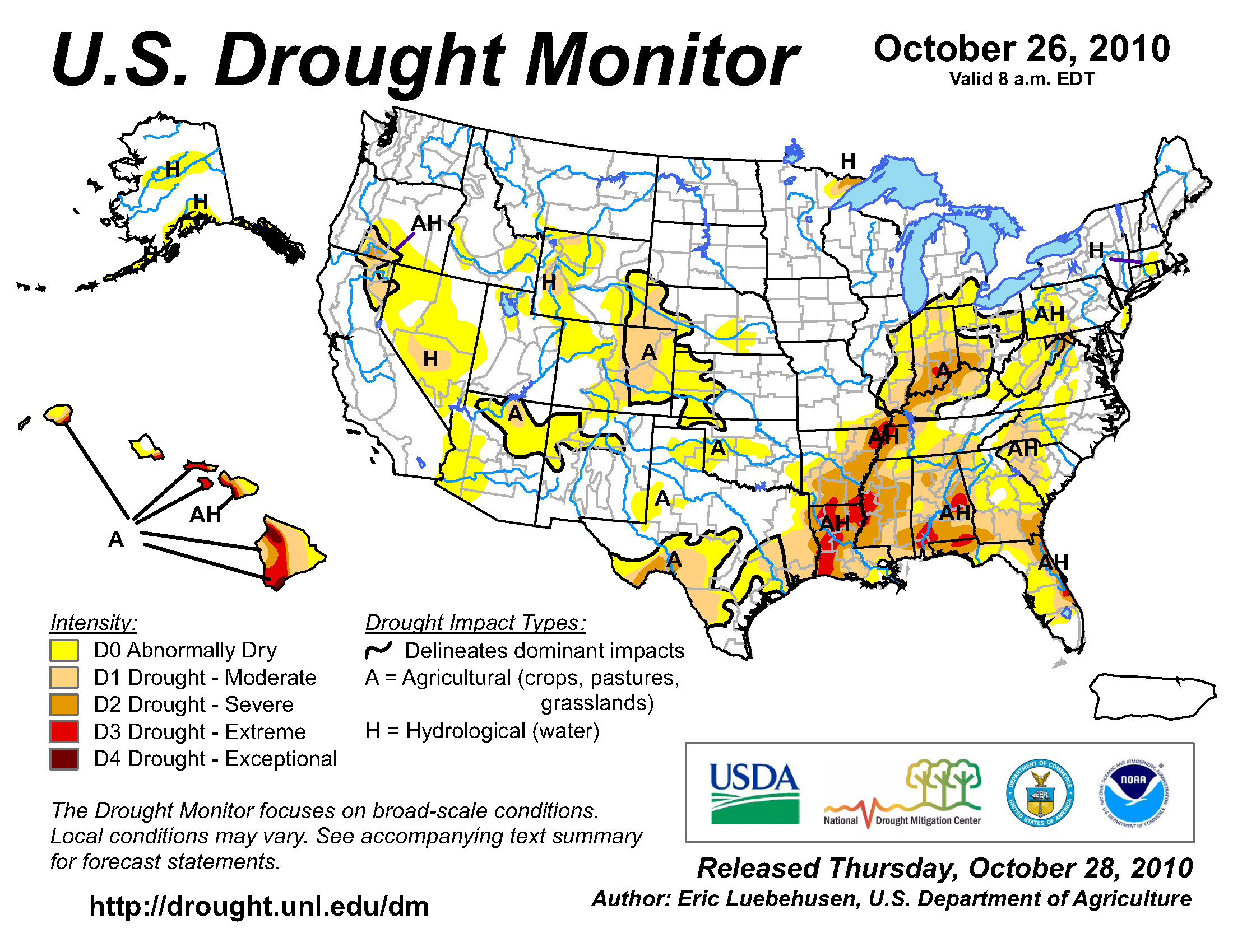
According to the U.S. Drought Monitor, drought conditions improved for some regions of the country and deteriorated for others during October. The remnants of Tropical Storm Nicole interacting with a frontal system moving across the country brought heavy rain to the Mid–Atlantic and Northeast coastal areas improving drought conditions one to two drought categories. The precipitation did not make it very far westward, with drought conditions worsening to severe and extreme across the Ohio River Valley, the Lower Mississippi River Valley, and parts of the Southeast. Drought also developed in Southern Texas. The Front Range of the Rockies experienced improving drought conditions as well as northern Arizona and most of Nevada.

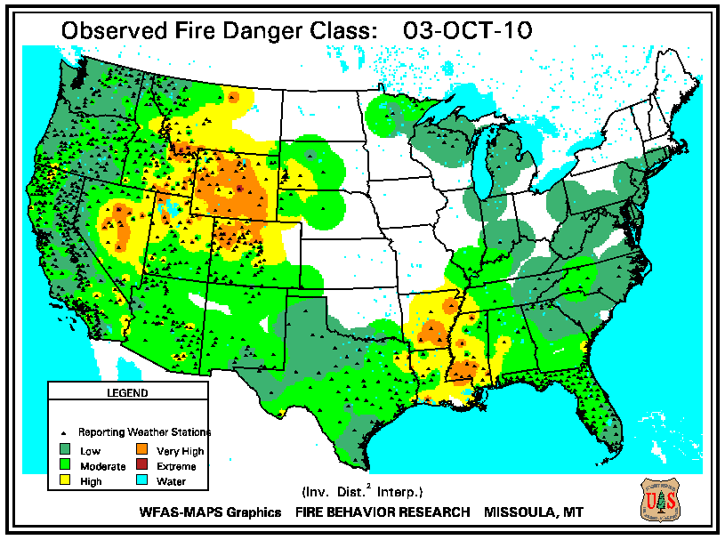
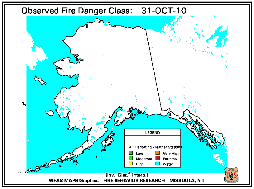
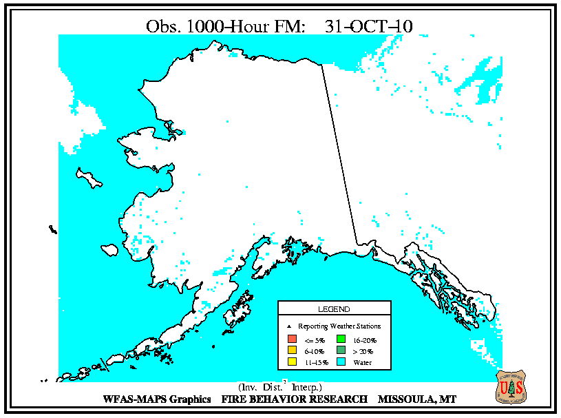
According to the U.S. Forest Service (USFS) Wildland Fire Assessment System, at the beginning of October, high fire danger was present where drought expanded in the Lower Mississippi River Valley as well as the central and northern Rockies, and the Great Basin. By the middle of the month, the high fire danger in the Lower Mississippi River Valley expanded to the rest of the Gulf Coast and deeper into the Southeast. The high fire danger persisted in the central Rockies, but precipitation and cloud coverFire danger was consistently low for Alaska during October.
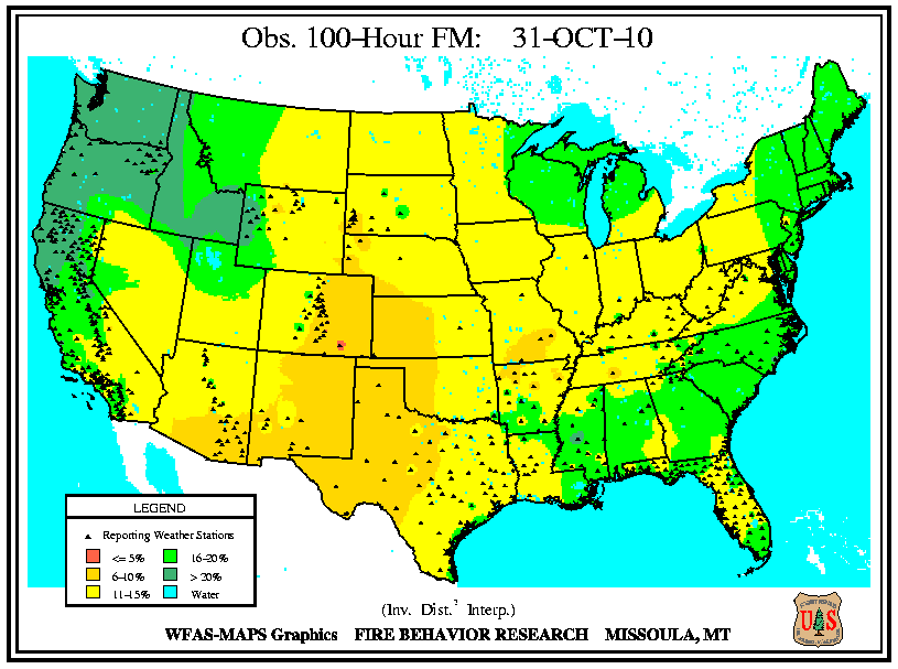
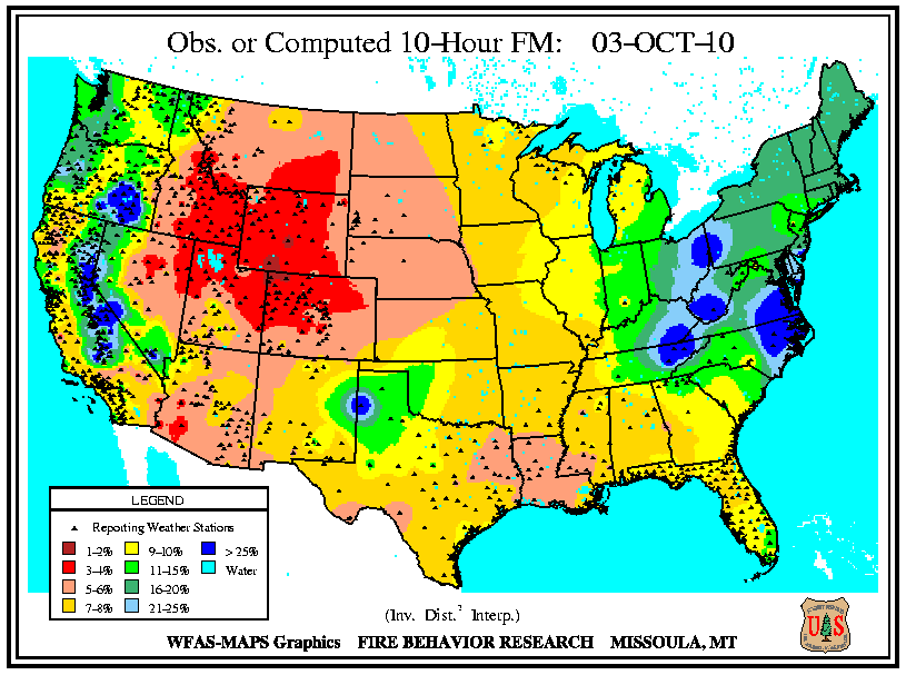
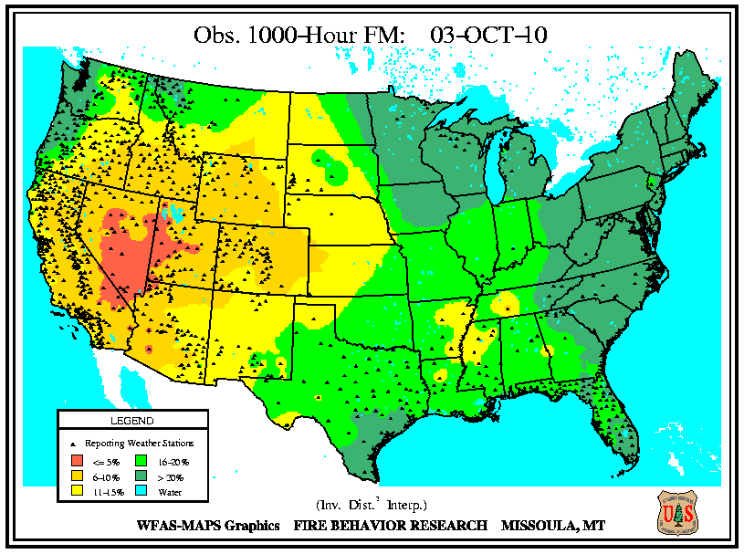
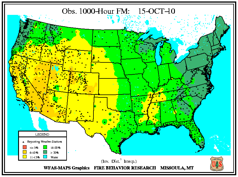
According to the USFS Wildland Fire Assessment System, the beginning of October brought low 10-hour fuel moistures to the entire intermountain West, as well as Coastal California, stretching eastward into the High Plains. Low 10-hour fuel moistures were also present along the western Gulf Coast. Observed 100-hour and 1,000-hour fuel moistures had similar spatial patterns, with low fuel moistures along and west of the Rockies. By the 15th, coverage of low fuel moistures changed little. Low 10-hour fuel moistures extended eastward to cover most of the Plains, Southeast, and Midwest. Low 10-hour fuel moistures also expanded into the Great Basin. Measured 100-hour and 1,000-hour remained unchanged. By the end of the month, 10-hour fuels moistened across most of the West, while dry 10-hour fuel moistures persisted in Colorado, New Mexico, and Texas. 10-hour fuel moistures continued to be dry across the eastern half of the country, with low 10-hour fuel moistures stretching into New England. The low 100-hour and 1,000-hour fuels moistened across the Pacific Northwest, where the rainy season had begun. Large fuel moistures remained unchanged elsewhere.

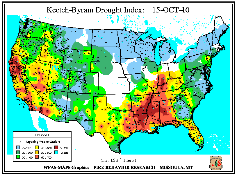
According to the USFS Wildland Fire Assessment System, at the beginning of the month, high Keetch–Byram Drought Index (KBDI) high KBDI values were present across the Lower Mississippi River Valley, the Ohio River Valley, as well as Nevada, southwestern Arizona, and most of California. By the middle of the month, conditions in the West remained generally unchanged, while high KBDI values expanded across the South, Southeast, and Ohio River Valley. On the 31st, the KBDI values in the western regions were much lower, with moderately high values only present for central California. The dry conditions continued for most of the South, Southeast, and Ohio Valley allowing the high KBDI values to persist.