Issued: 8 December 2009
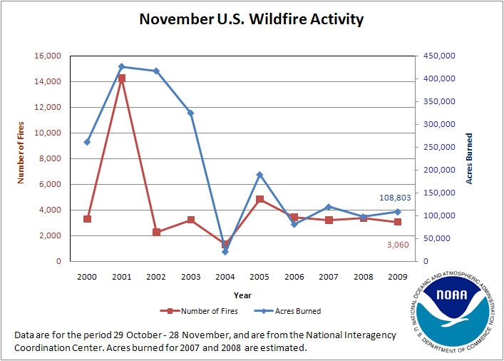
November is historically a month of low fire activity, and November 2009 was no exception. Wildfire activity across the nation in November was well below average for the month. A total of 3,060 fires burned approximately 108,803 acres. These values rank November 2009 as the eighth lowest in terms of the number of November fires over the past decade, and seventh lowest for the amount of acreage burned.
At the start of November, Arizona claimed the only large active wildfire. However, by November 10th, five large fires were burning in eastern Kentucky, bringing to nine the total number of active large wildfires across the nation. Fortunately, within a few days, only two large fires were present, one in southern Missouri and one in eastern Arizona. No significant fire activity was reported during the latter half of the month, and toward the end of November, just three large fires – one in Minnesota, and two in eastern Kentucky – were burning.
[ October 30
 |
November 13
|
November 13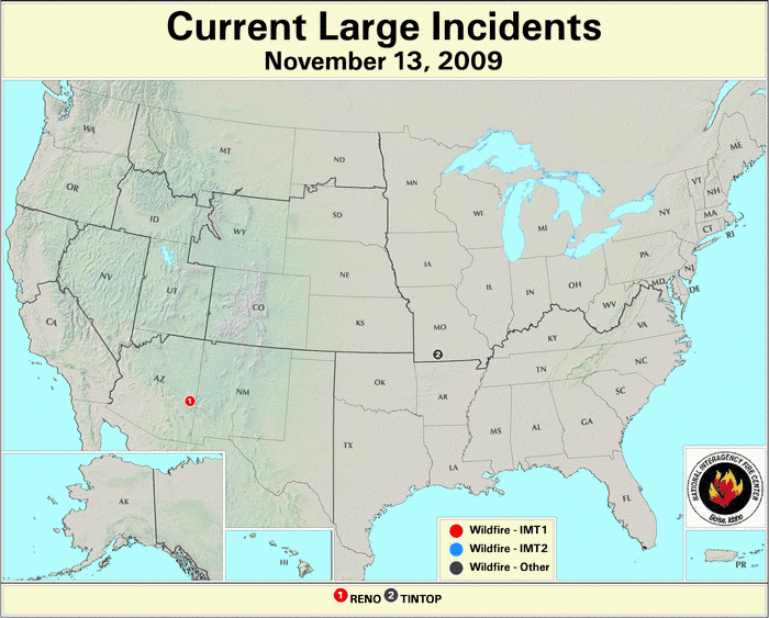 |
November 27
|
November 27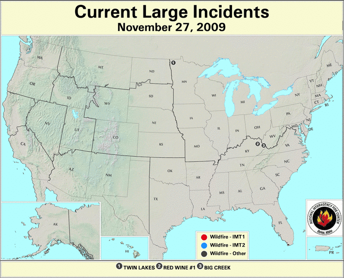 ]
]
Note: Unless conditions warrant it, the U.S. Forest Service updates out of season large fire maps once per week on Fridays.
2009 Wildfire Statistics
(Source: NIFC)| Year–To–Date Totals as of November 28th | Nationwide Number of Fires | Nationwide Number of Acres Burned |
|---|---|---|
| 11/28/2009 | 76,484 | 5,884,153 |
| 11/28/2008 | 77,228 | 5,138,628 |
| 11/28/2007 | 80,281 | 9,309,005 |
| 11/28/2006 | 89,975 | 9,524,251 |
| 11/28/2005 | 61,661 | 8,451,099 |
| 11/28/2004 | 64,334 | 8,063,921 |
| 11/28/2003 | 59,149 | 3,825,786 |
| 11/28/2002 | 71,644 | 7,124,849 |
| 11/28/2001 | 81,681 | 3,355,138 |
| 11/28/2000 | 91,094 | 7,309,887 |
| 5–yr average (2005 – 2009) |
77,126 | 7,661,427 |
| 10–yr average (2000 – 2009) |
75,354 | 6,818,672 |
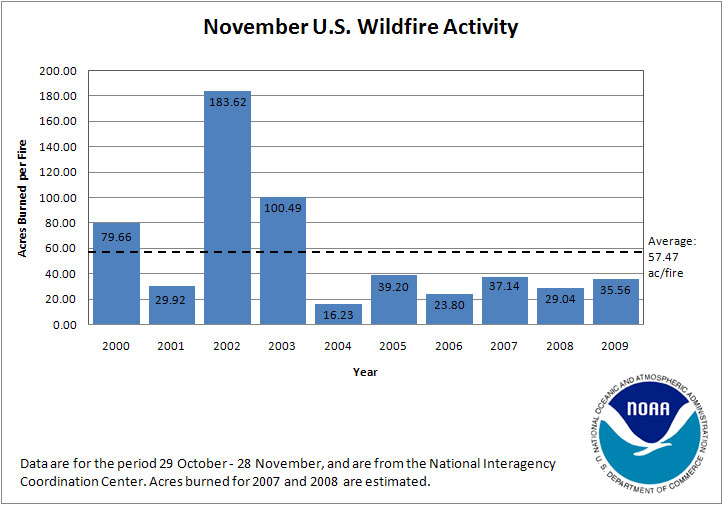
Statistics from the National Interagency Fire Center (NIFC) show that between October 29th and November 28th approximately 108,803 acres (44,031 hectares) were burned across the United States. The total acreage burned during November 2009 was 96,220 acres (38,939 hectares) below the 2000–2009 average of 205,023 acres (82,970 hectares), and for that 10–year period was the seventh highest (fourth lowest) November for acreage burned. A total of 3,060 new wildfires were reported, which is 1,171 fewer than the 2000–2009 average of 4,231 fires. This is the third fewest (eighth most) fires in November in the past decade. Average fire size in November 2009 was 35.6 acres (14.4 hectares) burned per fire. This value is 21.9 acres (8.9 hectares) per fire below the 2000–2009 average fire size of 57.5 acres (23.3 hectares) per fire.
For the period January 1st through November 28th, total year–to–date acreage burned was 5,884,153 acres (2,381,232 hectares), which was 934,519 acres (378,186 hectares) below the 2000–2009 average of 6,818,672 acres (2,759,419 hectares), and the fourth lowest (seventh highest) amount of acreage burned for the period since 1999. The year–to–date (January – November) number of fires was 76,484, or 1,130 fires above the 2000–2009 average of 75,354 fires. This ranks 2009 as the sixth highest (fifth lowest) year–to–date for number of fires over the past decade. Combined, the year–to–date number of fires and acreage burned yields an average of 76.9 acres (31.1 hectares) per fire, relative to the 2000–2009 average of 91.6 acres (37.1 hectares) per fire.


The U.S. Drought Monitor indicated that drought conditions improved in parts of Wisconsin and Arizona during November. However, areas of moderate to severe drought across the lower 48 states and Hawai'i remained relatively unchanged through the course of the month. Pockets of extreme to severe drought persisted in southern Texas and on Hawai'i's Big Island.

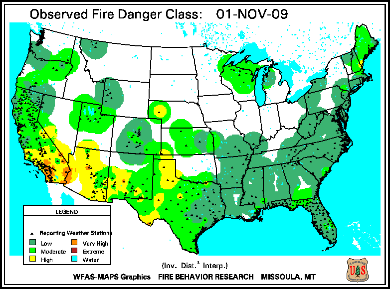
According to the U.S. Forest Service (USFS) – Wildland Fire Assessment System, the majority of the nation was under moderate to no fire danger throughout November. Areas of high to very high danger were limited to southern California throughout the month, portions of the Southwest at the start of the month, and an area centered on eastern Montana from mid–November onward.

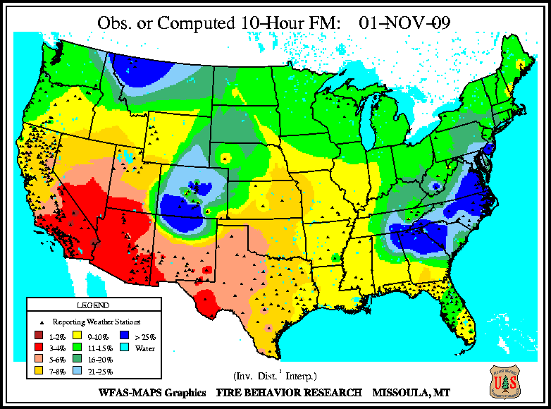
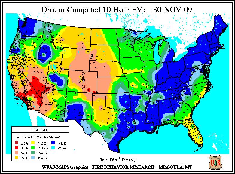
At the beginning of November, 10–hour fuel moisture levels were lowest in the Southwest U.S., from central Texas west to California's Pacific Coast and northward into Nevada. By mid–November, moderate dryness was present along the Atlantic seaboard, the northern tier of states, and much of the Southwest. Exceptionally dry tinder was present in southern California and Arizona, as well as eastern Nevada. Precipitation from a series of weather systems alleviated dry fuel conditions in the eastern U.S. during the second half of November, with dry fuels primarily centered on northeastern Colorado and southern Nevada.

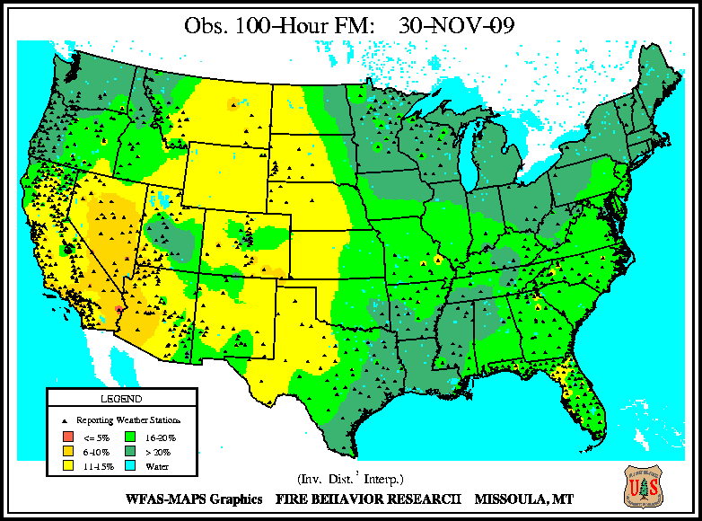
Low 100–hour and 1000–hour fuel moisture were present throughout November in the Southwest at the beginning of the month, but extended across much of the western U.S. by November's close. Small pockets of abnormally dry larger fuels were also present in Florida throughout the month.

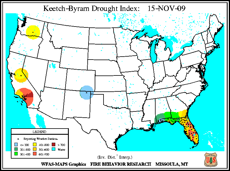
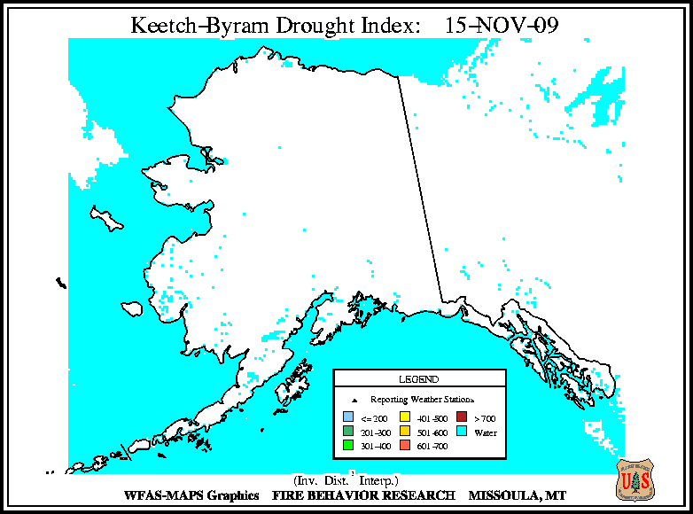
The Keetch–Byram Drought Index (KBDI), a widely used drought index for fire risk, indicated continued dryness and thus fire risk across much of California and Florida during November. High KBDI values were also found in eastern Nevada and western Texas during the middle of the month, and by the end of November, very high values were present in central Nevada and southwestern Arizona.