
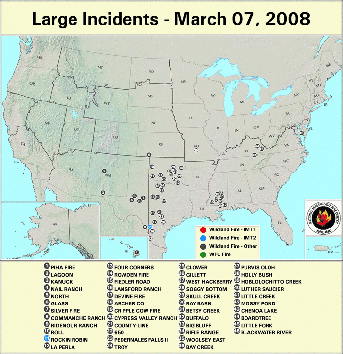
Fire activity that developed across the southern Plains in February persisted into early March, as numerous large blazes burned range and grasslands in Texas and Oklahoma.
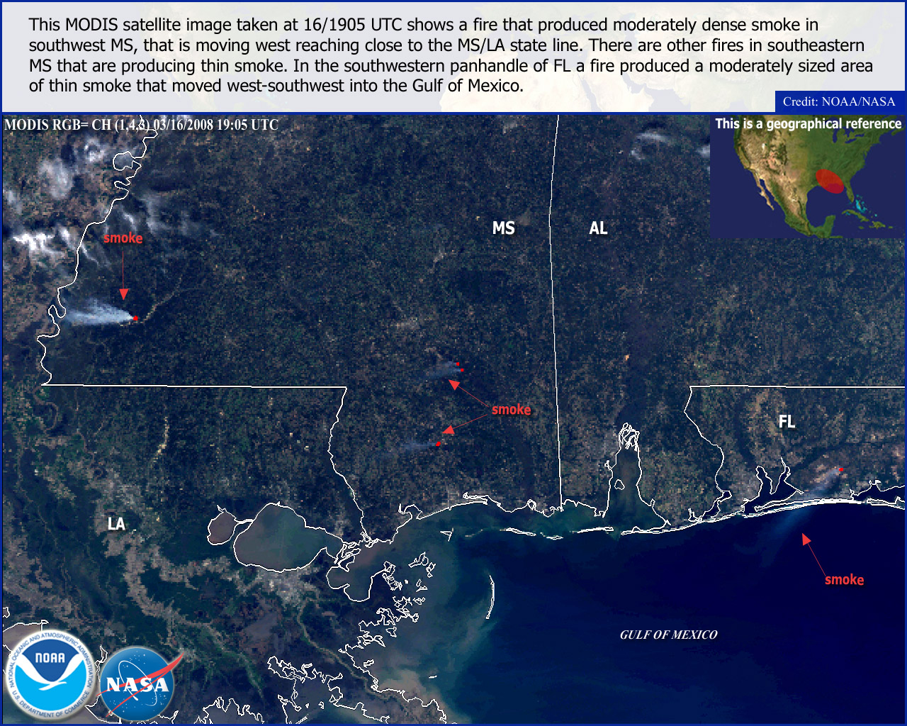
Wildfire activity also impacted the central Gulf Coast region, and spread eastward into the Tennessee Valley and the Mid–Atlantic region later in the month.
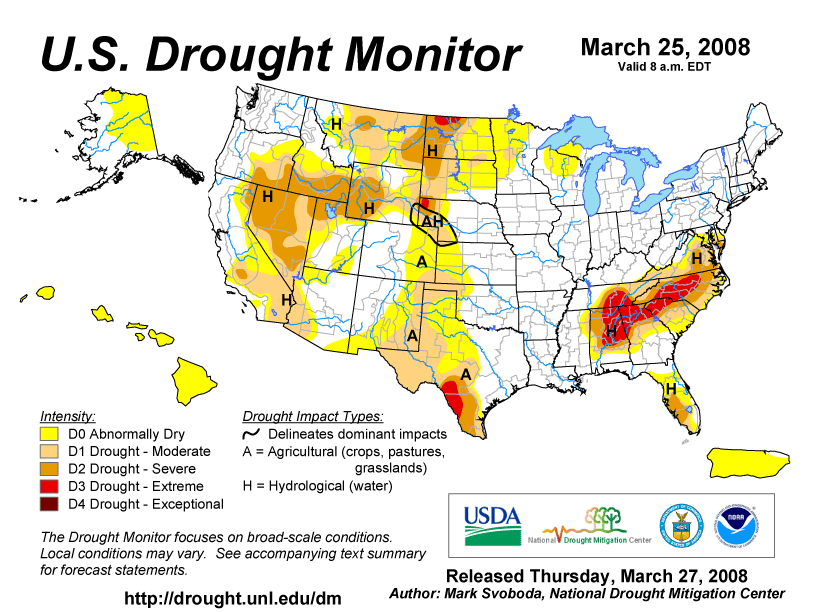
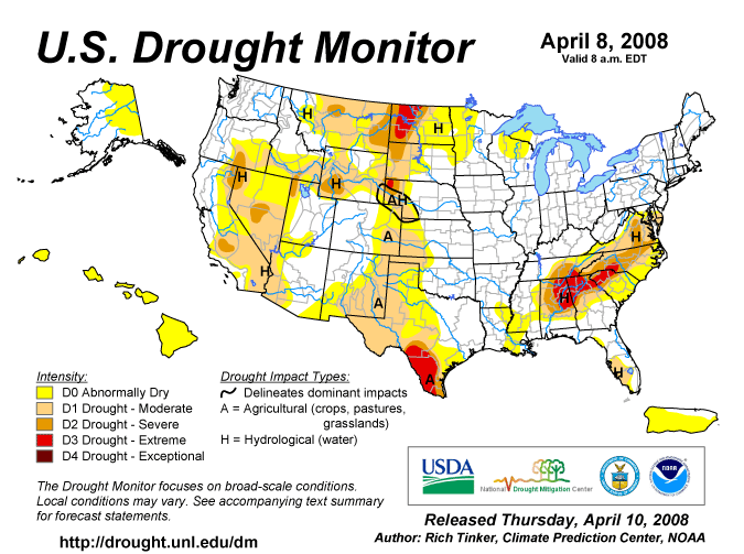
Long–term moisture deficits have continued to maintain moderate to severe drought conditions across large portions of the western U.S. in late March. These conditions across the West have persisted into early April, as seen in the U.S. Drought Monitor from April 8.
As of April 4th, there have been over 12,000 wildland fires and more than 1 million acres burned so far in 2008, according to the National Interagency Fire Center (NIFC).

The persistence of moderate–to–severe drought conditions across parts of the West have aided in developing a region of extreme fire potential across parts of the Southwest, according to the U.S. Forest Service (USFS) Experimental Fire Potential Index.
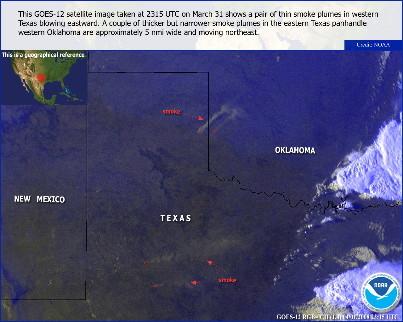
At the end of March, high to very high fire danger was observed across parts of Arizona, New Mexico and west Texas, with fires burning into early April in the Texas Panhandle. In addition, the fire danger was moderate across parts of Pennsylvannia and New York at the end of March.
| Year–To–Date Totals as of March 28th | Nationwide Number of Fires | Nationwide Number of Acres Burned |
|---|---|---|
| 3/28/2008 | 11,088 | 516,243 |
| 3/28/2007 | 15,936 | 254,827 |
| 3/28/2006 | 19,116 | 1,812,628 |
| 3/28/2005 | 9,253 | 130,797 |
| 3/28/2004 | 13,658 | 150,630 |
| 3/28/2003 | 7,223 | 91,712 |
| 3/28/2002 | 14,718 | 200,752 |
| 3/28/2001 | 14,412 | 266,547 |
| 3/28/2000 | 20,346 | 569,567 |
| 6–yr average (2003 – 2007) |
13,810 | 573,025 |
| 9–yr average (2000 – 2008) |
12,651 | 498,718 |
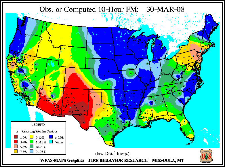
Dead fuel moisture levels have dried out across the Southwest during March. The 10–hour fuel moisture levels on March 30th were exceptionally dry throughout most of New Mexico, western Colorado and southern Arizona.
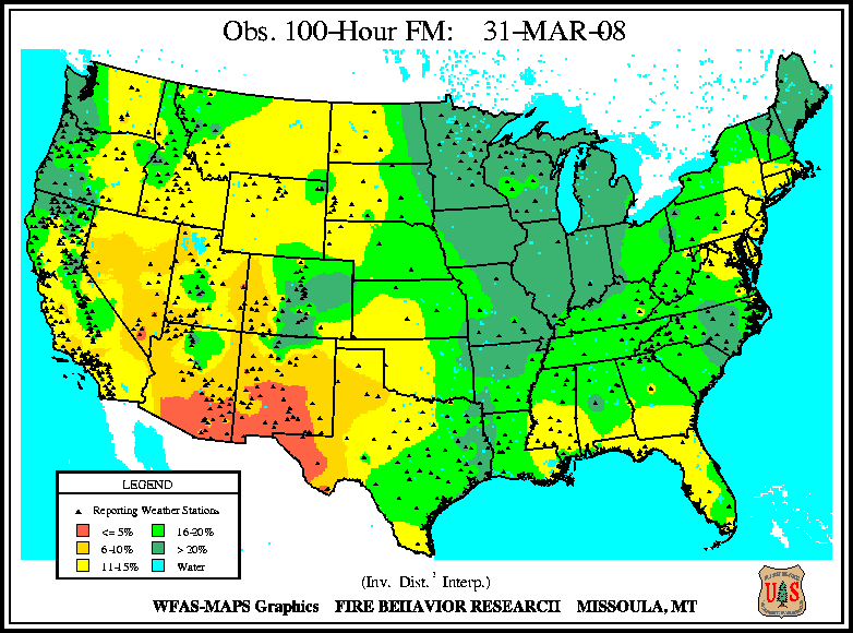
Medium to larger fuels (i.e., the March 31st 100–hr and March 31st 1000–hr fuel moistures) were also very dry, with the driest fuel conditions across southern Arizona, New Mexico and west Texas.
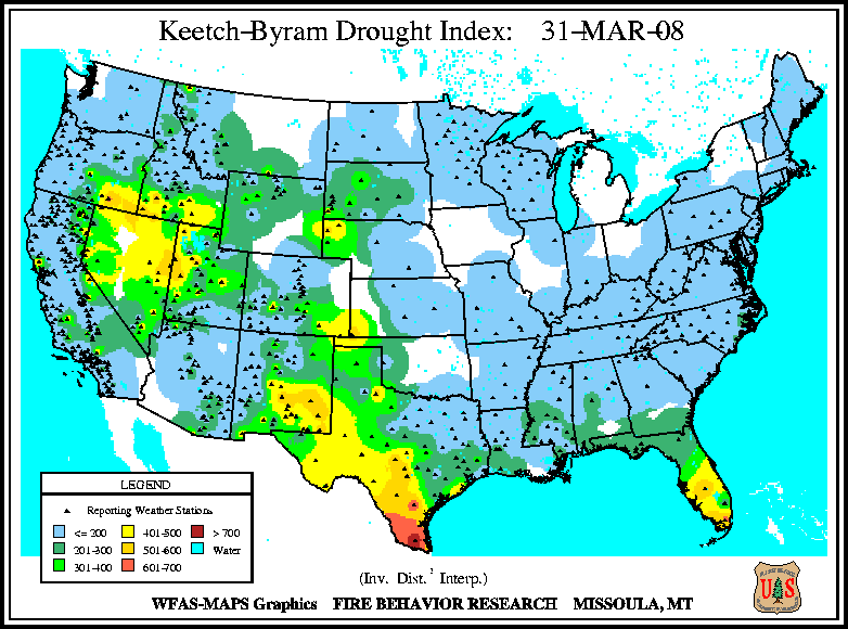
The Keetch–Byram Drought Index (KBDI), a widely used drought index for fire risk, had the largest potential for wildland fire activity in the contiguous U.S. across portions of the Great Basin, west Texas and New Mexico, as well as over portions of south Florida.