Fire activity spread dramatically across the West this past month. During mid–July, wildfires were burning across northern Nevada, eastern Oregon, and southern and central Idaho, and during the latter half of July activity was focused across the Northern Rockies.
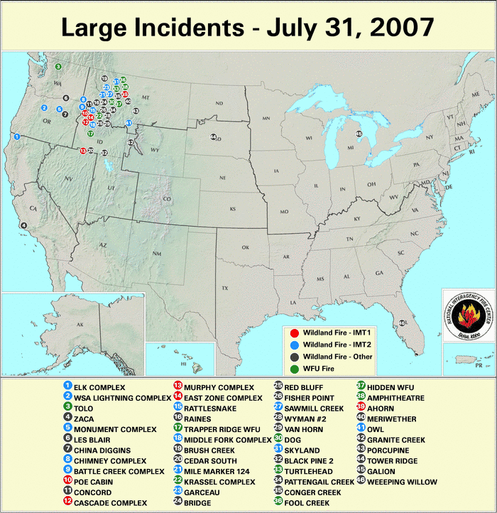
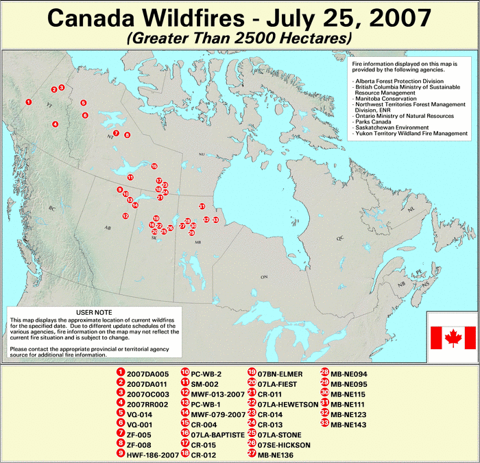
As of July 31st, 46 large fires were actively burning, with fire activity in late July focused on central Idaho and northwest Montana. Wildfires were also quite active across parts of the Northwest Territories and north-central Canada this past month
According to estimates from the National Interagency Fire center (NIFC), as of August 7th over 58,300 wildland fires were reported across the U.S. so far in 2007, with approximately 5.39 million Acres Burned.
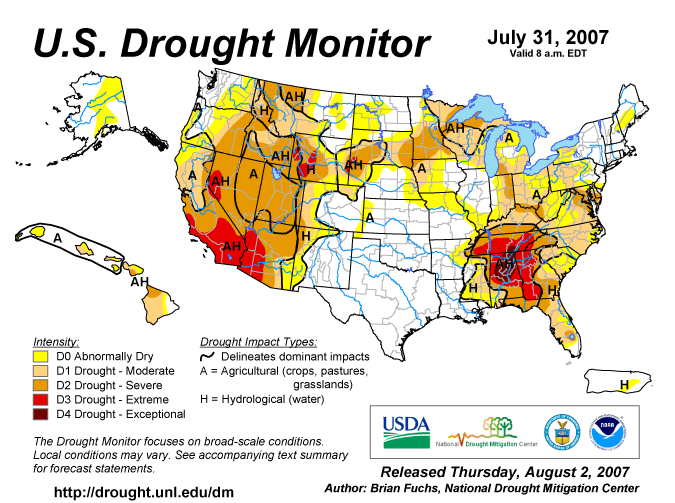
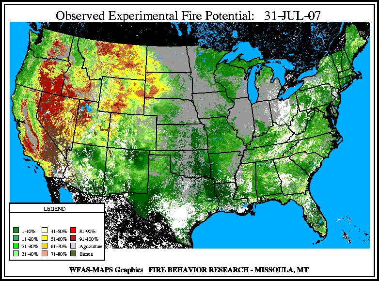
Unusually dry conditions and severe–to–extreme drought across most of the West has resulted in a large region of extreme fire potential according to the U.S. Forest Service (USFS) experimental fire potential index.
At the end of the month, the highest fire danger remained across parts of California, the Northern Rockes, the Great Basin, and the Columbia Plateau.

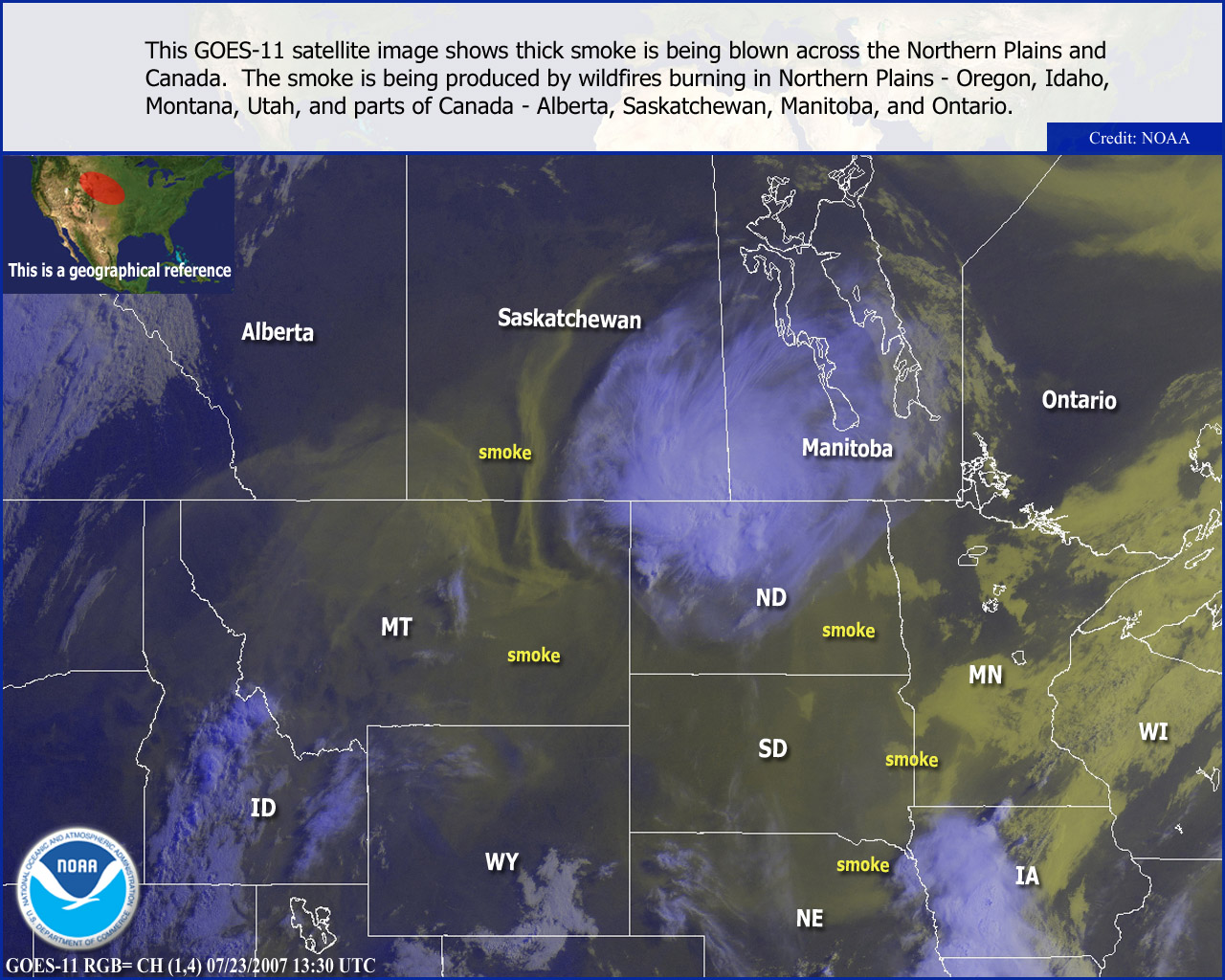
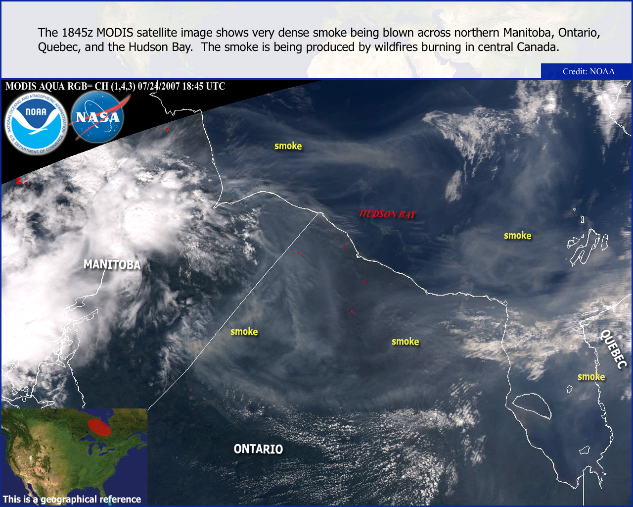
The numerous active fires generated vast smoke palls and poor air quality across northern portions of the Great Plains, as well as across northern and central Canada. By early August, the smoke pall generated by wildfires in Idaho and Montana had spread further south into the central Plains.
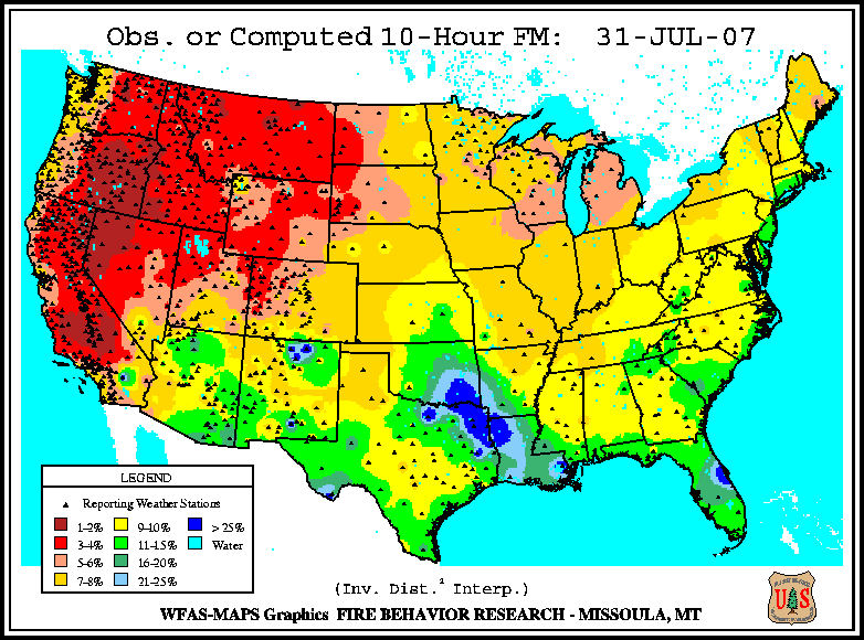
Dead fuel moisture levels have continued to dry out across the western U.S. during July. The 10–hour fuel moisture levels on July 31st were exceptionally dry throughout most of the western U.S.
| Totals as of July 31st | Nationwide Number of Fires | Nationwide Number of Acres Burned |
|---|---|---|
| 7/31/2007 | 57,197 | 5,073,197 |
| 7/31/2006 | 70,948 | 5,621,014 |
| 7/31/2005 | 38,371 | 4,673,837 |
| 7/31/2004 | 47,650 | 5,495,416 |
| 7/31/2003 | 36,301 | 1,822,974 |
| 7/31/2002 | 53,070 | 4,258,849 |
| 7/31/2001 | 50,054 | 1,547,312 |
| 7/31/2000 | 60,988 | 3,550,065 |
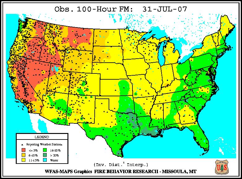
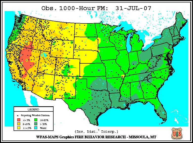
Medium to larger fuels (i.e., the July 31st 100–hr and July 31st 1000–hr fuel moistures) were also exceptionally dry, with the driest fuel conditions across a large area that encompassed most of California, the Great Basin, and Columbia Plateau.
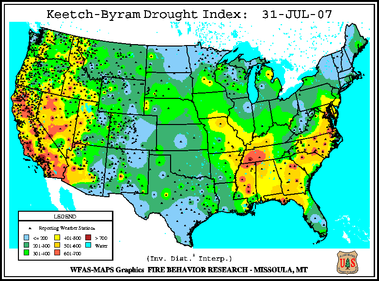
The Keetch–Byram Drought Index (KBDI), a widely used drought index for fire risk, had the largest potential for wildland fire activity in the contiguous U.S. across California and Nevada, as well as most of the Southeast.