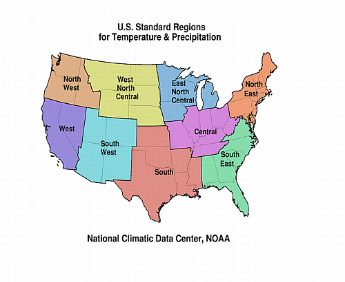
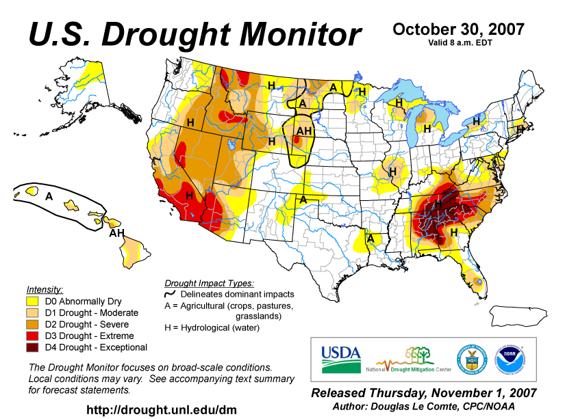
SOUTHEAST DROUGHT
As summarized by the Southeast
Regional Climate Center, drought persisted across much of the
Southeast during October, particularly in an arc stretching from
western Virginia through the western Carolinas to northern Georgia
and northeast Alabama. There was some relief on October 24-26 when
an upper-level low pressure system to the west brought 2 to 6
inches of rain over much of the area. As a result, the area in the
D4 (Exceptional Drought on the U.S.
Drought Monitor) category, which had been increasing early in
the month, decreased slightly. At month's end, slightly less then a
third of the region was still in Exceptional
Drought, although more than half was covered either by Extreme
or Exceptional Drought conditions. Only the northeastern and the
southern parts of the region saw an overall improvement as the
month progressed. For rainfall year-to-date values, many stations
were hovering around the second or third driest on record. For
example, so far (as of November 7) in 2007 Atlanta has received a
total of 26.11 inches of rain, the third driest year-to-date on
record, behind 1931 (23.61") and 1954 (24.68"). And the official
National Weather Service forecast suggests that, during the next
few months, the drought conditions will at least persist, and
possibly intensify, for all areas of the Southeast.
Some specifics:
- Several deep wells, ponds, and springs in the Southeast have
dried up.
- Streams were at record or near record low levels, with some at
flow levels half the previous record low.
- Reservoirs that supply water to major urban centers continued
to drop, with some areas (such as Atlanta, GA and several
communities in NC) having as little as three months of water supply
remaining. Many cities in the region have instituted mandatory
water restrictions. In North Carolina, Gov. Easley has said, "If we
do not get significant rain, some areas face the once unthinkable
possibility of water rationing and potentially running out of water
entirely." Low water levels in Lake Lanier, which services Atlanta,
prompted a meeting between the governors of Georgia, Alabama, and
Florida, and other interests, to modify water management practices
for the water in Lake Lanier.
NORTHEAST DROUGHT
Governor Rell issued a drought advisory for the state of
Connecticut on October 5. The officials in several Connecticut
towns enacted emergency rules encouraging water conservation.
Delaware's Governor Minner requested drought disaster relief from
the USDA in September and, in mid-October, issued a statewide
drought watch urging residents to voluntarily conserve water.
OTHER AREAS
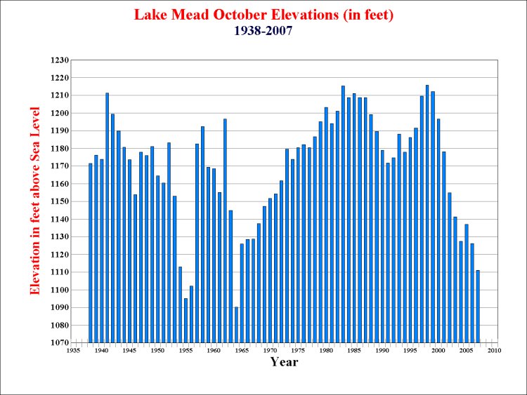
According to a
University of Nebraska report, levels in Lake Mead (in the
Southwest U.S.) continued to fall. The October 2007
Lake Mead level was at 1111.1 feet, which is 15 feet lower than
this time last year, the lowest October level since 1964, and the
fourth lowest October level in 70 years of record.
|


