Note: This Synoptic Discussion describes recent weather events and climate anomalies in relation to the phenomena that cause the weather. These phenomena include the jet stream, fronts and low pressure systems that bring precipitation, high pressure systems that bring dry weather, and the mechanisms which control these features — such as El Niño, La Niña, and other oceanic and atmospheric drivers (PNA, NAO, AO, and others). The report may contain more technical language than other components of the State of the Climate series.
Synoptic Discussion

Upper-level circulation pattern and anomalies averaged for March 2012.
Like much of this winter, the  weather pattern over North America in March 2012 consisted of an active jet stream which stayed mostly along or north of the U.S.-Canadian border, allowing warm southerly air to dominate most of the country east of the Rockies. Strong low pressure troughs frequently dug into the western U.S., bringing wet weather to the northern areas of the West and cooler-than-normal temperatures to much of the Far West. These troughs brushed northern Mexico before moving to the Great Lakes or Atlantic coast and occasionally dragging cold fronts across the southeastern United States. Twice during the month, troughs were cut off from the main jet stream flow and slowly meandered across the southern and central U.S., resulting in a large area of above-normal precipitation from the Southern Plains and western Gulf Coast to parts of the Central Plains as well as severe weather outbreaks in the South and Midwest. The preliminary monthly tornado count for March 2012 of 223 tornadoes was a record for March.
With well-above-normal temperatures dominating the country, March snow cover was well below normal. The month began with about a third (36%) of the country snow covered, but that rapidly dropped below ten percent for most of the month. A mid-month winter storm increased the snow coverage to about 20 percent, but that was mostly in the West and the snow cover rapidly contracted. More than 7700 record warm daily high temperatures and more than 7500 record warm minimum temperatures were tied or broken across the country during the month. Only 287 record cold daily low temperatures and about 600 record cold daily maximum temperatures were tied or broken, mostly in the West. The net result was that 25 states east of the Rockies had the warmest March on record and an additional 15 states ranked in the top ten warmest category. The national Residential Energy Demand Temperature Index (REDTI) for March 2012 was a record low March value, indicating heating fuel demand would be dramatically below the national average.
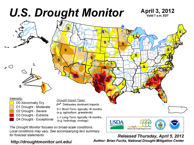
Rainfall from the cutoff low pressure systems improved drought conditions in the Southern Plains, effectively ending drought in parts of eastern Texas and eastern Oklahoma. But the storm systems missed many of the other drought areas. Several states in the Northeast had the tenth driest, or drier, March in the 1895-2012 record. The Southwest to Northern Plains was also dry, with Colorado having the driest March on record along with significant wildfire problems. The dry extremes were counter-balanced by wetness in the Northwest and Southern Plains where six states had the tenth wettest, or wetter, March on record. By April 3, moderate to exceptional drought shrank to cover 36 percent of the South and 37 percent of the contiguous United States, according to the U.S. Drought Monitor.
When averaged together, the mixture of temperature and precipitation extremes gave the U.S. the warmest and 25th wettest March in the 118-year record. Averaging extremes tends to cancel them out. But when extremes are combined cumulatively, like in the U.S. Climate Extremes Index (CEI), they may tell a different story. The preponderance of record warm highs, record warm lows, and heavy one-day precipitation events gave the U.S. its second largest CEI for March. The combination of persistent and unusual warmth, drought, and extreme daily precipitation events contributed to the highest national CEI for the year-to-date (January-March) and the last six months (October-March). Several regions also had the highest or second highest regional CEI for March, January-March, and October-March.
Cold fronts and low pressure systems moving in the storm track flow are influenced by the broadscale atmospheric circulation. Four such large-scale atmospheric circulation drivers were potentially influential during March:
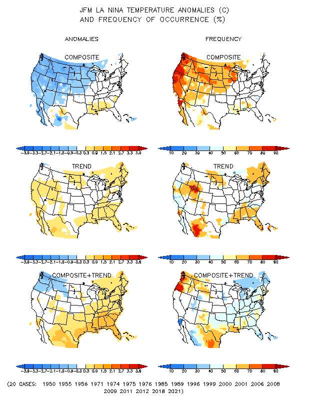
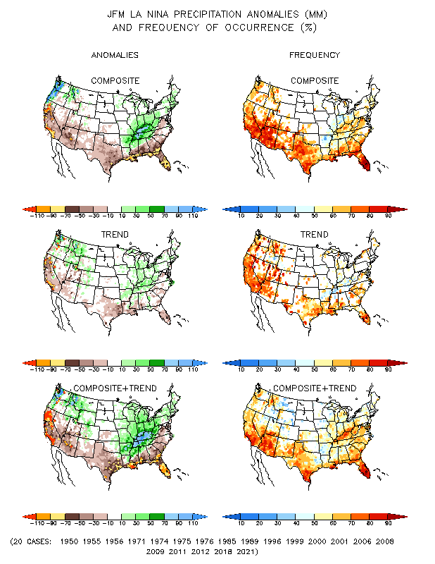
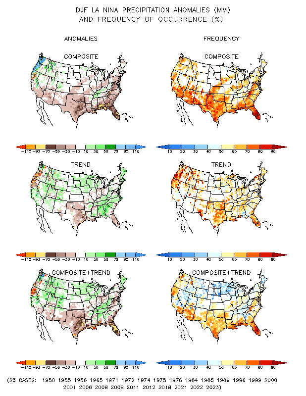
- Ocean temperatures and atmospheric circulation anomalies indicated that the equatorial Pacific continued in a La Niña state, but the La Niña continued to weaken. La Niña this time of year (January-March) is associated with temperature and precipitation anomalies across the U.S. — temperatures are typically warmer than normal from the Southern Plains to Mid-Atlantic Coast and colder than normal in the Northern Plains and much of the West, while drier-than-normal conditions dominate the southern tier and Middle Atlantic States, with wet conditions predominant in the Pacific Northwest and from the Mid- and Upper Mississippi Valley to the Northeast.
- The Pacific/North American (PNA) pattern was negative at the beginning of the month but turned positive for the last two-thirds of the month. A positive PNA this time of year (between January and April on the teleconnection maps) typically is associated with cooler-than-normal temperatures from the Southern Plains to Northeast and warmer-than-normal temperatures in the Northwest, with drier-than-normal conditions (especially earlier in the period) in the Northwest to Central Rockies and across much of the country from the Mississippi River to the East Coast.
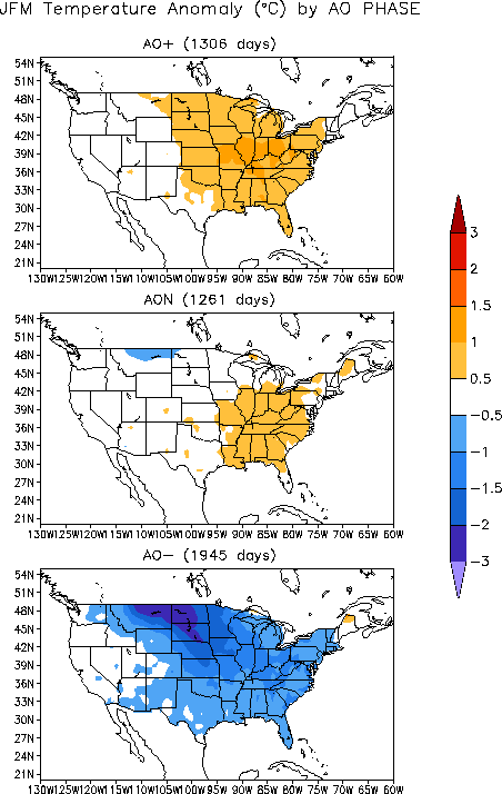
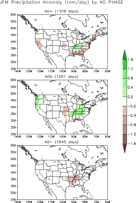
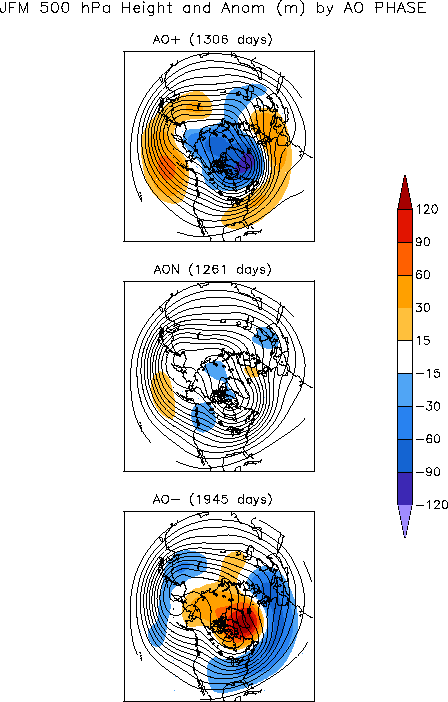
- The Arctic Oscillation (AO) pattern was positive during the first two-thirds of March but dropped to neutral (zero) during the last third of the month. A positive AO this time of year (January-March) is typically associated with warmer-than-normal temperatures east of the Rockies, dryness in the eastern Gulf Coast states to Northeast and much of California, and wetter-than-normal conditions in coastal Washington state and the Tennessee Valley. The January-March averaged upper-level circulation anomalies for a positive AO consist of a below-normal pattern over the Arctic, and above-normal pattern across the eastern half of the contiguous United States.
- The North Atlantic Oscillation (NAO) pattern was positive most of the month and approached zero by the end of the month. A positive NAO during this time of year (between January and April on the teleconnection maps) is typically associated with drier-than-normal conditions in the West, Central Plains, and Southeast, while temperatures trend warmer than normal from the Plains to East Coast and, later, into the West.
 |
 |
The March 2012 averaged upper-level circulation anomalies are consistent with a positive AO pattern across the Lower 48 States, although shifted slightly to the north and west. An analysis by the Physical Science Division of NOAA/ESRL related this anomaly pattern to persistent upper-level circulation anomalies (a "wave train pattern") extending from eastern North America westward toward the tropical central Pacific. The pattern of observed temperature anomalies for March 2012 and the last three months (January-March) corresponds to the positive phase of the AO and NAO east of the Rockies and the La Niña pattern from the Southern Plains to the Southeast. The March 2012 and January-March precipitation patterns are a bit more complicated. The dryness in the Southeast could be associated with the La Niña and positive NAO and AO patterns. Dryness in the Southwest is reminiscent of La Niña, in the Northeast of a positive AO, and in the Central Plains of a positive NAO. Wetness in the Northwest is reflective of La Niña. However, wetness in the Southern Plains matches El Niño teleconnections, not La Niña teleconnections.