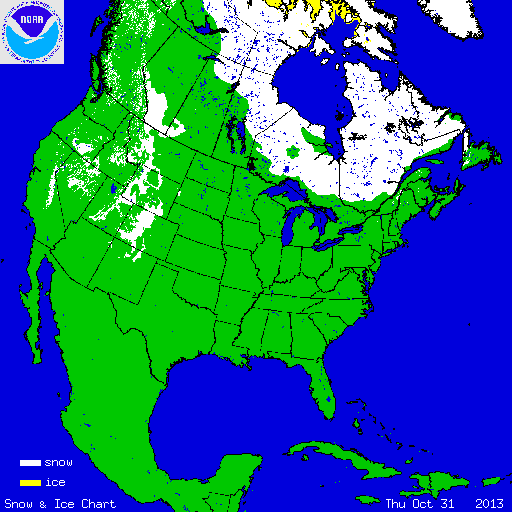
During October, the wetter and cooler than average conditions across the Central and Northern Rockies and Northern Plains were associated with above-average snow. According to NOAA's National Snow Analysis, at the beginning of October, 0.7 percent of the contiguous U.S. had snow on the ground — the highest elevations of the Northern Rockies and the Cascades. By the end of the month, 13.4 percent of the nation was snow covered — the Sierra Nevada Mountains, parts of the Great Basin, the Central Rockies, and parts of the Northern Plains. The monthly snow cover peaked on October 30th at 18.1 percent, after a storm system dropped snow from the Central Rockies into the Northern Plains.

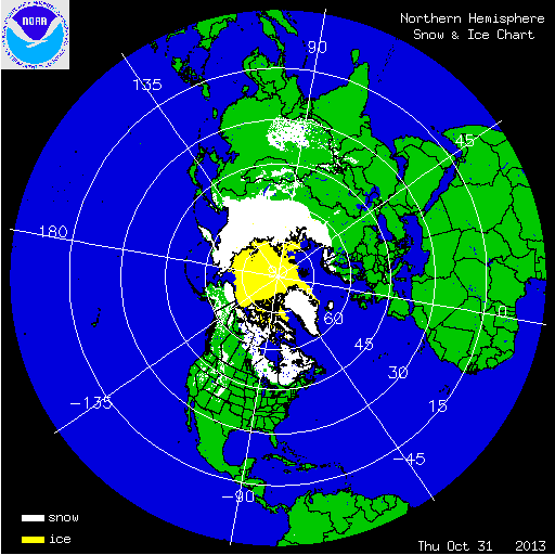
According to data from the Rutgers Global Snow Lab, the monthly snow cover extent across the contiguous U.S. during October was 132,000 square miles. This was more than 60,000 square miles above the 1981-2010 average and the fifth largest October snow cover extent in the 46-year period of record. During the month, above-average snow cover was observed across the Central and Northern Rockies and the Northern Plains. In Alaska, the monthly snow cover extent was 299,000 square miles, 53,000 square miles below average, and the ninth smallest October snow cover extent on record. Record warm temperatures across a large portion of the state contributed to below-average snow cover for most of Alaska.
Summary of Notable Snow Events:

Early October Storm Snowfall Totals
On October 3rd–5th, an early-season blizzard hit the Northern Rockies and Plains, dropping up to three feet of snow in some locations. Wind gusts over 70 miles per hour were also reported, with 25,000 homes losing power. The Black Hills Regions of South Dakota received the heaviest snowfall. During the three-day event, Rapid City received 23.1 inches of snow, breaking the maximum 1-day snowfall total for the month of October, the October monthly snowfall record (previous record was 15.1 inches in 1919), and ranked as the second highest 3-day snowfall total for any month, behind the 25.6 inches that fell in April 1927. Casper, Wyoming received 16.2 inches of snow during the event, ranking as the 10th highest single-storm snowfall on record for the city and the most snowfall this early in the season. The largest impact from the storm was the loss of cattle. An estimated 20,000 head of cattle died during the storm. This early in the season, most cattle had not yet grown thick winter coats, making them susceptible to the cold, snow, and wind. The cattle loss accounted for approximately 15 to 20 percent of South Dakota's entire cattle population. Warm and rainy conditions after the blizzard led to rapid snow melt, complicating the cleanup with fields and roads covered in mud. The storm received an initial rating of a Category 3, or Major Winter Storm, on the Regional Snowfall Impact (RSI) scale for the Northern Rockies and Plains region.