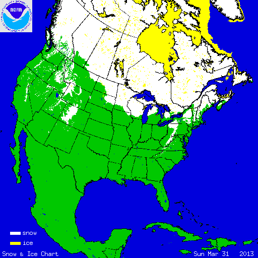
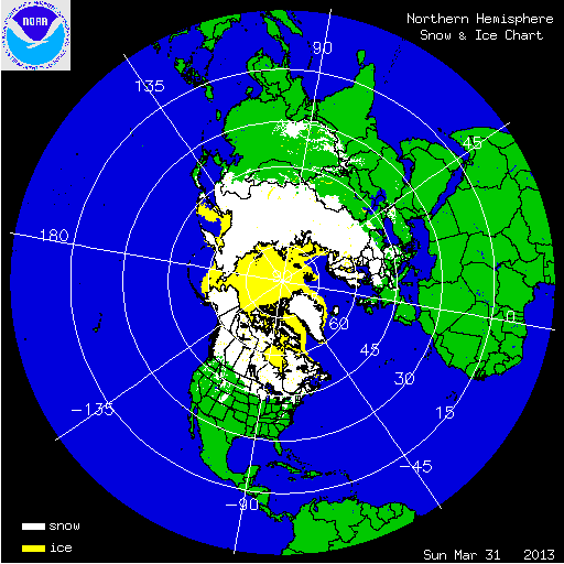
During March, a large portion of the eastern United States was cooler than average, with the exception of New England. Five states in the Southeast had March 2013 temperatures that were cooler than January 213. The West had near- to above-average March temperatures, with the Southwest having much above-average temperatures. Several storm systems impacted the Northern Plains, Midwest, Ohio Valley, and Northeast, bringing late-season snowfall to a large portion of the country. According to NOAA’s National Snow Analysis, at the beginning of March, 48.1 percent of the contiguous U.S. had snow on the ground — the high terrain of the West, the Northern and Central Plains, the Midwest, Northeast, and along the Appalachians. On March 31st, 16.9 percent of the Lower 48 was snow covered — the highest terrain of the West, the Northern Plains and western Great Lakes, parts of the Northeast, and the central Appalachians.

According to data from the Rutgers Global Snow Lab, the monthly snow cover extent across the contiguous U.S. during March was nearly 1.0 million square miles, which was 239,000 square miles above the 1981-2010 average. This marked the 10th largest March snow cover extent in the 47-year period of record. During the month, the Central and Southern Plains, the Midwest, Mid-Atlantic, and Northeast experienced above-average snow cover. Much of the West had below-average monthly snow cover.

Western snowpack on April 1st across the mountainous areas of the West is an important indicator of water availability during the upcoming summer period. At this point in the season, most regions have received the majority of their snowfall. The amount of late spring and summer snowmelt will determine the annual water budget for both agriculture and human use in the region. According to data from the USDA, on April 1st,, above-normal snowpack was observed across the Cascades of Oregon and Washington; near-normal snowpack was present for much of the Northern Rockies of Idaho and Montana; below and much below normal snowpack was observed for central and eastern Oregon, the Sierra Nevada Mountains, much of the Great Basin and in the Central and Southern Rockies. Locations in California, Nevada, Arizona, and New Mexico had snowpack totals less than 25 percent of normal. In Alaska, much of the state had near-normal snowpack with the exception of northwestern and southwestern areas of the state. Snowpack totals greater than 130 percent of normal were reported along the Alaskan panhandle.
Summary of Notable Snow Events:

4-9 March 2013 NESIS
A late-season snow storm moved from the Northern Plains to the Mid-Atlantic on March 4th–9th bringing snowfall from the Dakotas to East Coast. The storm originated as a fast-moving low pressure system from Canada, often referred to as a ‘clipper'. The storm intensified into a Nor’easter as it moved off the East Coast. Locations in the Central Appalachians of the Virginias, as well as parts of New England, received over 20 inches of snowfall from the storm. Locations in seventeen states received at least 6 inches of snow. The storm also caused coastal flooding and erosion from Delaware to Maine as it moved along the coast. The large size of the storm, combined with strong winds, caused water to pile up along coastal regions resulting in high water levels. Several structures along the water front were lost in Massachusetts. The storm was rated a Category 2 (“Significant”) storm on the Northeast Snowfall Impact Scale (NESIS).