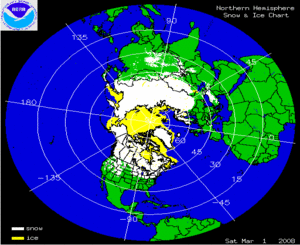
The two satellite-derived images above show the daily snow cover across the Northern Hemisphere (left map) and North America (right map) throughout March 2008. By clicking on the images, the gradual retreat of snowpack across much of North America, Europe and Asia and the expansion and contraction of sea ice across parts of the North Atlantic, North Pacific and portions of the Great Lakes can be seen during the month. In addition, a few snowstorms can be seen across eastern Europe, Mongolia, China, and the United States during March. By the end of the month, much of the snow cover had begun receding in the mid-latitudes with the increase of temperature and solar radiation.
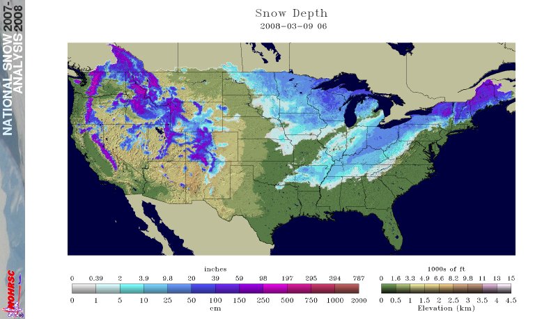
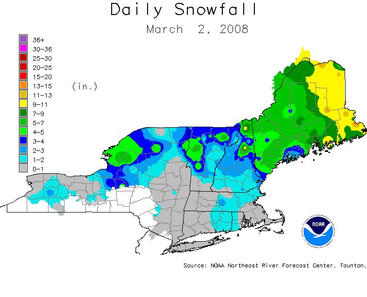
Although March marks the beginning of climatological spring, the volatile month brought several large winter storms across portions of the northern, central, and even south-central parts of the U.S. The largest of these storms, from March 7-10, brought snow from south-central Texas through western New England. The greatest accumulation was in Columbus, Ohio, where 20.5 inches (52.1 cm) was reported, a new all-time record for a single storm. Earlier in the month, parts of New England and much of Maine received a heavy snowfall on March 2.
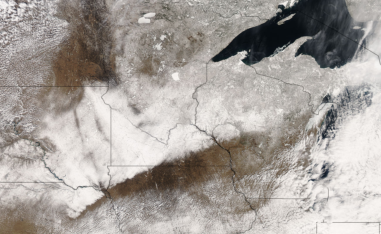
MODIS image of of the Upper Midwest
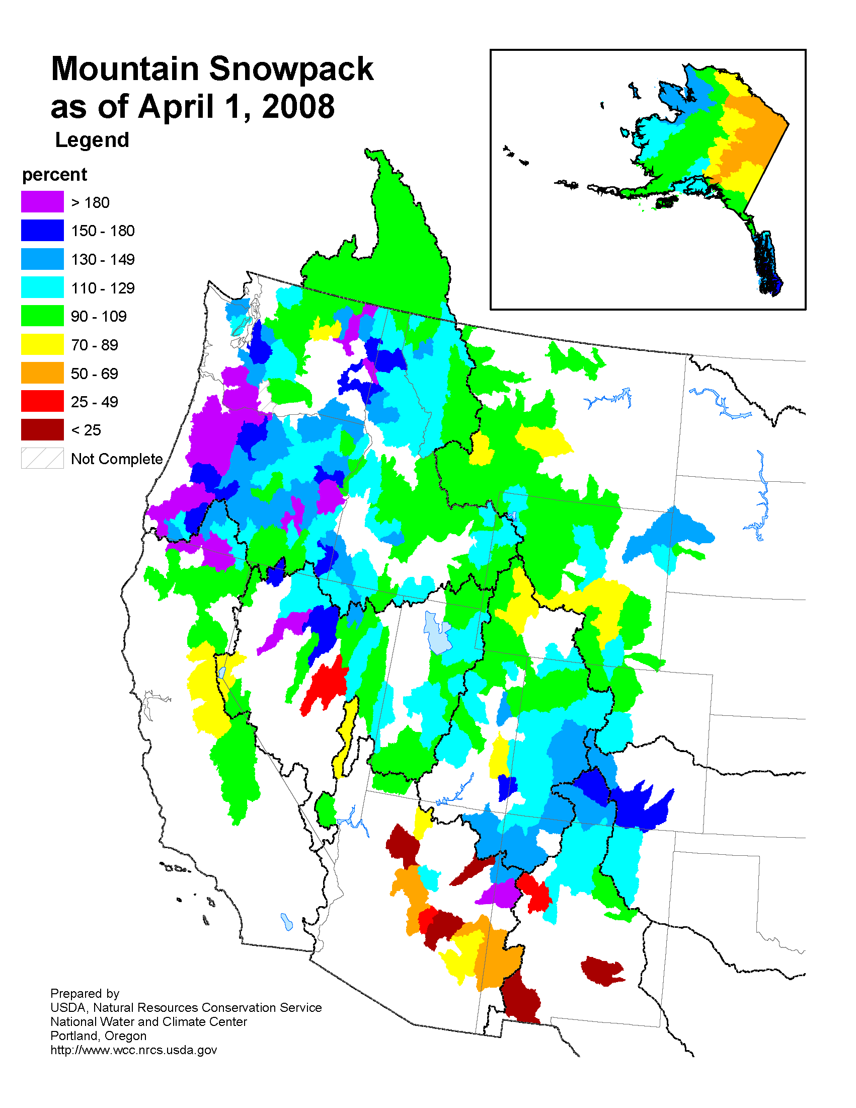
April 1, 2008
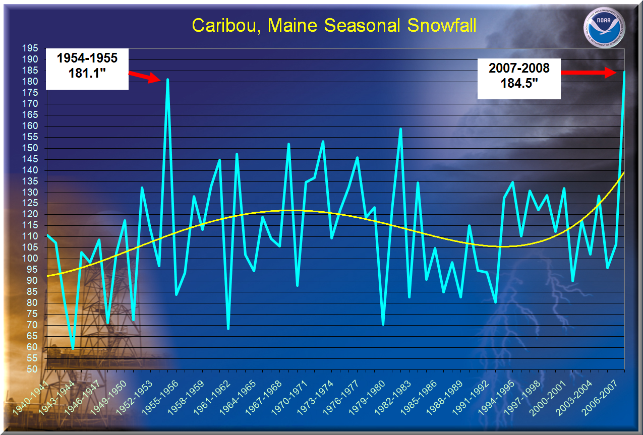
Seasonal Snowfall Chart
Caribou, ME as of March 21, 2008
Several cities set new seasonal snowfall records during March. Madison, Wisconsin set a new seasonal record snow total of 100.1 inches (254.2 cm) on March 24, breaking the previous record of 76.1 inches (193.3 cm) from the 1978-79 season. Milwaukee, WI had its second snowiest winter on record as of March 24. The seasonal snowfall total in Caribou, ME on March 21 reached a new all-time record when the 2007-2008 total of 184.5 inches (468.6 cm) surpassed the previous record of 181.1 inches (460.0 cm) set during the 1954-55 snowfall season. By the end of the month, the snowfall total at Caribou was 190.7 inches (484.4 cm). Snowfall records at Caribou began in 1939. By the end of March, the winter of 2007-08 in Concord, NH ranked as the second snowiest on record, only six inches (15 cm) shy of the all-time seasonal record of 122 inches (310 cm) set in the winter of 1873-4.
The map to the right depicts the snowpack levels in many Rocky Mountain basins on April 1, 2008, illustrating above-average snow cover over much of the Rockies and Cascades in the western U.S. Some areas in Oregon, Washington, Arizona, New Mexico, and Nevada had levels above 180% of normal at the beginning of April. Conversely, much of Arizona and southern New Mexico and parts of Wyoming, Montana, Nevada and California had levels below normal, as did much of eastern Alaska. Much of this snowpack is residual from heavy events in previous months, as March brought relatively little precipitation across Utah, Arizona, Nevada and California, more typical of a La Niña winter. Above-average snowfall this season is bringing relief to many areas of the Western U.S. that have been plagued by drought in recent years.
More information on March severe winter weather can also be found on NCDC's Hazards page.