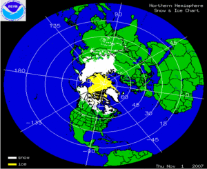
The two satellite-derived animations above show the daily snow cover across the Northern Hemisphere (left map) and North America (right map) throughout November 2007. The maps illustrate the advance of the snow pack in the northern latitudes. By clicking on the images, the gradual expansion of snow and ice cover, with occasional setbacks, is shown throughout the month of November. During the last several days of November, snow cover expanded across much of Canada, the U.S. and parts of Asia. By the 30th, much of Russia, Kazakhstan, Mongolia, Alaska, Canada and parts of Europe and the western U.S. were snow covered. Arctic sea-ice also increases throughout the month and ice cover on Hudson Bay begins to form along the perimeter. Great Lakes ice cover has yet to develop in 2007.
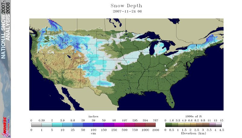
The map to the left depicts the satellite-derived accumulated snowfall present across a wide swath from the southern Great Plains to the Great Lakes on November 24th. The season's first large winter storm in the central U.S. swept across this region from the day before Thanksgiving through Saturday, causing dangerous road conditions for many travelers.
More information on November severe winter weather can also be found on NCDC's Hazards page.