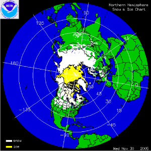
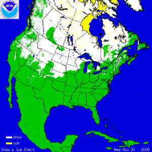
The two satellite-derived animations above show the daily snow cover across the Northern Hemisphere (left map) and North America (right map) throughout November 2005. The maps illustrate the advance of the snow pack in the northern latitudes. By clicking on the images, the gradual expansion of snow and ice cover is shown and by the end of the month, much of Siberia as well as Alaska and Canada are snow covered. Arctic sea-ice and Hudson Bay ice also increases throughout the month. Ice cover across the Great Lakes has yet to develop in 2005.
More information on significant winter weather and other hazards can be found on NCDC's Hazards page.
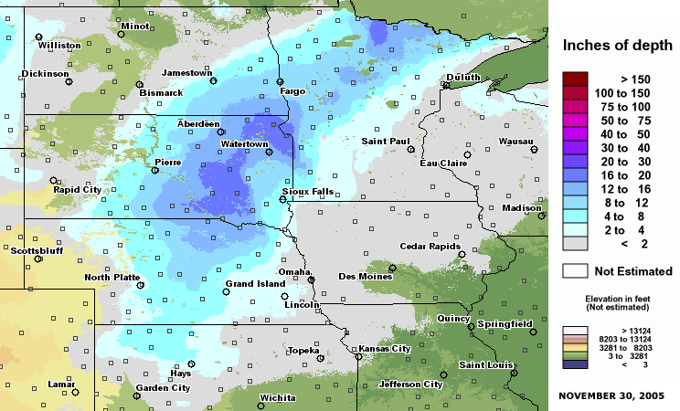
The map to the left depicts snow depth across the northern Great Plains on the 29th of November after a major winter storm swept across the region on the 27th/28th. Snow accumulation was well over a foot across a large area of the northern Plains while high wind gusts (in excess of 60 mph) led to blizzard conditions and widespread power outages. More information on November severe winter weather can also be found on NCDC's Hazards page.