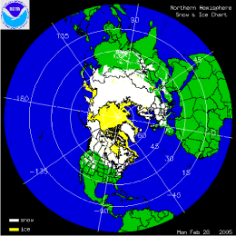
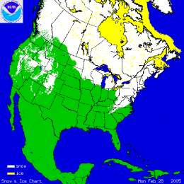
The two images above show the daily snow cover across the Northern Hemisphere (left map) and North America (right map) throughout the month of February 2005. The map to the left shows snow cover on February 28th, illustrating the culmination of a snowy winter for much of Europe. Heavy snow and avalanches also impacted the India/Pakistan border in February killing as many as 230 people in India. More snow fell across the Northeast U.S. in February with an additional 17.7 inches during the month for Boston, bringing the winter total to 68.2 inches for the city. Snow also continued to fall across the Southwest in February, maintaining much above average snowpack for the region. More information on significant winter weather and other hazards can be found on NCDC's Hazards page.

The map to the left depicts the percent of average seasonal snowpack across the western U.S. as of March 1st. In stark contrast to well above average snowpack in the Southwest, the Northwest has had below average snowfall this snow season and this is reflected in the lower snowpack percentages. As reported by the USDA, several individual stations in the remote high altitude SNOTEL network set new record lows (in the north) and highs (in the south) for both snow water content and water-year-to-date accumulated precipitation. Many stations in the Pacific Northwest and northern Rockies shattered snow water content records set during the record dry 1976-77 winter. Snowpack conditions in Alaska were generally above normal in the interior regions, below normal in coastal areas.