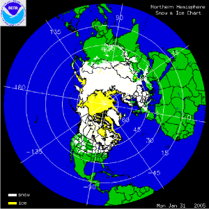
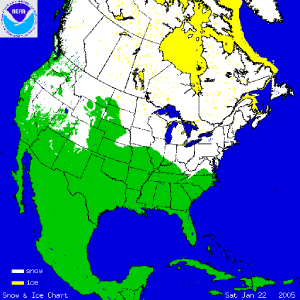
The two images above show the daily snow cover across the Northern Hemisphere (left map) and North America (right map) throughout the month of January 2005. The map to the right shows snow cover on January 31st after several days of winter storms affected much of Europe. The severe weather led to at least 6 deaths and a state of emergency declaration in Bulgaria (CBS/AP). Dozens of villages were cut off by the snowfall across Greece and Albania, while the risk of avalanches increased across much of central and eastern Europe. Rare snow fell on Rome, Italy, and even the island of Mallorca in the Mediterranean Balearic Islands (east of Spain) had some snow during the blast of wintry weather across Europe.
From the same storm system, the Algerian capital had its heaviest snow in 50 years (Reuters). Two days of snowfall in Algiers caused as many as 13 deaths and over 40 injuries, also paralyzing the northern Algerian public transportation system. More information on significant winter weather and other hazards can be found on NCDC's Hazards page
Heavy snow fell across the Midwest and Northeast U.S. Nearly a foot of snow fell at Chicago O'Hare Airport, while parts of New England, and especially eastern Massachusetts also had substantial snow accumulations. Widespread snow amounts exceeding a foot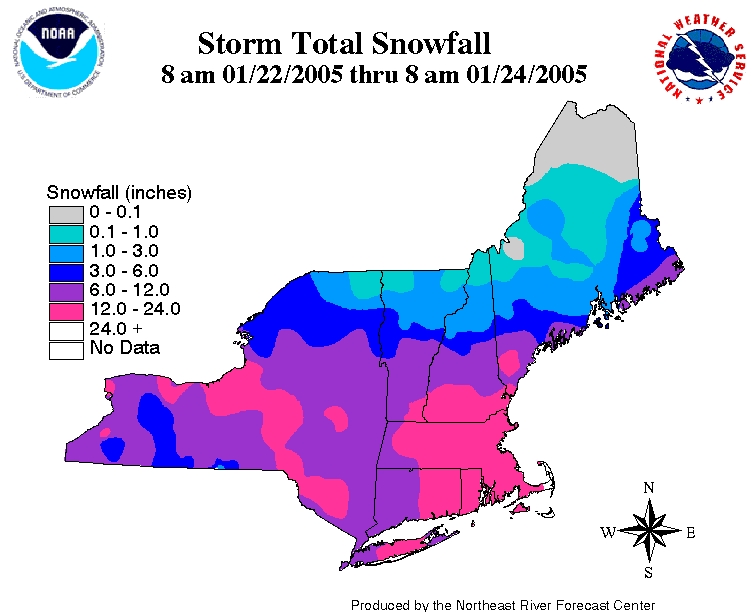 were evident across southeastern New England and over 2 feet of snow fell across parts of far eastern Massachusetts and Cape Cod. Boston concluded January with its snowiest month on record with a total of 43.1 inches. Worcester, MA had its snowiest January and second snowiest month on record with 51.1 inches.

The map to the left depicts the percent of average seasonal snowpack across the western U.S. as of February 1st. In stark contrast to well above average snowpack in the Southwest, the Northwest has had below average snowfall this snow season and this is reflected in the lower snowpack percentages. Much of the West is reliant on winter precipitation to refill reservoirs in preparation for the higher summer water demand. It is the 6th year of drought in parts of the northern Rockies and High Plains. However, record-breaking snow fell during late December and early January in parts of the southern West. A series of storms that also led to devastating rain and flood damage in southern California, left well over 10 feet of snow in the higher locations of the Sierra Nevada. Even areas below 7000 ft in the Sierra received snowfall totalling 4-6 feet in accumulation. Nevada, northern Arizona and Utah also received much above average snowfall for the month and percent of seasonal snowpack was over 150% in some parts of the southern West at the end of January.

Sea ice increased across the Great Lakes in January 2005 with Lake Erie being almost completely ice-covered and Lake Ontario remaining ice-free only in the center of its surface. Lakes Huron, Superior and Michigan still had substantial ice-free areas in early February, though lake-surface temperatures were below 40°F across all lakes.
Northern Hemisphere January sea-ice extent was the lowest on record for the month in 2005, with an area of 14.8 million km2. Satellites have been able to estimate sea ice extent since 1978 and the trend in January Northern Hemisphere sea ice extent since 1979 is -2.9% per decade (data and graphic courtesy of the National Snow and Ice Data Center).