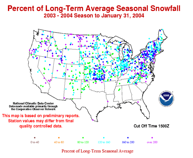
The map to the right shows departures from normal (in percent) for seasonal snowfall totals across the US. Most areas of the country received near average or much above average snowfall for the season as of January 31st. Areas of much above average snowfall include the Northeast, especially western areas of the Northeast (NY, PA), and parts of the northern Great Plains, with snowfall as much as 200% above normal.
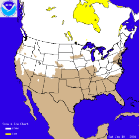
The image to the left shows the snow cover on January 10th, 2004, after a storm left parts the east coast blanketed in snow. Another storm late in the month (26th) left over a quarter of a million people without power after snow and ice swept across Georgia and the Carolinas. At least 14 people died in storm-related accidents (Reuters). The same storm dumped up to a foot of snow in parts of the Northeast, while areas of the Midwest (especially Minnesota) received over a foot of snow in a separate storm during the same period. Extreme lake effect snows impacted areas of western New York state with some parts of Oswego County, NY recording over 130 inches of snow for the month and over 3 feet for a single 3-day event near the end of January.