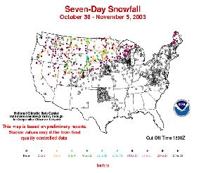
The first significant snowfall of the 2003-2003 winter season arrived early in November across parts of Montana, Wyoming and the Dakotas.
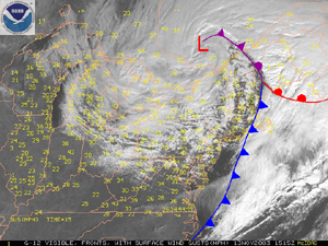
A strong storm system that moved across the U.S. Great Lakes and into Quebec during the 12th-13th produced a variety of weather impacts, including severe thunderstorms , strong winds and heavy snows. Winds gusting to 80-95 km/hr (50-60 mph) across the Ohio Valley, Great Lakes, Northeast and Mid-Atlantic knocked out power to over 200,000 customers in the region (Associated Press). Heavy snows affected areas of southeastern Canada, including Quebec, while snow also fell downwind of the Great Lakes.
The image to the left shows the snow cover on November 24th 2003 after the most significant storm outside of the mountains this year left parts of the North Central region of the country with more than 10 inches of snow. Click on the image for an animation of daily snowcover throughout the month of November.
See NCDC's snow monitoring page for the latest snow totals and the snow climatology pages for snow statistics for U.S.states and stations.
 NOAA's National Centers for Environmental Information


