 Larger image
 |
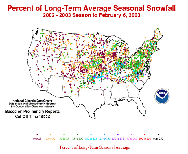
The image to the left shows the percent of average seasonal snow fall for stations across the continental U.S. Many of the stations were more than 25% below average across much the West and Midwest. Stations in the east received a greater percentage of their seasonal snow fall as of February 6th, however, even in the east, percentages of 50-75 percent of the long-term mean were common. The tracks of several winter storms are visible, (from paths of stations registering above average seasonal totals), such as a swath from northeastern Oklahoma through Missouri and Illinois to Indiana. Some higher than average percentages can also be found in the Carolinas where a storm system dumped up to 10 inches (25.4 cm) of snow across parts of North Carolina in January (more details below). |
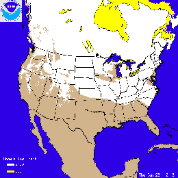
| The image to the right shows the snow cover on January 23rd 2003, after a large snowstorm (described below) left up to 10 inches (25.4 cm) of snow over a large area of the Southeast and Mid-Atlantic. Click on the image to the right for an animation of snowcover throughout the month of January. |
 |
 Larger image
 |
The image to the left
from NOAA's National Weather Service Northeast River Forecast
Center shows snowfall totals in the Northeast for the first
week of January 2003. Well over a foot (30.5 cm) of snow fell
across almost the entire state of Massachusetts, and much of the
rest of New England and New York. The snow was accompanied by
sustained winds in excess of 30 mph (48.3 kph) in some coastal
locations, with gusts reaching above 40 mph (64.4 kph). Some of the
mountain towns in Massachusetts, such as Ashfield, Goshen, and
Worthington had one and a half to two feet (46-61 cm) of snow on
the 3rd and 4th. Further snow interrupted traffic and caused
numerous problems in upstate New York over the weekend of the 11th
and 12th of January. Over 50 inches (4 feet / 122 cm) of snow fell
in parts of Osceola and Lewis counties - the result of cold
air-amplified lake-effect snow from Lake Ontario. |
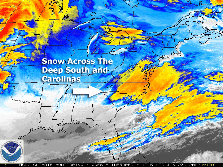
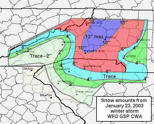
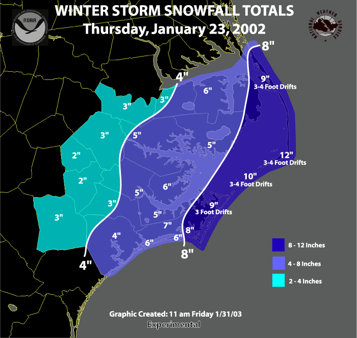
| A winter storm brought significant accumulations of snow to parts of the U.S. Deep South, including the Carolinas, on the 23rd. Snowfall accumulations of 4 to 12 inches (10-30 cm) were common across areas of western and central North Carolina, as well as the Outer Banks. The Outer Banks usually escapes heavy snow due to the warm insulating water of the Atlantic Ocean around Cape Hatteras. Some of the heaviest snow fell between Forest City and Morganton in western North Carolina exceeding the area's seasonal snowfall totals in just a few hours according NOAA's National Weather Service Office in Greenville-Spartanburg, SC. |
 larger image |