 Larger image
 |
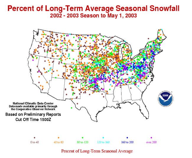
The image to the left shows the percent of average seasonal snow fall for stations across the continental U.S. (Data is based on preliminary reports, final values will likely change for some stations). Many of the stations were significantly below average across much the West. Stations in the eastern U.S. received a greater percentage of their seasonal snow fall as of May 1st, with some stations recording over twice the seasonal average. The tracks of several major winter storms are visible (from paths of stations registering above average seasonal totals), such as a swath from northeastern Oklahoma through Missouri and Illinois to Indiana. |
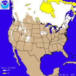
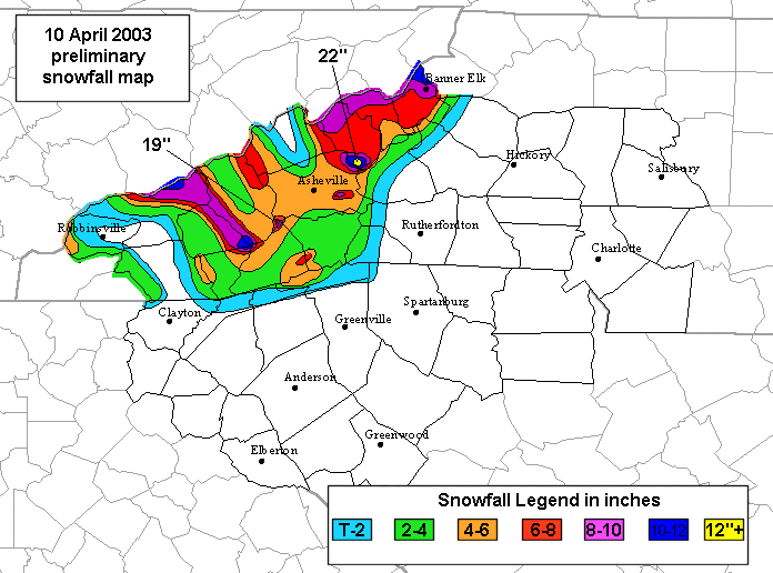
| The image to the right shows the snow cover on April 10th 2003, after a late winter snowstorm left up to 22 inches (55.8 cm) of snow over high elevations of western North Carolina. The storm also quickly dumped 2-8 inches (5-20cm) in and around the lower elevations of Asheville, NC, and was accompanied by lightning and thunder. Elsewhere in the U.S., a large snow storm on April 6th-8th caused problems for residents in the Central Plains as snow depths of 4-8 inches (10-20cm) were common throughout the area. An animated image of daily snow cover over the U.S. through the month of April can be seen by clicking on the image to the right. The general northward retreat of snow cover across the continent during the month is visible in this animation. |
 |