
 Tropical Storm Gamma |
November 2005 Tropical Storm Gamma, the 24th named storm of the record-breaking 2005 Atlantic Hurricane season, brought flooding and loss of life to parts of Central America. Additional information can be found below. |

Across the United States, moderate to severe long-term drought persisted throughout parts of the Pacific Northwest eastward into the northern Rockiess. Meanwhile, severe to extreme drought affected areas of the Great Lakes region, where some of the worst conditions were observed in northwestern Illinois. Extreme drought also plagued areas of northeast Texas. |
 U.S. Drought Monitor |
For comprehensive drought analysis, please see the current U.S. drought report. |
 Africa Rainfall Anomalies |
Long-term drought continued in parts of the Greater Horn of Africa, including southern Somalia, eastern Kenya and southeastern Ethiopia. Across southeastern Africa, long-term drought affected parts of Mozambique, southern Malawi and Zimbabwe. In Malawi, the World Food Programme (WFP) estimated that nearly 5 million people would need food aid until March 2006 (OCHA). For the latest African analysis and forecast, see the Famine Early Warning System Network. |
Austral spring (September-October) temperatures ranked as third warmest in Australia (behind 2002 and 1980), with a temperature departure of 0.98°C (1.76°F). Queensland, the Northern Territory and Tasmania all had their warmest spring in the historical record. Additional information is available from the Australian Bureau of Meteorology. |
 Temperature Anomalies Across Australia |


In Sri Lanka, floods triggered by heavy rains killed 6 people and damaged thousands of homes during mid-November. Flooding affected areas that had been devastated by the tsunami that occurred on December 26, 2004 (Reuters). |
 Precipitation Anomalies Across India/Sri Lanka |
 Southern India Flooding |
Heavy rains brought flooding in adjacent areas of southern India during the last two weeks of the month. In the state of Tamil Nadu, over 2 million people were affected by the flooding with at least 162 fatalities. Two of the worst-affected districts in the state were Cuddalore and Nagapattinam (IFRC). |

Severe thunderstorms produced a deadly tornado near Evansville, Indiana during the early morning hours of November 6. There were 23 fatalities from the tornado, with 19 of the deaths occurring in the Eastbrook Mobile Home Park located just to the southeast of the city (Associated Press). It was Indiana's deadliest tornado since the "Super Outbreak" on April 3, 1974. A complete report on the tornado is available from the National Weather Service/Paducah, Kentucky. |
 Tornado Damage Near Evansville, Indiana |
 Radar Image Of Severe Thunderstorms |
More severe weather impacted the same region of the United States on the 15th. Severe thunderstorms produced over 30 tornadoes in 6 states, resulting in one fatality and at least 35 injuries (Associated Press). Some of the worst damage occurred in Henry county, Tennessee, where numerous homes and businesses were damaged or destroyed. Preliminary information on this storm is available from reports provided by the National Weather Service. |
While the peak months for severe thunderstorms and tornadoes in the United States are typically April through June, outbreaks of severe weather are not uncommon in November, as the seasonal transition can provide atmospheric conditions analogous to those in the springtime. |

 Typhoon Kai-Tak |
Typhoon Kai-Tak developed on October 29 in the South China Sea and attained typhoon strength the next day. Kai-Tak moved parallel to the coast of northern Vietnam while slowly weakening, finally coming ashore near Vinh on November 2nd with maximum sustained winds near 85 km/hr (45 knots or 50 mph). Up to 737 mm (29 inches) of rain drenched Quang Ngai province, resulting in massive flooding. There were at least 15 deaths in Vietnam (Reuters). |
Tropical Storm Tembin developed in the Philippine Sea on the 7th and reached the northern Philippines by the 10th with maximum sustained winds near 85 km/hr (45 knots or 50 mph). Tembin's primary impact was torrential rain over Luzon. The storm dissipated over the South China Sea on the 11th. |
 Tropical Storm Tembin |
 Gamma Flooding in Honduras |
Tropical Storm Gamma developed off the north coast of Honduras on the 18th from the regenerated Tropical Depression #27 which had initially formed on the 13th in the eastern Caribbean Sea. Gamma dissipated on the 20th, however, heavy rains in parts of Central America produced a significant impact. In Honduras, flooding and mudslides killed 34 people, while 3 deaths were reported in Belize (AFP). |
Typhoon Bolaven developed in the Philippine Sea as a depression on the 13th, reaching typhoon strength by the 17th. Bolaven weakened considerably as it approached the northern Philippines, tracking across northern Luzon as a tropical storm on the 20th with maximum sustained winds near 75 km/hr (40 knots or 45 mph). Heavy rainfall was the primary impact from Bolaven. |
 Typhoon Bolaven |
For 2005 basin tropical cyclone statistics, please refer to the
following:
|

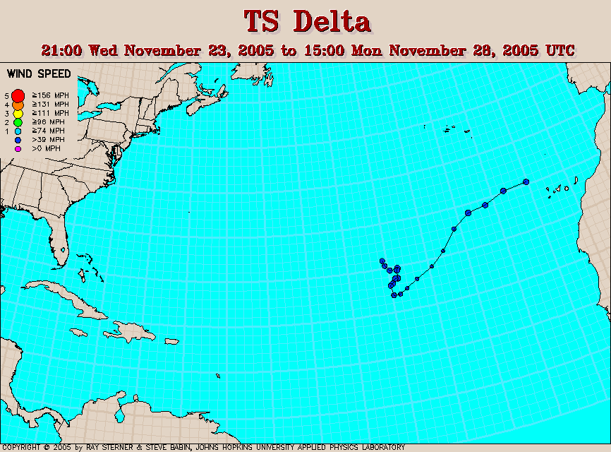
 Tropical/Extratropical Storm Delta |
Delta existed as a tropical storm in the open waters of the central Atlantic Ocean during November 23-28. The storm lost its tropical characteristics on the 28th, transforming into an extratropical cyclone. The extratropical remnants of Delta tracked across the Canary Islands and into Morocco on the 29th. Winds gusted as high as 200 km/hr (124 mph) in parts of Tenerife, causing wind damage. At least 7 deaths were attributed to the storm (BBC News). |

 Asia/Europe Snow Cover |
The seasonal expansion of Northern Hemisphere snow cover continued in November. By the end of the month, snow covered much of Alaska, Canada, Russia and portions of Europe, Kazakhstan and eastward into Mongolia. |
A major winter storm affected parts of Nebraska and the Dakotas during the 27th-28th. Snowfall accumulations of 41-51 cm (16-20 inches) were observed in parts of eastern South Dakota, while wind gusts exceeding 97 km/hr (60 mph) also accompanied the snow, creating blizzard conditions. Thousands of power outages were caused by the combination of strong winds and heavy snow. In South Dakota, about 8,000 utility poles and 10,000 miles of transmission line were brought down by the storm (Associated Press). |
 Plains Blizzard Snow Depth |