
*Data are for the period April 30th–June 1th, and are from the National Interagency Fire Center.
Updated: 7 June 2010
[ May 3
 |
May 20
|
May 20 |
May 31
|
May 31 ]
]
Wild fire activity during May was near normal in terms of acreage burned with the number of reported fires much below average. The U.S. has a whole experienced above-normal precipitation for the month. See the national temperature and precipitation State of the climate report for additional information. The Northeast and Southwest were drier than normal, while the Southeast, Ohio River Valley, northern Plains, and Northwest were wetter than normal. Fire activity tended to be contained in those regions with below-normal precipitation. The month got off to a slow start in terms of number of large fires, with only one large fire burning in the U.S. in Michigan. By the 20th, six large fires were active across the country: two in Michigan, two in New Mexico, one in Arizona, and one in central Alaska, where conditions have been dry for several months. At the end of May and beginning of June wildfire activity remained relatively quiet across the contiguous U.S., with only four large fires active — two in New Mexico, one in Arizona, and one in Texas. Ten large wildfires were reported active across central and southern parts of Alaska.
2010 Wildfire Statistics
(Source: NIFC)| Year–To–Date Totals as of June 1st | Nationwide Number of Fires | Nationwide Number of Acres Burned |
|---|---|---|
| 06/01/2010 | 25,784 | 674,222 |
| 06/01/2009 | 41,785 | 1,410,776 |
| 06/01/2008 | 27,120 | 1,501,036 |
| 06/01/2007 | 36,714 | 1,334,672 |
| 06/01/2006 | 41,845 | 2,556,162 |
| 06/01/2005 | 25,058 | 374,405 |
| 06/01/2004 | 32,068 | 531,270 |
| 06/01/2003 | 21,542 | 405,937 |
| 06/01/2002 | 30,817 | 1,115,133 |
| 06/01/2001 | 33,876 | 726,576 |
| 06/01/2000 | 39,865 | 1,027,072 |
| 5–yr average (2005 – 2009) |
34,504 | 1,435,410 |
| 10–yr average (2000 – 2009) |
33,069 | 1,098,304 |
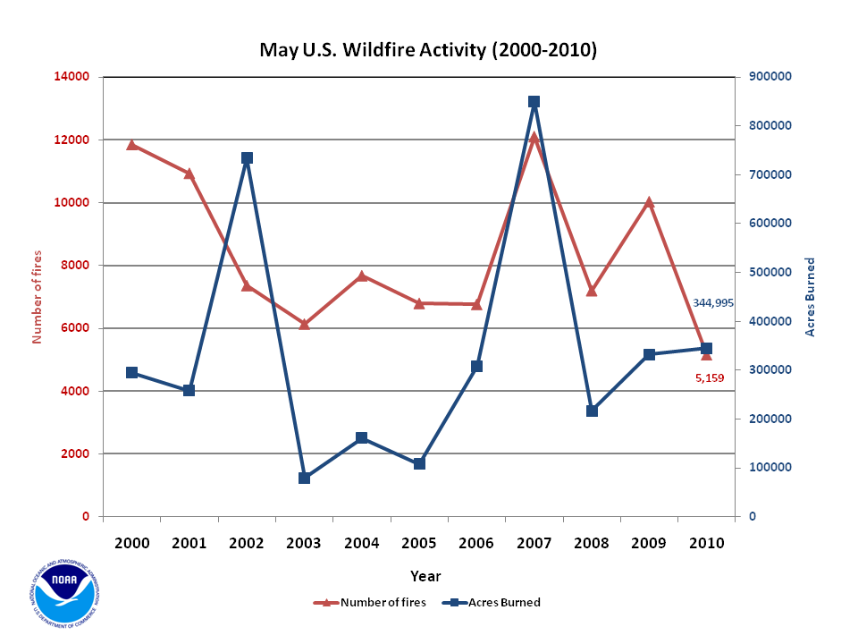
According to statistics from the National Interagency Fire Center (NIFC), at the beginning of June, the number of nationwide fires year-to-date was 25,784 which burned 674,222 acres (272,848 hectares) with an average of 26.1 acres (10.6 hectares) per fire. Between April 30th and June 1st, approximately 344,996 acres (139,614 hectares) burned across the U.S., which is 3 percent above the 2000-2009 average and marked the third most May fires since 2000. A total of 5,159 new fires were reported during the month, which is 41 percent below the 2000-2009 average and the lowest number of new May fires reported since records began in 2000. The average number of acres burned per fire was 66.9 (27.1 hectares) during May and is 77 percent above the 2000-2009 average and the third most acres burned per fire in the 11 year period of record.
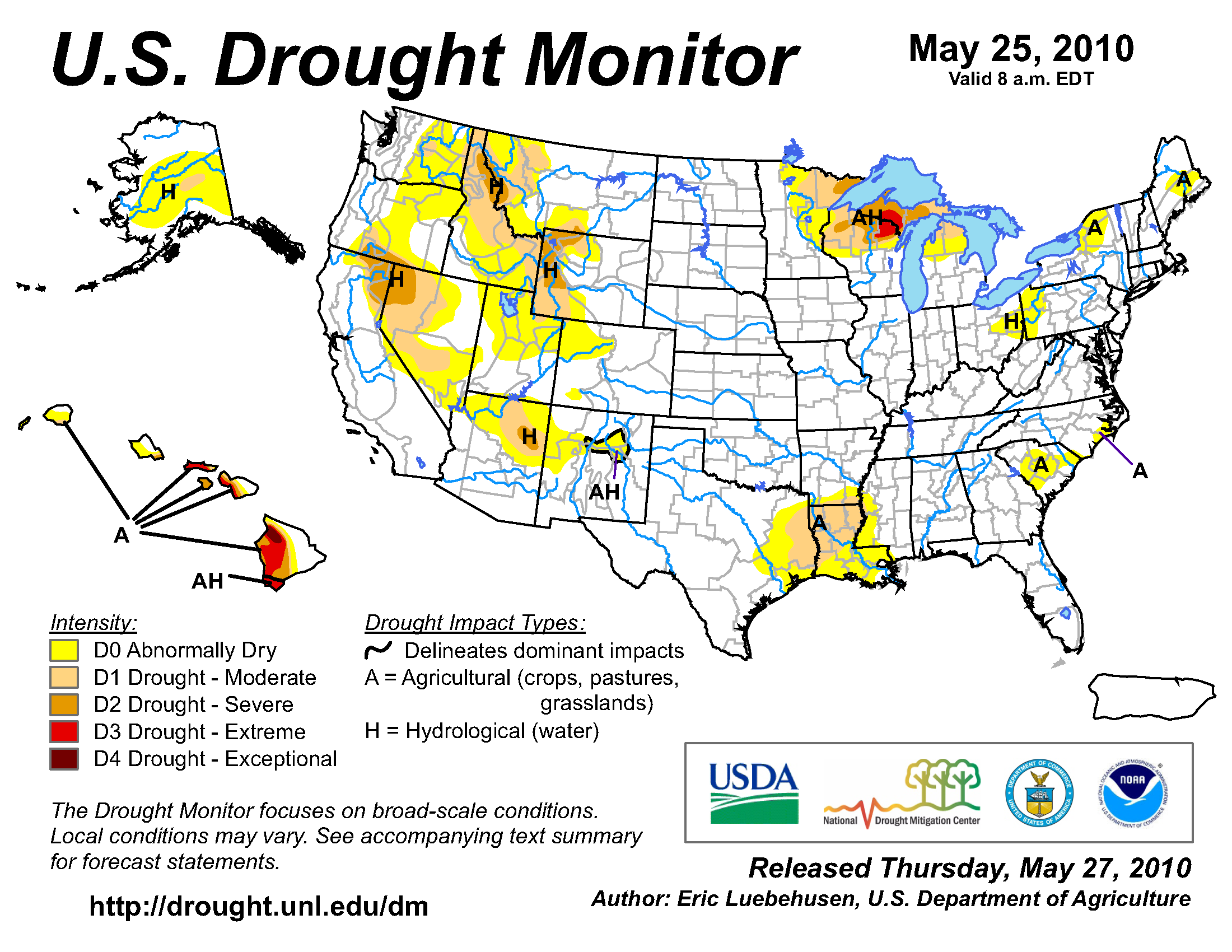
According to the U.S. Drought Monitor, during May drought conditions worsened across some regions of the U.S., but were ameliorated or remained unchanged in others. The ongoing severe drought conditions across the western Great Lakes were classified as extreme drought in northern Wisconsin and the western Upper Peninsula of Michigan. Very warm and dry conditions during May accelerated the expansion of drought in the region. The moderate drought occurring in Louisiana at the end of April was expanded into far eastern Texas. Ongoing dryness in central Alaska prompted the classification of moderate drought, where stream flows and year-to-date precipitation values were below their 25th percentiles. The severe-to-exceptional drought across the Hawaiian Islands remained generally unchanged. Drought conditions improved over much of the eastern half of the country where wet conditions generally prevailed during May. The moderate drought in Kentucky, Pennsylvania, and New York were all alleviated, with pockets of abnormally dry conditions remaining in the Carolinas, and parts of the Northeast. Severe drought in Northern California shrank, while the abnormally dry conditions in Oklahoma, Kansas, southern Arizona, and western Wyoming and Montana improved. Drought conditions for the rest of the U.S. generally remained unchanged during May
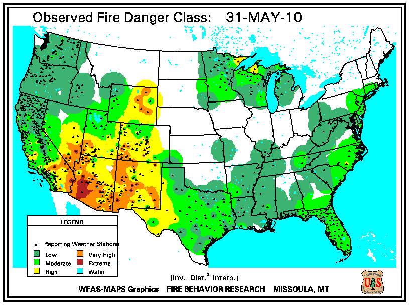
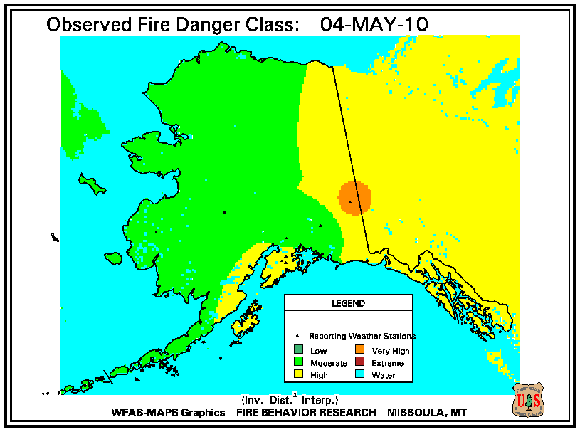
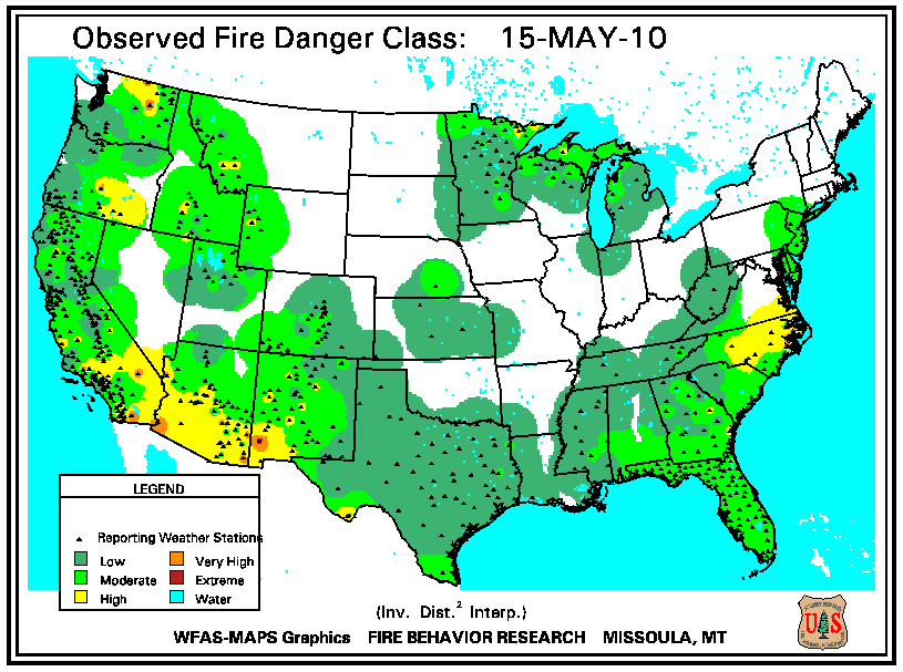
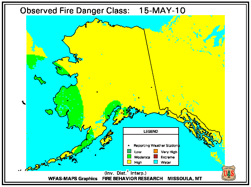
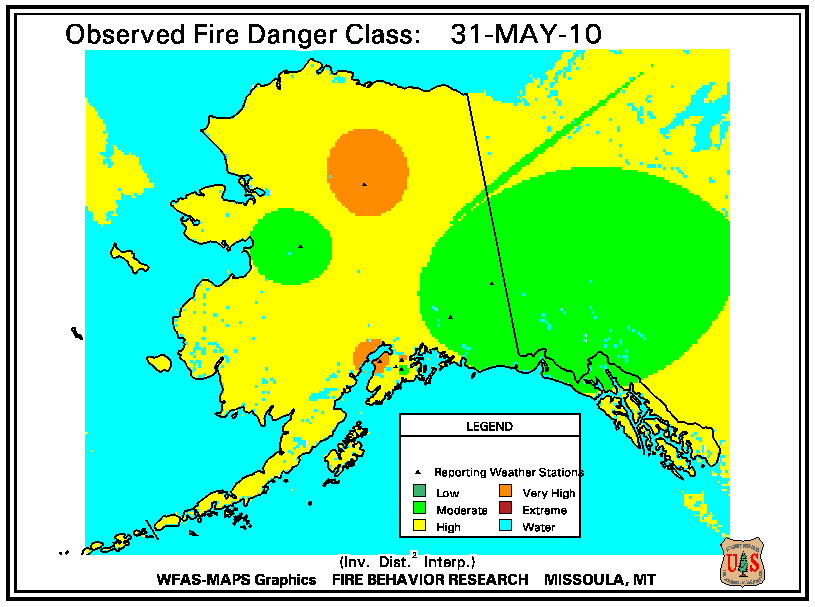
According to the U.S. Forest Service (USFS Wildland Fire Assessment System, at the beginning of the month the majority of the country was under no fire danger, except for high to very high fire danger ratings across the mid-Atlantic coast, western Great Lakes, the Four Corners region, Nevada, Southern California and western Arizona. By mid-May, the high fire danger along the coastal mid-Atlantic had spread in-land to cover nearly half of North Carolina. High to very high fire danger was present for interior Oregon and Washington, as well as continued high fire danger in the Southwest. By the 31st, the high fire danger in the east had improved, except for a few locations in the Upper Midwest. Very high fire danger was reported for most of the central and southern Rockies, with extreme fire danger in southwestern Arizona. For Alaska, the fire danger became increasingly greater during May.

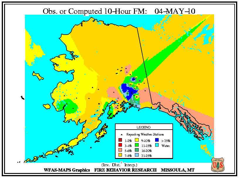
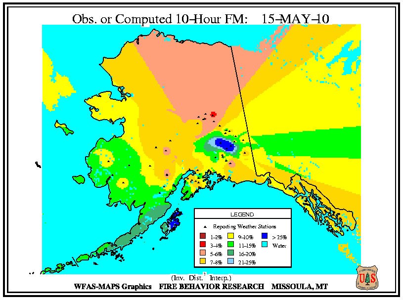
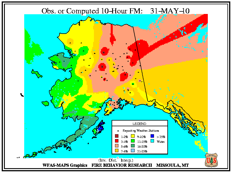
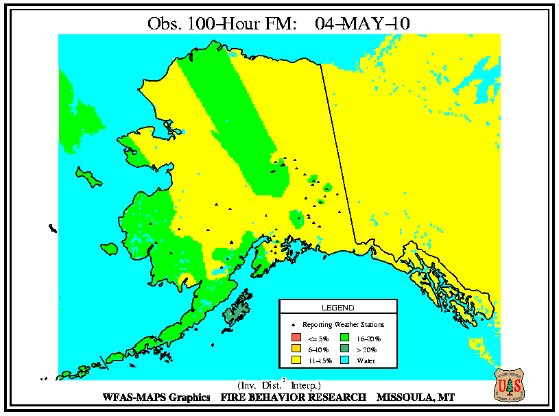
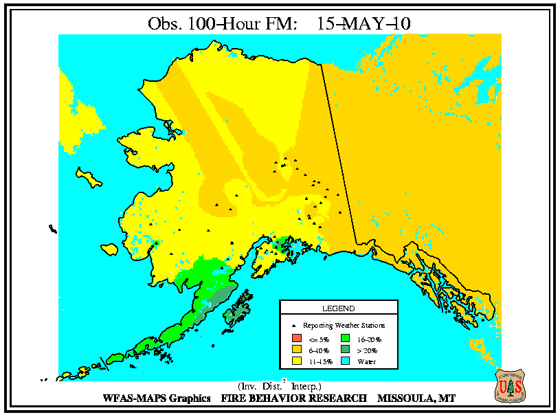
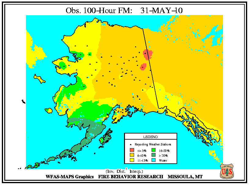
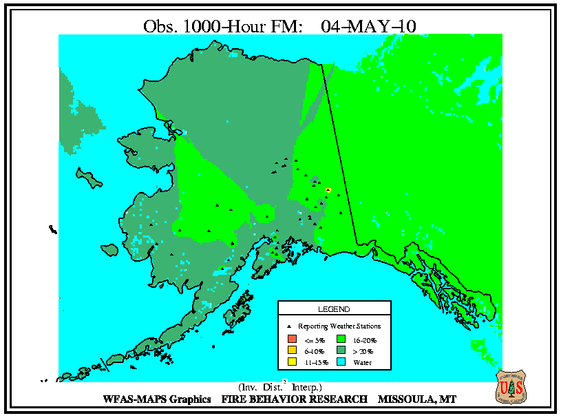
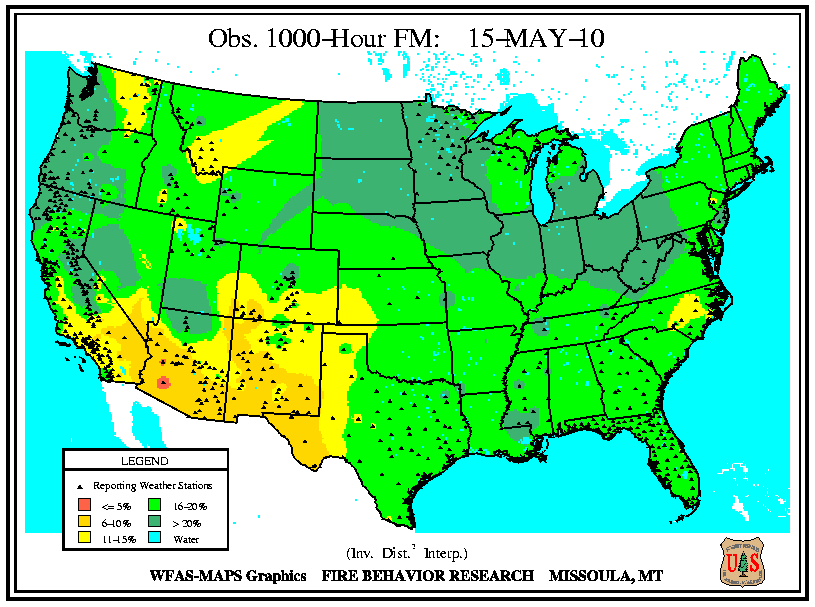
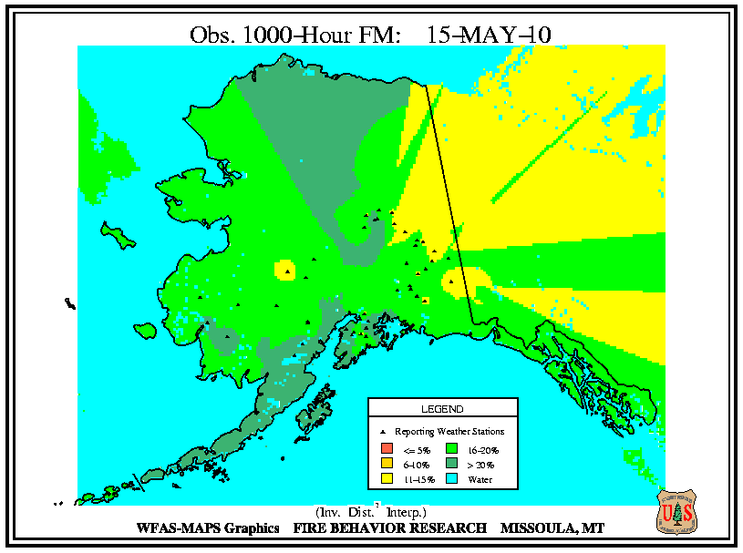
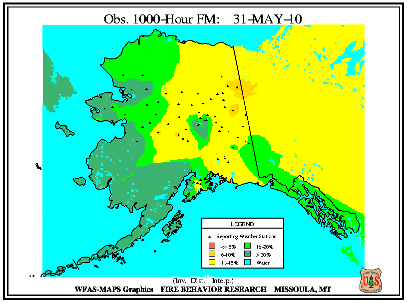
According to the USFS Wildland Fire Assessment System, the beginning of May had very low small fuel moistures (10-hour) across the Southwest with moderately low fuel moistures stretching to the Great Lakes and the Northeast. Dry small fuels were also present across central and southern Alaska. Medium size fuels (100-hour) were moderately dry across the Northeast, Great Lakes, Mid-Atlantic, and Florida. While 100-hour fuels were very dry across the southern Rockies, western Texas, and the Southwest. Dry large fuels (1000-hour) were confined to the Southwest. By mid-May, small fuels were dry along the entire East Coast and stretching across the northern tier of the country. Very dry small fuels were present from the Northwest along coastal California into the Southwest, as well as central and northern Alaska. Medium and large size fuels had a similar pattern of dryness with the lowest moistures in Arizona and New Mexico. At the end of May, small fuels were dry across the Northeast, Mid-Atlantic Coast, the Plains, southern Rockies, and the Southwest. Medium size and large fuels were dry across the Great Basin, Southwest, and southern Rockies. For Alaska, all fuel sizes were dry to very dry across the eastern half of the state. Check out the USFS site for definitions of the different dead fuel moisture classifications.

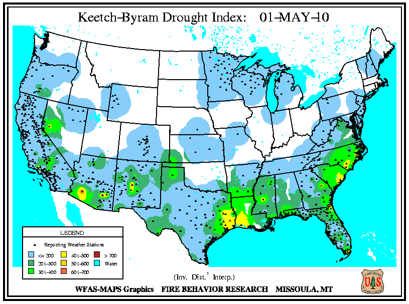
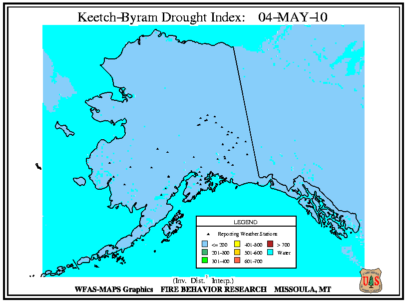
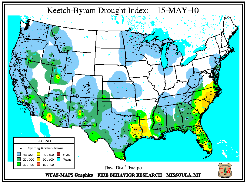
According to the USFS Wildland Fire Assessment System, at the beginning of the month, the only moderate Keetch–Byram Drought Index (KBDI) values were present in Arizona, New Mexico, and parts of the Southeast coast. By mid-month, KBDI values increased along the Carolinas’ coast, eastern Texas, western Louisiana, and the Florida peninsula. On May 31st, conditions continued to worsen for the Southeast coastal areas and the western Gulf Coast. Conditions also deteriorated across the Great Basin and parts of the Southwest. For the entire month, KDBI values were low for all of Alaska.