
Data are for the period 26-Feb to 26-March, and are from the National Interagency Fire Center.
Updated: 6 April 2010
[ March 5
 |
March 12
|
March 12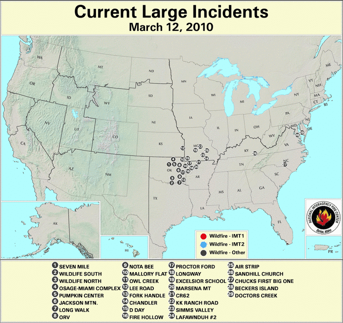 |
March 26
|
March 26 ]
]
For the month of March, wildfire activity increased across the country. Conditions tended to be drier and warmer than normal, leading to an increased fire potential— see the national temperature and precipitation state of the climate report. At the beginning of the month, eight large fires were active, mainly in the South — three in Oklahoma, two in North Carolina, two in Mississippi, and one Missouri. By the middle part of March, 29 large fires were active, clustered in the states of Oklahoma (13), Arkansas (5), Missouri (6), Maryland (2) with at least one fire in Kansas, Kentucky, and North Carolina. At month’s end, the number of fires was down to 15, with fires in Montana (1), Minnesota (1), Oklahoma (8), Texas (2), Mississippi (1), New Jersey (1) and Alabama (1). According to the National Interagency Fire Center (NIFC), 49 large fires were contained during the month.
2010 Wildfire Statistics
(Source: NIFC)| Year–To–Date Totals as of March 26th | Nationwide Number of Fires | Nationwide Number of Acres Burned |
|---|---|---|
| 03/26/2010 | 8,535 | 140,617 |
| 03/26/2009 | 21,338 | 530,296 |
| 03/26/2008 | 11,088 | 516,243 |
| 03/26/2007 | 15,936 | 254,827 |
| 03/26/2006 | 18,653 | 1,808,225 |
| 03/26/2005 | 9,253 | 130,797 |
| 03/26/2004 | 13,658 | 150,630 |
| 03/26/2003 | 6,435 | 84,796 |
| 03/26/2002 | 14,160 | 193,015 |
| 03/26/2001 | 14,412 | 266,547 |
| 03/26/2000 | 18,779 | 549,866 |
| 5–yr average (2005 – 2009) |
15,254 | 138,058 |
| 10–yr average (2000 – 2009) |
14,371 | 448,524 |
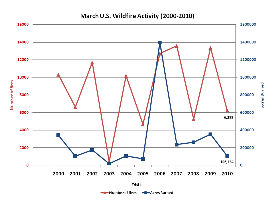
According to statistics from the NIFC, by March 26th, the number of nationwide fires to–date was 8,535 which burned 140,517 acres (56,865 hectares), with an average of 16.5 (6.7 hectares) acres per fire. Between February 26th and March 26th, approximately 106,164 acres (42,963 hectares) burned across the United States, which is 200,313 acres (81,064 hectares) below the 2000–2009 average of 306,477 acres (124,027 hectares). A total of 6,233 new wildfires were reported for the month, which is 2,646 fires below the 2000–2009 average of 8,880. This ranks March 2010 as the fourth slowest month in terms of number of fires and fifth slowest month for acres burned since 2000. The average acreage burned per fire was 16.5 acres (6.7 hectares) per fire, which is 11.9 acres (4.8 hectares) below the 2000–2009 average of 28.4 acres (11.5 hectares).

According to the U.S. Drought Monitor, drought conditions changed little during the month of March. Increased dryness east of the Mississippi River led to the development of abnormally dry classification in parts of the Ohio River Valley, the southern Mississippi River Valley, and the northern Great Lakes. The moderate–to–severe drought in northern Wisconsin continued. Drought conditions in the Southwest generally improved with much needed precipitation falling in the region. The severe drought conditions expanded in northern Nevada and California, as well as western Wyoming. The severe drought in central Washington improved one–category as the relatively dry winter ended and beneficial spring rain and snow fell in the Cascades. Central and western Alaska continued to have abnormally dry conditions for the month with below–average snowpack in the higher terrain. Some locations in the state have not received precipitation for over 90 days. The Hawaiian Islands had a mixed–bag of drought changes during the month. Drought conditions across the smaller, western islands remained nearly constant during the month, while the windward side of the Big Island had drought conditions improve from moderate to non-existent. The leeward side of the Big Island experienced worsening drought with extreme–to–exceptional drought becoming more widespread.

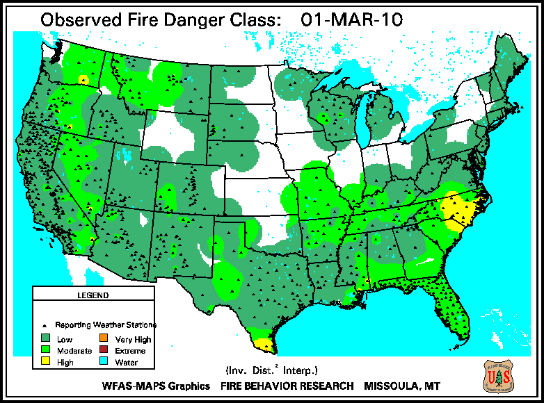
According to the U.S. Forest Service (USFS) – Wildland Fire Assessment System, on March 1st, high fire danger was present across the piedmont region of the Carolinas, far–southern Texas, and a few locations in the West. By mid–March, extreme fire danger conditions were reported in the Big Bend area of Texas, and very high fire danger was occurring in southern Mississippi, western Texas, and parts of southern and coastal California. A warm, dry end to March across most of the eastern two-thirds of the nation caused the fire danger to spread. Extreme danger was reported across northern and western Texas, central New Mexico, southeastern Nebraska, and central North Carolina.

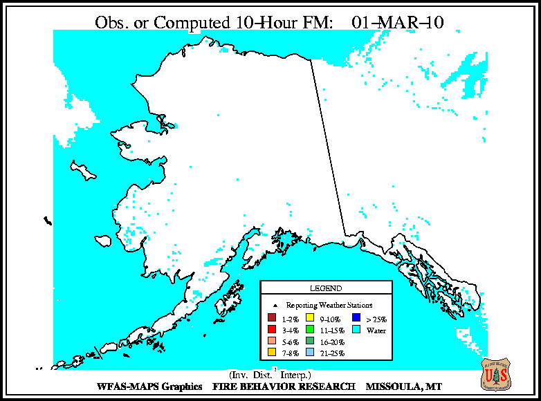
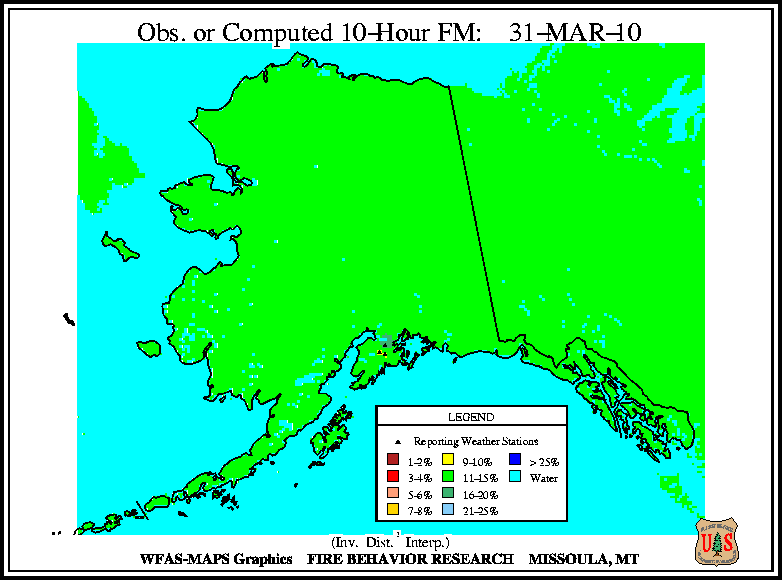
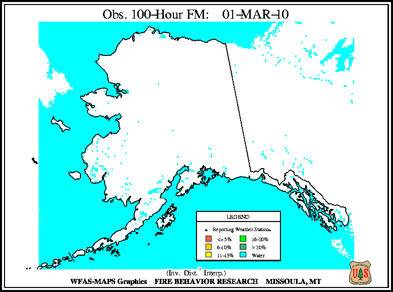
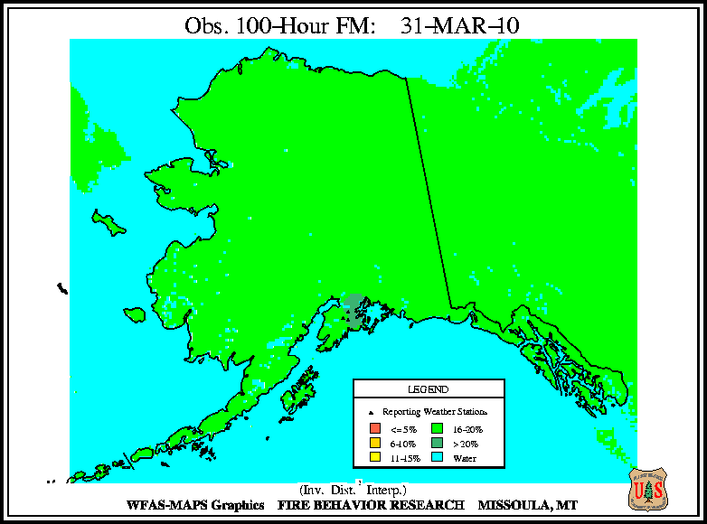
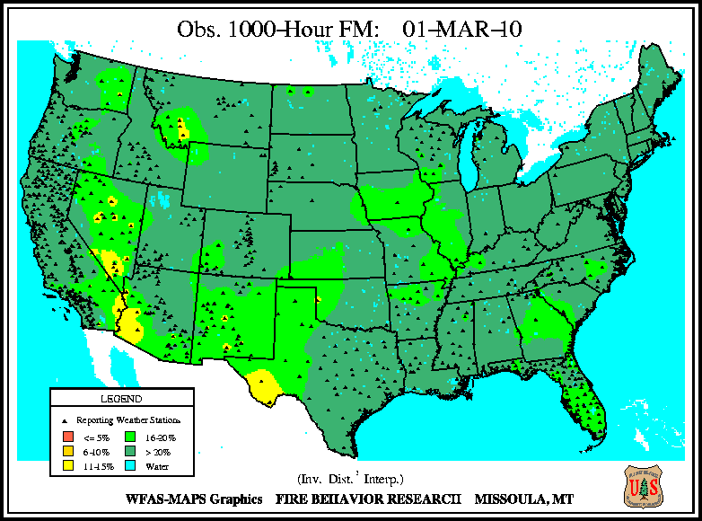
According to the USFS – Wildland Fire Assessment System, at the beginning of the month, the 10–hour and 100–hour fuel moistures were low across the southeastern United States, the Great Basin, extreme southeastern California, and western Montana. The largest fuels had high moistures over much of the country with the exception of the Big Bend area of Texas and parts of the Southwest. At month’s end, 10–hour fuel moistures were low for most regions east of the Rockies, except for the unusually wet Northeast. The southern Rockies had the lowest small fuel moistures in the nation. The lowest fuel moistures for medium and large fuels were confined to the southern Rockies, and the Great Basin. Check out the USFS site for definitions of the different dead fuel moisture classifications .

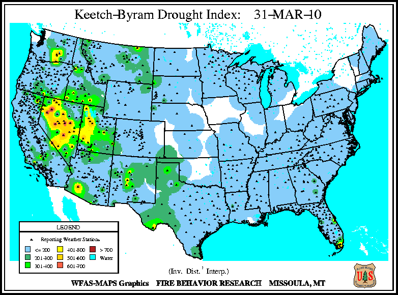
According to the (USFS) – Wildland Fire Assessment System, at the beginning of the month the only moderate–to–high Keetch–Byram Drought Index (KBDI) values were occurring in the Great Basin and southern Florida. At mid-March conditions improved for much for Florida except for the southernmost parts of the state. Conditions also improved for central Nevada, but worsened in western Utah. By month’s end, the KBDI was almost identical to the beginning of the month, except for improved conditions in Florida and higher KBDI in Washington state.