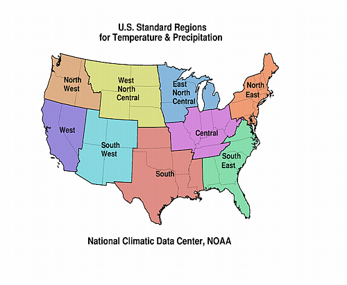
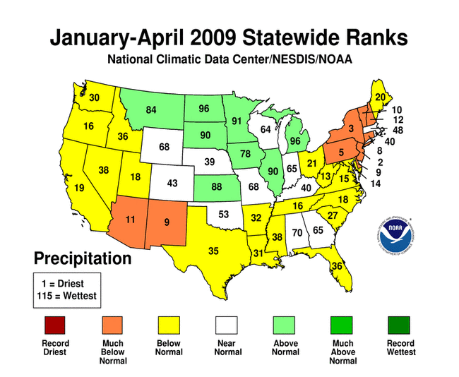
SOUTHEAST DROUGHT
According to the Southeast
Regional Climate Center, much of the region had below normal
precipitation totals for April, especially the Carolinas, southern
Virginia, and the southern three-quarters of Florida. Monthly
precipitation totals were less than 50 percent of normal across
much of southern Florida. In contrast, monthly precipitation totals
across most of Georgia and small portions of Alabama and South
Carolina were above normal. Prodigious monthly precipitation totals
over southern Georgia and western Florida were associated with
multiple mesoscale convective systems that tracked across the
region in association with the approach of two cold fronts between
the 1st and 3rd of the month. Most of Puerto Rico experienced below
normal precipitation totals for the month.
Severe drought (D2) conditions persisted across portions of central
and southern Florida, and a small region of southwestern Florida
was upgraded to the extreme drought classification (D3). Drought
conditions in northeast Georgia and northwest South Carolina showed
continued improvement early in the month in response to plentiful
rainfall in late March and early April. The small area of severe
drought (D2) in northwest South Carolina was downgraded to the
moderate drought (D1) classification. This was tied to a reduction
of the size of the D1 region, which occupied only a small portion
of northeastern Georgia and western North Carolina by the middle of
the month. Moderate drought conditions across northern Virginia
lessened to abnormally dry conditions during the month. Dry
conditions over the last 4 months contributed to the development
and rapid spread of a wildfire near Myrtle Beach, South Carolina on
the 22nd that burned nearly 20,000 acres and destroyed 76 homes.
Additionally, on the 23rd of the month, lightning sparked a brush
fire in the drought-stricken Everglades of southern Florida forcing
the closure of Interstate 75.
SOUTHERN REGION DROUGHT
As noted by the Southern
Regional Climate Center, the month of April had variable
precipitation for the Southern Region. Large areas of the region
experienced above normal monthly totals, while other large areas
received below normal precipitation. Precipitation totals in
Mississippi were generally below 75 percent of normal. Totals were
25-50 percent of normal in the coastal areas of Mississippi and in
southeastern Louisiana, specifically the Florida parishes of the
state. There was also a second dry belt that extended from north
eastern Louisiana, through central Mississippi to northeastern
Mississippi. Along this belt, monthly totals ranged from 25 to 50
percent of normal. The driest areas of the Southern Region
consisted of the western Texas panhandle and the southern tip of
Texas where precipitation totals were mostly below 25 percent of
normal. Many stations in Texas Climate Divisions 5 (Trans Pecos)
and 10 (Lower Valley) reported little to no precipitation for the
month. Conversely, the wettest portions of the Southern Region
included south eastern Texas, west central Texas, north central
Texas, and south central Oklahoma. These areas all experienced
precipitation totals that ranged from 200 to 400 percent of
normal.
The spatially variable pattern of April precipitation led to both
improvements and deteriorations in drought conditions within the
Southern Region. Near normal precipitation led to improved
conditions in eastern Tennessee. Similarly, normal rainfall for the
month in southern Arkansas resulted in the removal of abnormally
dry conditions. Heavy precipitation totals in Oklahoma allowed for
a great improvement throughout the state. Drought conditions were
improved by one category along the Oklahoma panhandle. Last month,
this area was categorized as moderate to severe drought. In Texas,
the northern Texas panhandle experienced a two category improvement
from moderate drought to drought-free conditions. There were also
significant improvements in the eastern portions of the state,
where precipitation totals for the month were well above normal. In
the southernmost counties of Texas, dry conditions (continued from
last month) led to a slight expansion of exceptional drought.
MIDWEST DROUGHT
As explained by the Midwest
Regional Climate Center, April was a wet month with nearly all
the region receiving above-normal precipitation. Minnesota,
northwest Iowa, northwest Wisconsin, and eastern Ohio were below
normal for the month, but elsewhere precipitation was above
normal.
HIGH PLAINS REGION DROUGHT
As noted by the High Plains
Regional Climate Center, showers and thunderstorms during April
helped erase the D2, D1, and much of the D0 (severe drought to
abnormally dry) conditions in Kansas. However, areas across north
central Kansas and eastern Nebraska missed out and D0 (abnormally
dry) conditions spread by the end of the month. Drought conditions
improved across Wyoming and parts of Colorado, but abnormally dry
conditions developed in western North Dakota in mid April. By the
third week of April, more than 10 percent of North Dakota was under
abnormally dry conditions. Divide, Burke Williams, Mountrail,
McKenzie, Billings and Golden Valley counties were so dry, the
National Weather Service put out Fire Danger statements during the
second and third week covering most of the Bismarck County Warning
Areas.
WESTERN DROUGHT
As summarized by the Western
Regional Climate Center, precipitation was below normal across
most of the western and southern portions of the region. Interior
areas of the Great Basin, the Wasatch, parts of the Central and
Northern Rockies, and the plains of Montana, along with isolated
pockets of southern Arizona were wetter than normal. Parts of
Wyoming, Montana and Colorado had an exceptionally wet and snowy
April. Great Falls, Montana tied their all-time snowiest month ever
with 35.4 inches (89.9 cm). Bozeman, Montana also recorded their
snowiest month of all time with 49.6 inches (126 cm). The large
snow event along the Front Range of Colorado on the 17-19th
produced 56.3 inches of snow (143 cm) in Rollinsville.
Mountain snowpack remained mostly healthy in the Pacific Northwest
and Intermountain region with snowpack on May 1st near or slightly
above normal. The Southwest and California remained well below
normal. Snowmelt inflow to Lake Powell on the Colorado River was
expected to be near average. California snowmelt runoff was again
expected to be well below average for the third consecutive
year.
California: As noted by California and NOAA
officials, the precipitation of recent months has improved reservoir
levels along the Sierra Nevada from where they were earlier
this year, although several reservoirs to the north and west still
had low levels. The end-of-April 2009 overall statewide reservoir
storage was approximately at the same level as April 30, 2008. In
northern California, Shasta county experienced early May rains
which have improved short-term conditions. However, long-term
conditions remained dry. According to local reports, multiple
consecutive low rainfall years have dropped the water table causing
agricultural wells to go dry.
Alaska: According to National Weather
Service reports (from information compiled and provided by Audrey
Rubel at NOAA NWS Alaska Region Headquarters), precipitation for
the month showed a pattern of discontinuity with drier-than-normal
conditions in eastern Alaska and wetter than normal in the west.
Due to the gradual warm-up taking place during April with
lengthening daylight hours, the seasonal snowpack disappeared or
was significantly reduced at many locations.
NORTHEAST DROUGHT
As noted by the Northeast
Regional Climate Center, April 2009 was the third consecutive
month with above-normal temperatures in the Northeast and the
fourth month in a row with below-normal precipitation. The regional
average was 3.24 inches (8.23 cm) or 91 percent of the normal April
precipitation amount. This represented a range of values from 66
percent of normal in Vermont to 141 percent of normal in Delaware.
The general weather pattern this month kept the bulk of the
precipitation in the southern three states and along the coast,
leaving interior sections of the Northeast quite dry.
Above-normal rainfall in the southern third of the Northeast
improved drought conditions in West Virginia and Maryland from
moderate drought to abnormally dry, according to the April 28, 2009
USDM. Most of western West Virginia improved to normal conditions.
Below-normal precipitation in the central portion of the Northeast
resulted in abnormally dry conditions in Delaware, New Jersey,
Pennsylvania, southern New York and western Massachusetts and
Connecticut.
|


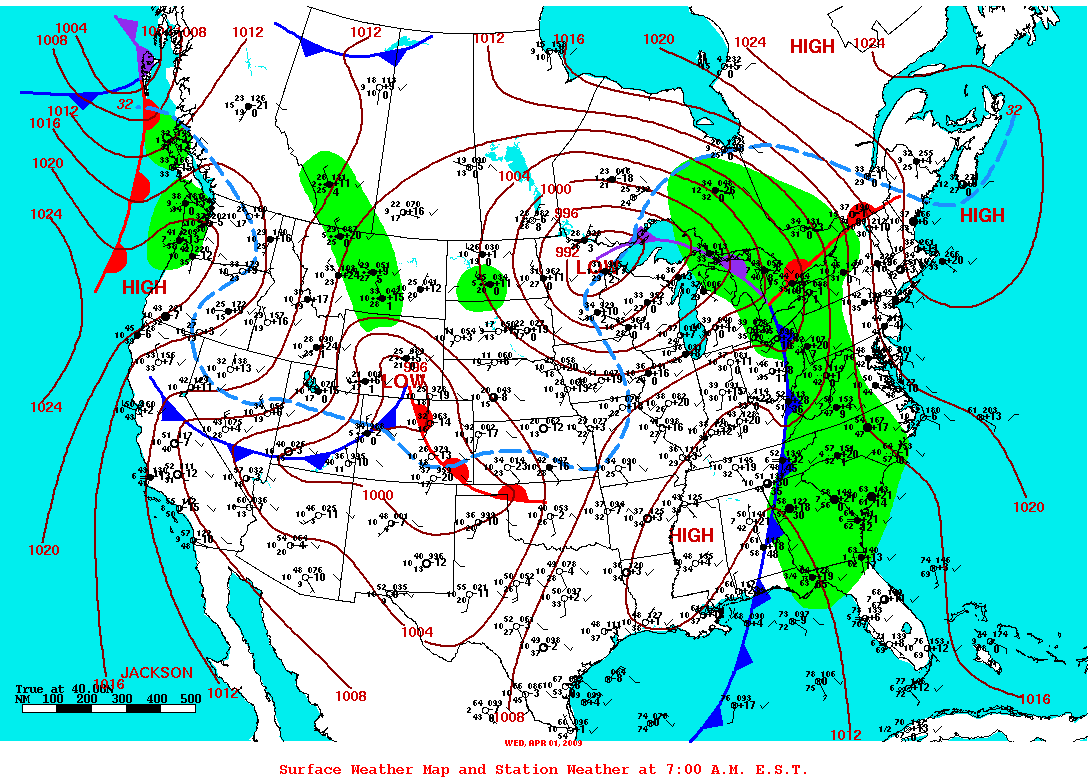 weather pattern
for April consisted of a generally
westerly flow in the atmosphere. Strong low pressure systems
and associated fronts, embedded in this west-to-east circulation,
brought rain and snow to areas of
the country, with heavy
precipitation falling over parts of the Plains,
Midwest, and South. Rain or snow especially benefited the
drought areas of the southern Plains, intermountain West,
Southeast, and mid-Atlantic states. The precipitation largely
missed the Southwest,
parts
of California, southern
Texas, the southern half of
Florida, and parts of the
Northeast, with drought or abnormally dry conditions expanding
in these areas (April 28 USDM
versus March 31
USDM).
weather pattern
for April consisted of a generally
westerly flow in the atmosphere. Strong low pressure systems
and associated fronts, embedded in this west-to-east circulation,
brought rain and snow to areas of
the country, with heavy
precipitation falling over parts of the Plains,
Midwest, and South. Rain or snow especially benefited the
drought areas of the southern Plains, intermountain West,
Southeast, and mid-Atlantic states. The precipitation largely
missed the Southwest,
parts
of California, southern
Texas, the southern half of
Florida, and parts of the
Northeast, with drought or abnormally dry conditions expanding
in these areas (April 28 USDM
versus March 31
USDM).


