U.S. Drought Highlights:

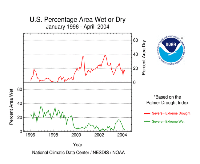
- On the national scale, severe to extreme drought affected about 15 percent of the contiguous United States as of the end of April 2004
- moderate to extreme drought affected about 32 percent of the contiguous U.S.
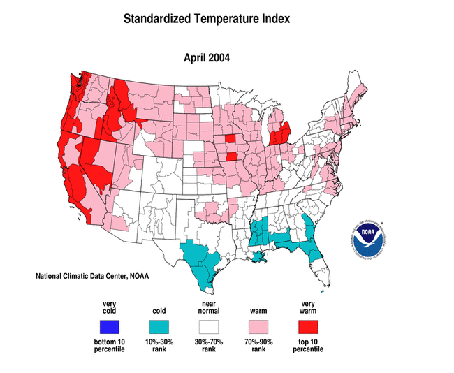
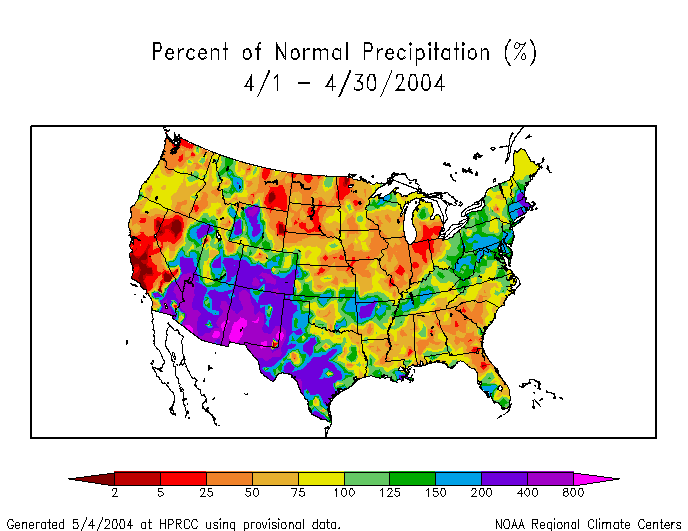
- April was warmer than normal across much of the western and Great Plains drought areas, but above-normal precipitation across the southern and central Rockies and adjoining Plains resulted in a contraction of the national percentage drought area
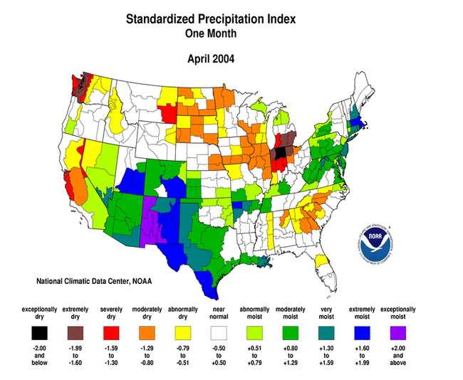
- The month was dry across much of the Far West, from the northern Rockies across the Great Plains to the southern Great Lakes, and in the Southeast
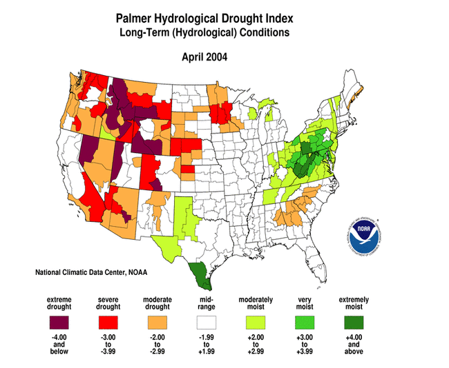
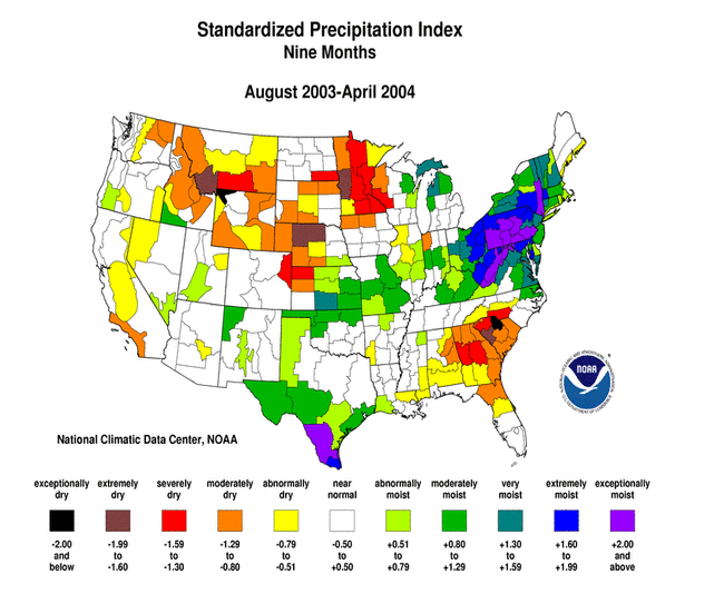
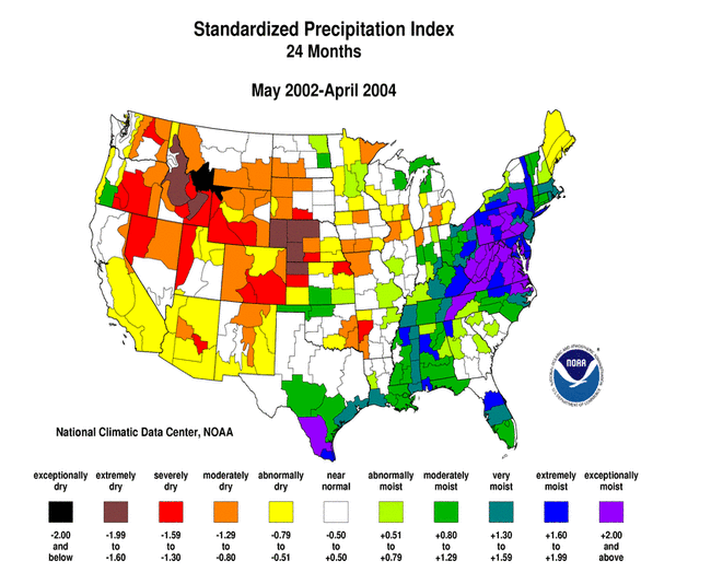
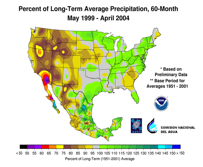
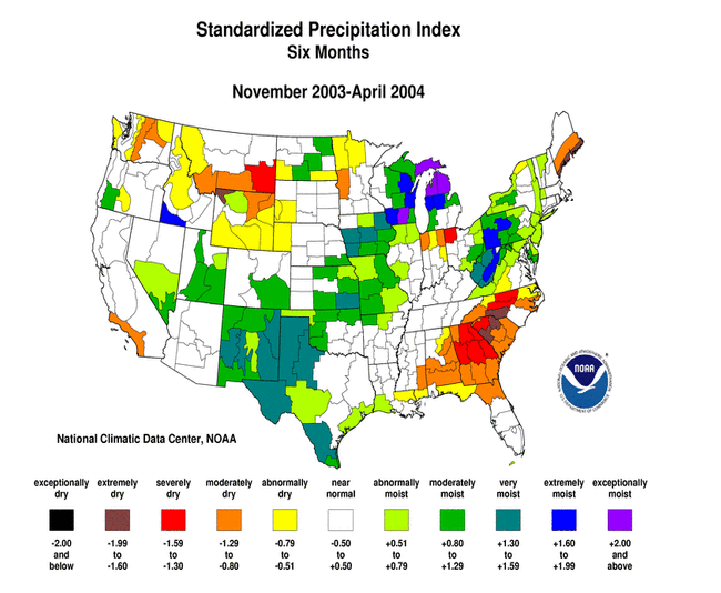
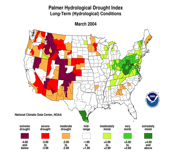
- Long-term moisture deficits (last 9 to 24 to 60 months) persisted across parts of the Upper Midwest to central Plains, parts of the Southeast, and most of the West
Please Note: The data presented in this drought report are preliminary. Ranks, anomalies, and percent areas may change as more complete data are received and processed.
National Overview
On the national scale,
- severe to extreme drought affected about 15 percent of the contiguous United States as of the end of April 2004, a decrease of about 3 percent compared to last month
- about 32 percent of the contiguous U.S. fell in the moderate to extreme drought categories (based on the Palmer Drought Index) at the end of April
- on a broad scale, the last two decades were characterized by unusual wetness with short periods of extensive droughts, whereas the 1930s and 1950s were characterized by prolonged periods of extensive droughts with little wetness
- about 3 percent of the contiguous U.S. fell in the severely to extremely wet categories at the end of April
- a file containing the national monthly percent area severely dry and wet from 1900 to present is available
- historical temperature, precipitation, and Palmer drought data from 1895 to present for climate divisions, states, and regions in the contiguous U.S. are available at the Climate Division: Temperature-Precipitation-Drought Data page in files having names that start with "drd964x" and ending with "txt" (without the quotes).
Regional Overview
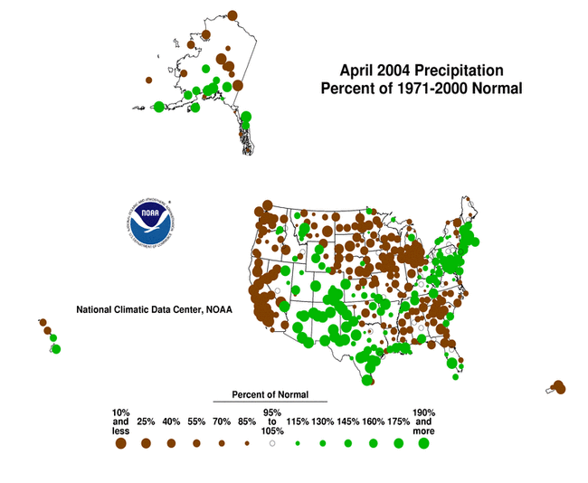
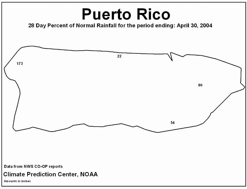
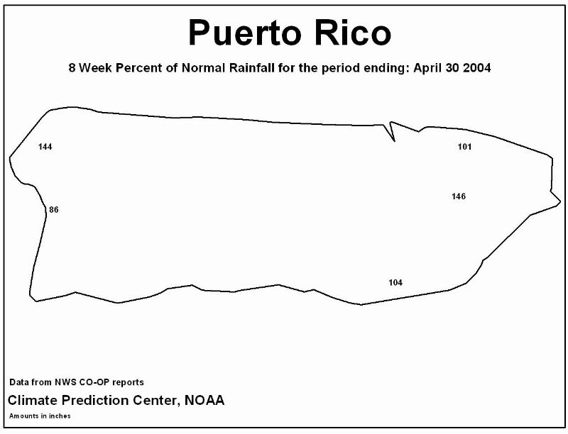
April was dry across much of the Far West, from the northern Rockies across the Great Plains to the southern Great Lakes, and in the Southeast. Above-normal precipitation across the southern and central Rockies and adjoining Plains states brought short-term drought relief to those areas. Much of Alaska was drier than normal, but wetter than normal conditions prevailed at the primary stations along the southern coastal band and the southern interior regions. The rainfall pattern in Hawaii was mixed. The primary stations in Puerto Rico were generally drier than normal, especially for the last 4 weeks, but the pattern was mixed at 8 weeks.
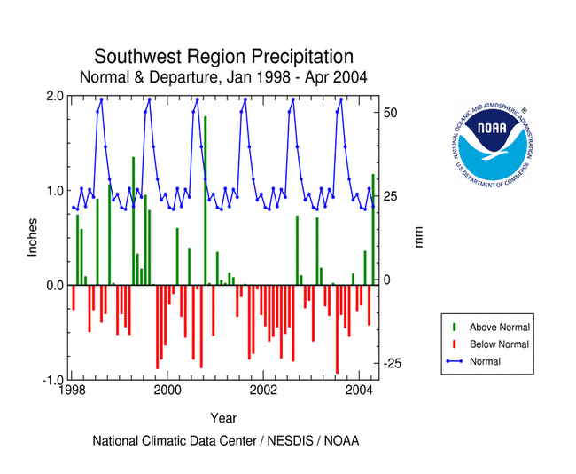
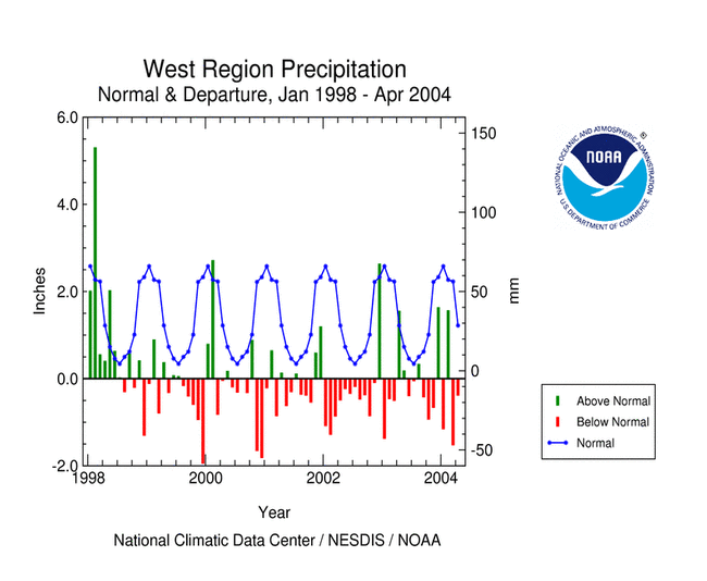
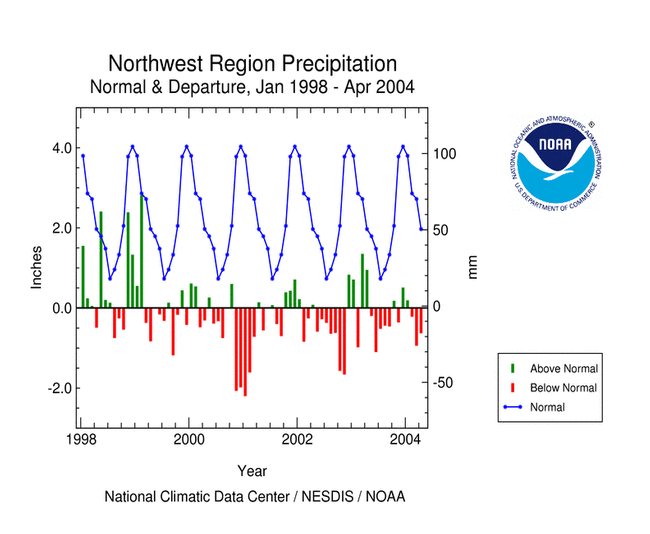
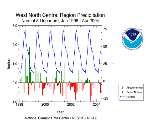
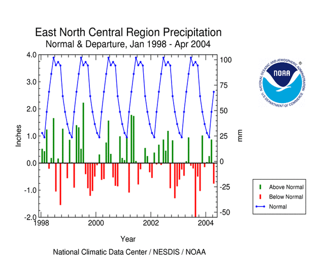
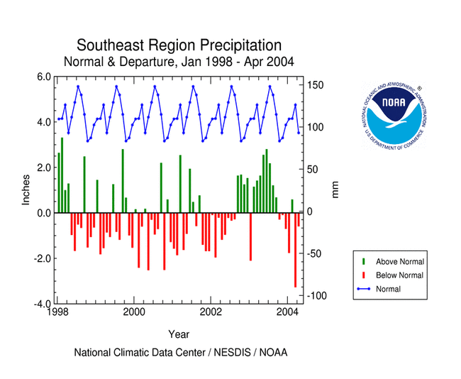
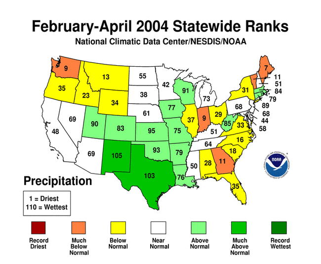
Wet conditions during April in the Northeast and Southwest brought relief from recent (and long-term) dry spells in those areas. This month marked the second and third consecutive dry months, respectively, for the West and Northwest regions. April 2004 ranked as the 22nd and 25th driest April, respectively, in the 110-year record for the West North Central and East North Central regions. Six of the last seven months have averaged near to much drier than normal for the Southeast. This recent dryness, combined with the prolonged dryness that occurred from 1998-2002, has resulted in the reappearance in the Southeast of an area of drought based on the Palmer Drought Index (February, March, April).
This month's short-term dryness compounded the long-term moisture deficits (last 9 to 24 to 36 to 60 months) in many areas.
Some regional highlights:
- Several states had the tenth driest, or drier, month or season for:
- April (Indiana)
- February-April (Indiana, Maine, Washington)
- driest January-April (Maine)
- November-April (South Carolina)
- May-April (Idaho, Montana)
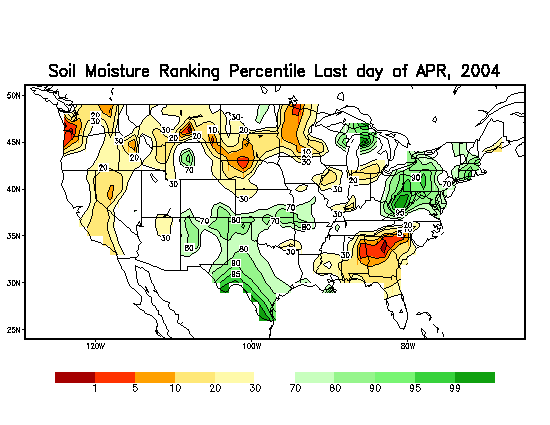
- Soil moisture conditions:
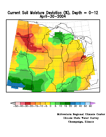
- End-of-month soil moisture conditions were much drier than normal in the Southeast and parts of the Midwest and West, based on model computations.
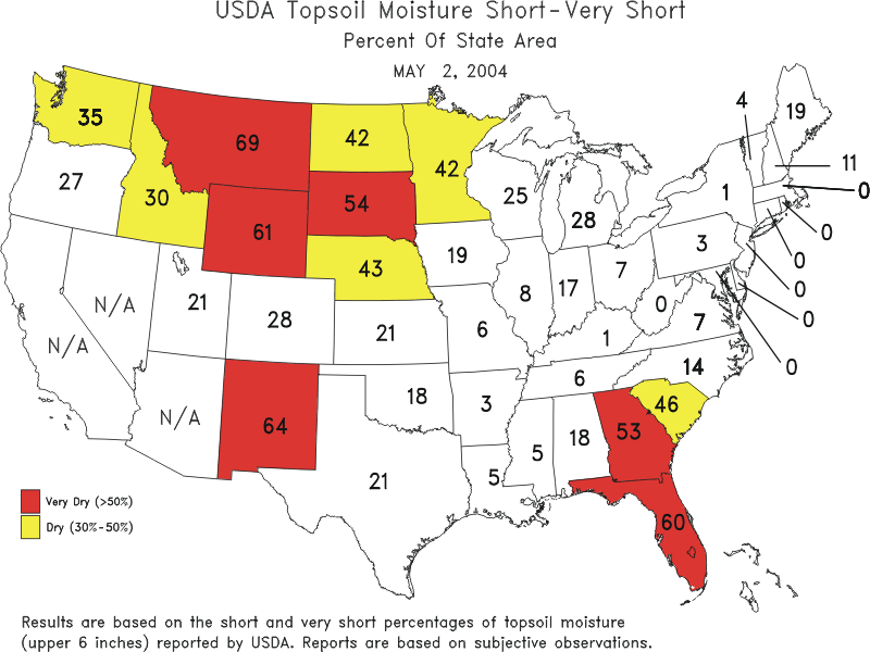
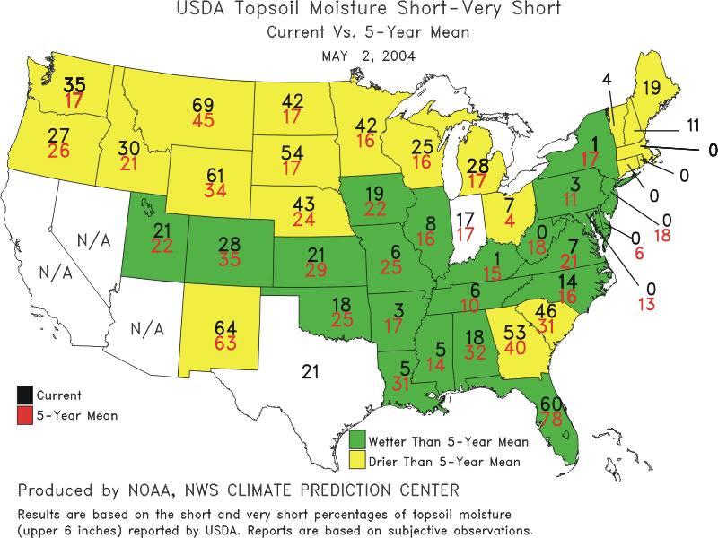
- USDA topsoil moisture observations were dry to very dry (both observed and compared to recent climatologies) in states in the Southeast, New England, Great Lakes to northern Plains, and parts of the West.
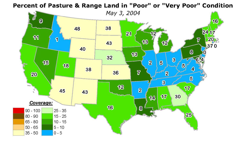
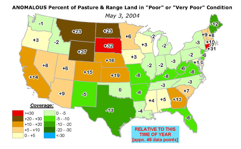
- According to early May USDA reports, more than 30 percent of the pasture and range land was in poor or very poor condition in the Rocky Mountain states and adjoining central and northern Plains states. Several other states had poor or very poor condition percentages that were higher than seasonal norms.
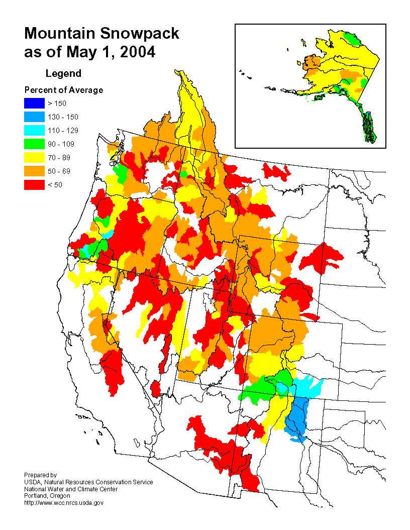
- Hotter than normal temperatures and an early snowmelt season exacerbated drought conditions across much of the West.
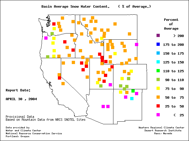
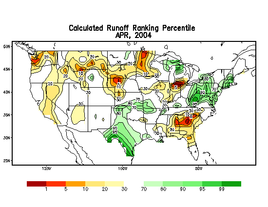
- High elevation SNOTEL station reports and snow course observations reveal a much below-average mountain snowpack. Western streams and reservoirs depend on water from spring snowmelt.
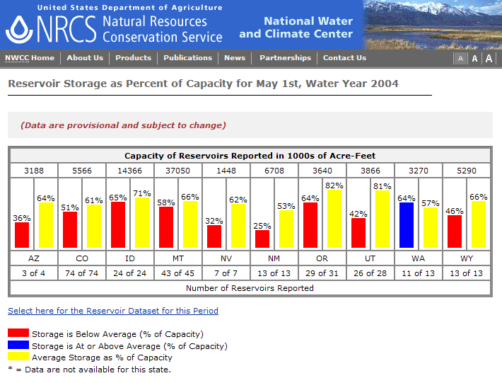
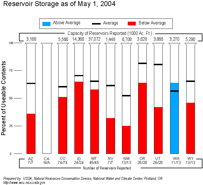
- Reservoirs in most of the western states were still low or depleted.
- Streamflow levels were below seasonal norms, especially in the northern Rockies, both as computed by models and based on USGS observations.
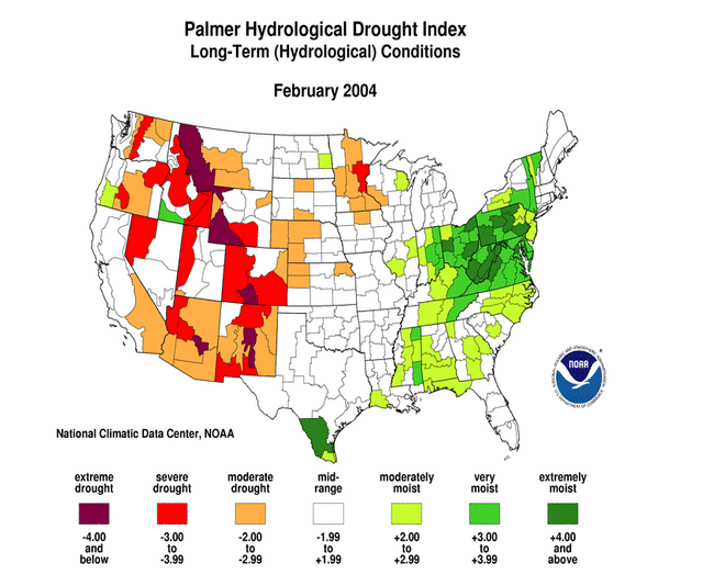
- The percent area of the western U.S. (Rockies westward) experiencing moderate to extreme drought (as defined by the Palmer Drought Index) decreased slightly during April to about 61%. While this is not near record historical levels, it is still comparable to the major droughts of the 20th Century.