U.S. Drought Highlights:

- On the national scale, severe to extreme drought affected about 12 percent of the contiguous United States as of the end of April 2003
- moderate to extreme drought affected about 24 percent of the contiguous U.S.
- Short-term conditions were dry across much of the southern Plains and southern Rockies, parts of the northern Plains and northern Rockies, and across much of the Northeast to Great Lakes
- Above-normal precipitation fell over some of the drought areas of the West and central Plains
- Long-term moisture deficits persisted across parts of the Ohio Valley and southern Great Lakes and much of the West
Please Note: The data presented in this drought report are preliminary. Ranks, anomalies, and percent areas may change as more complete data are received and processed.
National Overview
On the national scale,
- about 24 percent of the contiguous U.S. fell in the moderate to extreme drought categories (based on the Palmer Drought Index) at the end of April;
- severe to extreme drought affected about 12 percent of the contiguous United States as of the end of April 2003, a decrease of about 5 percent compared to last month;
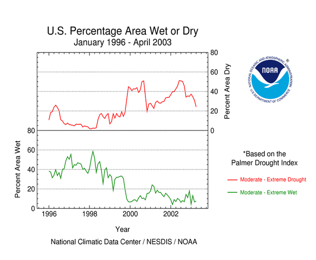
- the coverage of the current (November 1999-present) national-scale drought first peaked in August 2000 at about 37% of the contiguous U.S. (in the severe to extreme categories), which was as extensive as the major droughts of the last 40 years, but not as large as the "dust bowl" droughts of the 1930s and 1950s;
- the total drought area decreased to about 9 percent by November 2000, but had a general increasing trend for much of the period since then, reaching in July 2002 the peak it had first reached in August 2000; there has been a generally decreasing trend in drought area since July 2002 (see graph below left);
- on a broad scale, the last two decades were characterized by unusual wetness with short periods of extensive droughts, whereas the 1930s and 1950s were characterized by prolonged periods of extensive droughts with little wetness (see graph below right);
- although various parts of the U.S. have experienced unusually wet conditions during the last 42 months, little change occurred in the aggregate national wetness picture during much of this period;
- the percentage of the nation severely wet has remained below about 11 percent during this period, hovering around 2 percent by the end of April 2003 (see graph below left);
- a file containing the national monthly percent area severely dry and wet from 1900 to present is available;
- historical temperature, precipitation, and Palmer drought data from 1895 to present for climate divisions, states, and regions in the contiguous U.S. are available at the Climate Division: Temperature-Precipitation-Drought Data page in files having names that start with "drd964x" and ending with "txt" (without the quotes).
Regional Overview

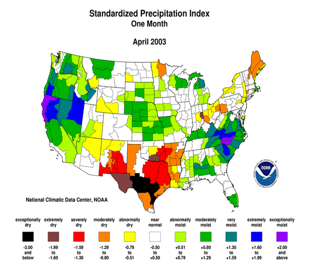
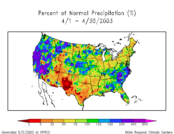
- Above normal precipitation fell across many drought areas during April 2003, especially over parts of the Far West, central Plains, and Great Lakes
- April was dry over the southern Rockies and Plains, and parts of the Ohio Valley, Northeast, and northern Plains and Rockies
- Most of the primary stations in Alaska and Hawaii had drier than normal conditions during April, and the precipitation pattern for the year-to-date (January-April) was generally dry for Hawaii and mixed for Alaska
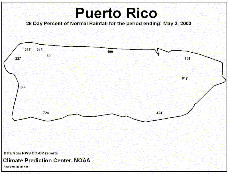
- April was generally wet at the stations in Puerto Rico (as seen in the 4-week precipitation anomalies ending April 25 and May 2)
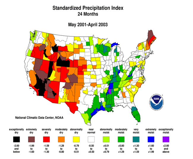
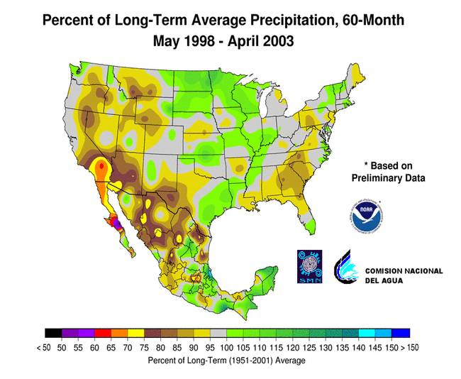
- Long-term drought continued across much of the West, from the central Plains to the southern Great Lakes, and over parts of Maine
- Although unusually wet conditions for the last 8 months have ended drought in the Southeast U.S., precipitation deficits remained at the 24-month to 60-month timescales
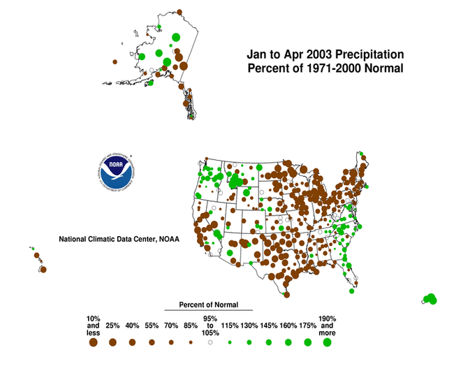
A percent of normal precipitation map for April, created by the NOAA Regional Climate Centers (HPRCC) from Cooperative Network station data, shows greater detail of the spatial variability of the moisture anomalies.
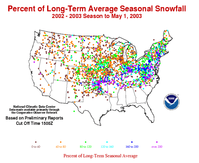
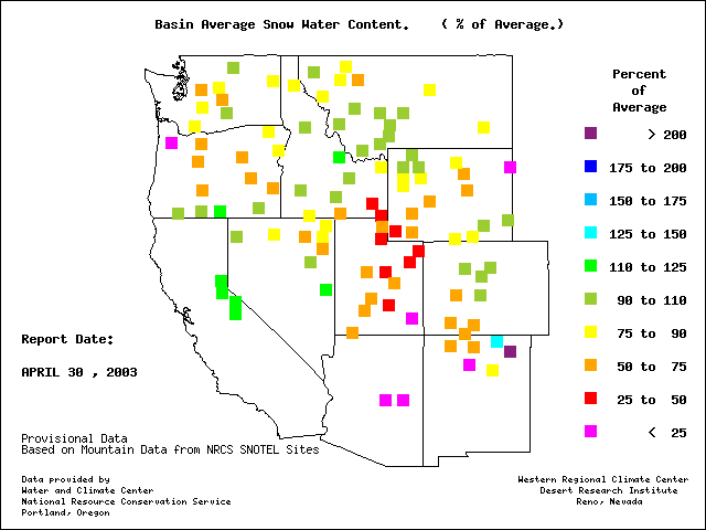
The long-term dryness is also evident in the pattern of snowfall anomalies. Season-to-date (July 1, 2002 - May 1, 2003) snowfall has totaled below the long-term average across much of the Far West, central and northern Great Plains, and the Great Lakes region.
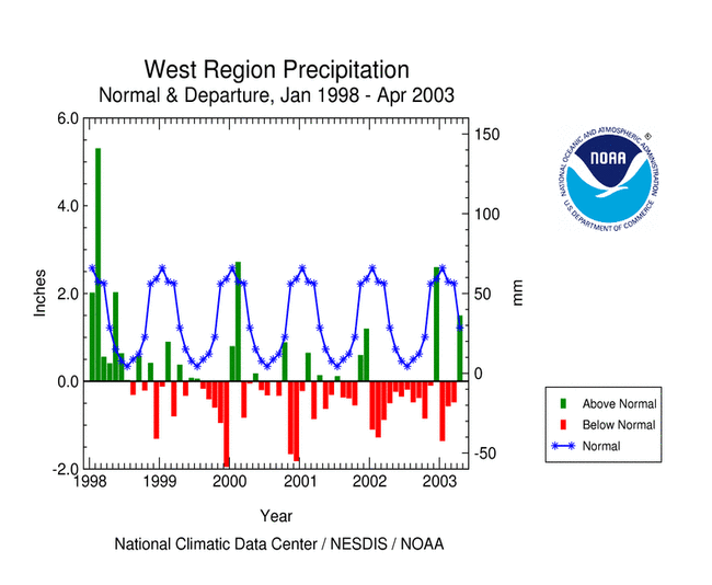
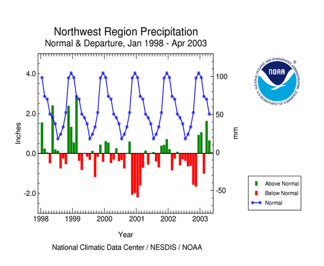
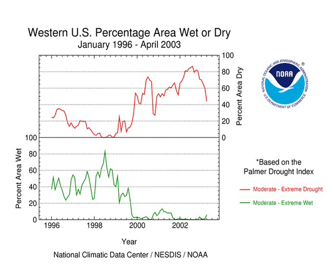
Western U.S. Drought
Wet conditions during April 2003 broke a run of three dry months for the West region. Four of the last 5 months have averaged wetter than normal for the Northwest. In the Southwest region, a mixed pattern of precipitation anomalies resulted in the 44th driest April. While recent months reflect improvement in short-term conditions across much of the West, long-term conditions remained dry. May 2002-April 2003 ranked as the 34th driest such 12-month period for the Northwest and 35th driest for the Southwest.


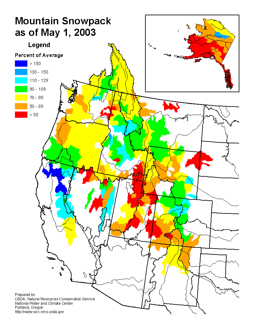
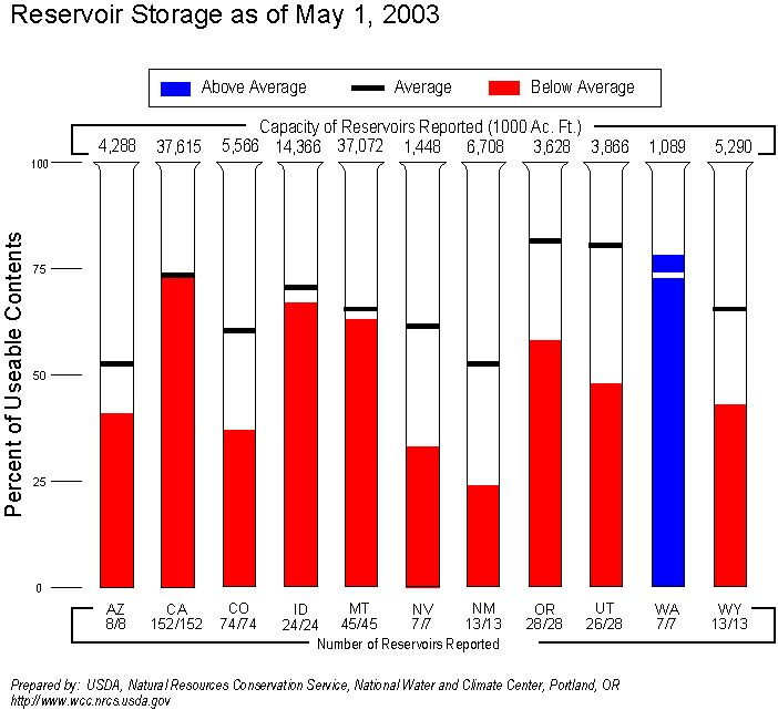
Moderate to extreme drought covered about 44% of the western U.S. (Rocky Mountains to west coast) at the end of April. This is a decrease of about 16% compared to last month due to short-term wet conditions, but the 44% figure still indicates lingering moisture deficits. These long-term drought conditions were reflected in below-average snow cover as monitored by snow course measurements, mountain SNOTEL station reports, and satellite observations, as well as by low reservoirs in most western states. The winter mountain snowpack is the source of spring meltwater which fills western reservoirs and is used for irrigation during the spring and summer growing seasons. The low spring snowpack and reservoirs have prompted regional concerns about a long, dry summer (CNN, 4/9).
According to early May (05/04) USDA reports, 40% or more of the range/pasture conditions in the following states were rated very poor to poor:
- New Mexico - 70%
- Maine - 57%
- Colorado - 53%
- Arizona - 45%
- Wyoming - 41%
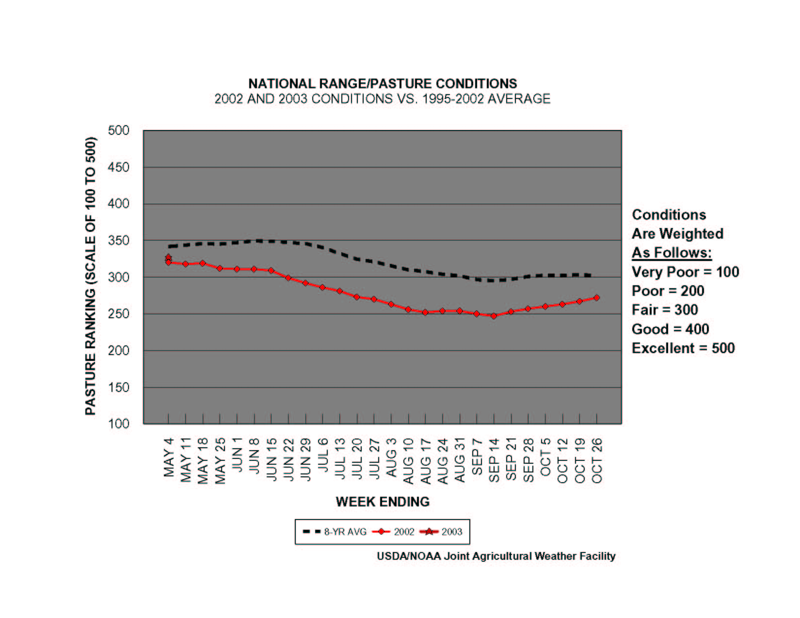
Despite recent pasture improvements, national pasture figures have not yet climbed back to average levels (1995-2002 base period) since falling below that level in August 1999.
Central U.S. Drought
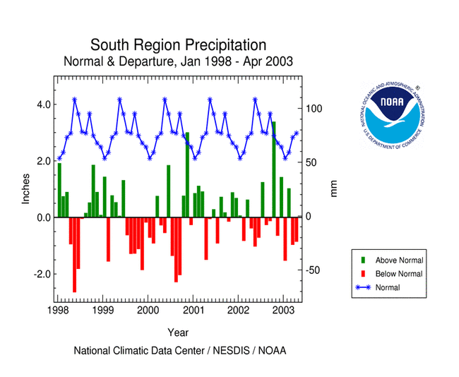
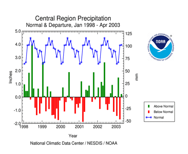
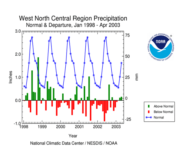
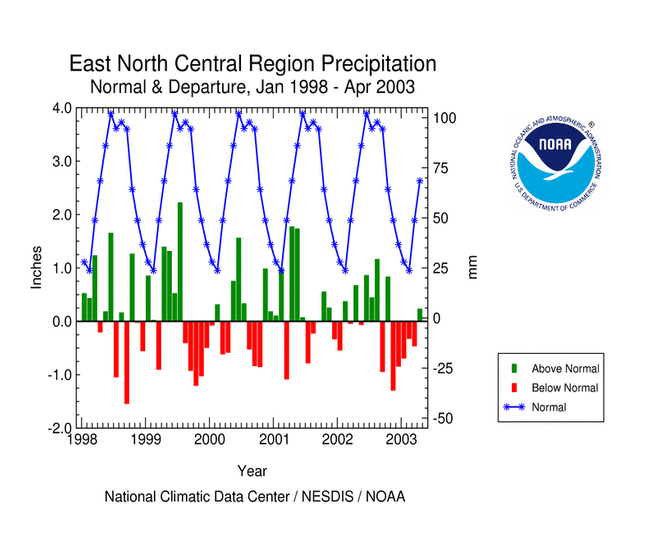
April marked the second consecutive month with drier than normal conditions averaged across the South region, resulting in the 13th driest March-April, 14th driest January-April, and 17th driest April. Heavy rains over parts of the Central, West North Central, and East North Central regions gave these regions slightly wetter than average conditions for the month. However, long-term conditions remained dry, with the East North Central region having the 5th driest November-April, the West North Central region the 19th driest May-April, and the Central region the 25th driest March-April. Minnesota had the driest November-April on record and Arkansas the third driest March-April.


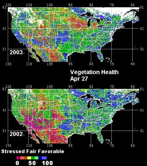
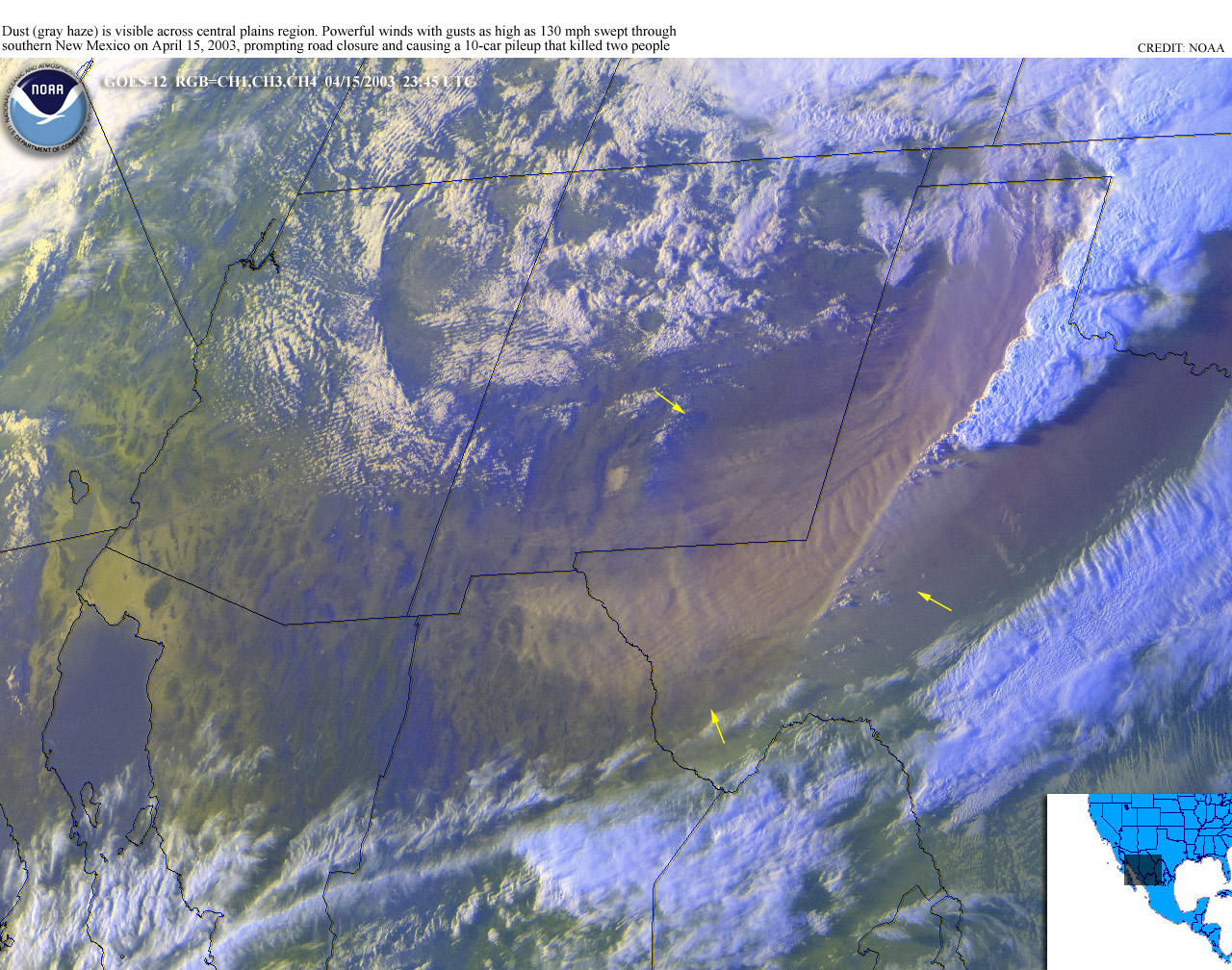
Low precipitation and stressed vegetation laid the groundwork for a significant duststorm in the southern Plains. A strong frontal system with winds up to 130 mph swept through southern New Mexico and west Texas on April 15, whipping up a duststorm which closed roads and contribuited to a 10-car pileup that killed two people. According to mid-April USDA reports, winter wheat was rated very poor to poor in the following states:
- NM: 50% very poor to poor
- TX: 25%
- KS: 21%
- NE: 20%
- CO: 18%
- SD: 16%
- WY: 15%
- OK: 9%
- MT: 7%
- MO: 5%


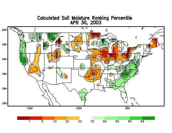
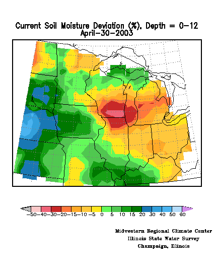
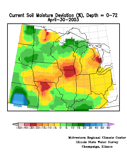
April rains improved soil moisture conditions across part of the drought area, but dry soils persisted at the end of April from the southern Great Lakes and Ohio Valley into parts of the eastern Plains. This is evident in modeled soil moisture departures as computed by the NOAA Climate Prediction Center and the Midwest Regional Climate Center at both the top soil layers and deeper layers.
Eastern U.S. Drought
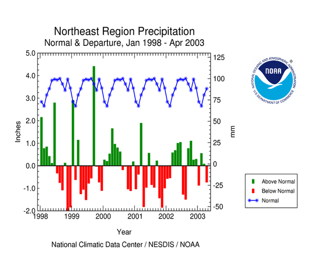
This month averaged drier than normal for the Northeast U.S., ranking as the 29th driest April in the 109-year record. April 2003 ranked 14th driest for Maine, but persistent dryness in both the short- and long-term gave the state the 6th driest January-April, 7th driest July-April, and 11th driest May-April. This year marks the 3rd consecutive dry May-April for the state.

